In the rapidly evolving landscapes of East Africa, understanding how land use and land cover are transforming is critical for sustainable development and environmental management. Recent research conducted by Bwire and Alhassan delves deeply into such dynamics within Uganda’s Lake Victoria basin, focusing on the Namanve area, a region where industrial growth, urban expansion, and ecological concerns intersect. This study, published in Environmental Earth Sciences, provides a comprehensive analysis of past trends and future projections of land use and land cover, unveiling insights that could influence policymaking, conservation efforts, and urban planning.
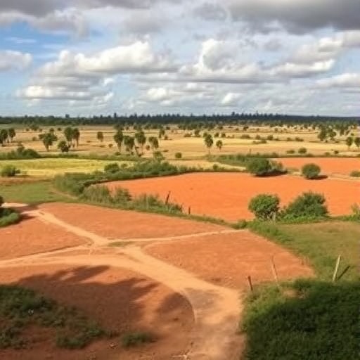
The Lake Victoria basin, shared among Uganda, Kenya, and Tanzania, represents not only a vital hydrological catchment but also a socio-economic hotspot characterized by dense populations and diverse ecosystems. The Namanve area, situated on the northern edge of Lake Victoria, has experienced significant anthropogenic pressure, particularly due to rapid urbanization and industrialization. These pressures have altered land cover patterns, with forested areas and wetlands increasingly replaced by built environments and agricultural lands. Bwire and Alhassan’s research tackles the urgent need to quantify and comprehend these shifts to anticipate and mitigate environmental consequences.
Utilizing remote sensing data combined with geographic information system (GIS) technology, the researchers analyzed multi-temporal satellite imagery captured over several decades. This high-resolution spatial and temporal data allowed for a precise assessment of land cover classes, such as forests, wetlands, water bodies, cultivated land, and urban spaces. The integration of statistical models further enabled the team to forecast future land cover scenarios based on observed trends and current developmental trajectories.
Through their rigorous methodology, the authors reveal that between the early 1990s and 2020, the Namanve area underwent notable reductions in natural vegetation and wetland ecosystems. Forest cover declined significantly, largely replaced by agricultural plots and expanding settlements. Meanwhile, wetlands—critical for biodiversity, water filtration, and flood control—have shrunk due to drainage for agriculture and infrastructure projects. This transformation not only threatens local biodiversity but also jeopardizes ecosystem services that Lake Victoria depends upon.
One critical aspect highlighted in the study is the expansion of urban infrastructure in the Namanve industrial park and adjacent residential areas. The researchers point out that industrial growth is a double-edged sword; while it boosts economic development and employment, it exerts pressure on surrounding natural habitats and water resources. This urban sprawl often lacks adequate planning measures, leading to informal settlements with minimal environmental safeguards, thereby exacerbating land degradation and pollution challenges.
Bwire and Alhassan’s future projections up to 2040 present a sobering outlook: if current trends continue unabated, natural land cover will shrink further, with urban and agricultural land encroaching upon critical ecosystems. Their predictive models indicate that forested areas in the region are likely to decline by approximately 25-30%, while wetlands could be reduced by nearly 40%. Such a decline poses severe risks to flora and fauna, as well as to the hydrological stability of the Lake Victoria basin.
The authors underscore the importance of incorporating their findings into regional land-use policies and environmental management frameworks. They advocate for integrated land-use planning that balances development with conservation. This includes promoting sustainable agriculture, reforestation initiatives, wetland restoration projects, and stringent regulation of urban expansion. Effective enforcement of environmental laws is also critical to prevent further degradation.
Beyond local implications, the research by Bwire and Alhassan offers valuable lessons for other rapidly urbanizing regions across sub-Saharan Africa. The interplay between economic development and environmental sustainability is a global challenge. As rural landscapes transform, the loss of ecosystem services threatens food security, water quality, and resilience against climate change-induced hazards. By providing spatially explicit data and projections, this study supports evidence-based decision-making essential for sustainable futures.
Technological advancements in remote sensing have played a pivotal role in enabling such detailed land cover analyses. The use of satellite imagery from platforms like Landsat and Sentinel, combined with machine learning classification algorithms, allows for high-accuracy land use mapping across large and often inaccessible areas. Bwire and Alhassan’s study exemplifies how these tools can track subtle landscape changes over time and predict plausible future pathways.
The social implications of land cover changes are profound. For communities around Namanve, shifting land use patterns affect agricultural productivity, access to natural resources, and vulnerability to environmental risks. The depletion of wetlands, for example, can exacerbate flooding and reduce available water for irrigation and domestic use. Recognizing these linkages is vital for crafting policies that address both ecological health and human well-being.
In examining the drivers of land use change, the study identifies population growth and economic incentives as primary factors. Uganda’s population has been growing rapidly, leading to increased demand for housing, food production, and industrial commodities. This demographic pressure often results in converting natural lands into farmland or urbanized zones. Meanwhile, government policies promoting industrial estates such as Namanve contribute to land transformation but require complementary measures to ensure sustainability.
Climate variability further complicates the land cover dynamics in the Lake Victoria basin. Erratic rainfall patterns and temperature fluctuations influence crop yields, vegetation health, and water availability. The reduction of natural buffers such as forests and wetlands reduces the landscape’s resilience to these climatic stresses. Therefore, integrating climate adaptation strategies into land management plans is imperative.
Bwire and Alhassan’s forward-looking approach involves scenario modeling that incorporates various assumptions about socio-economic development, policy interventions, and conservation efforts. Their models simulate different futures, ranging from ‘business-as-usual’ to more sustainable trajectories where land degradation is minimized. Such scenario planning aids stakeholders in visualizing potential outcomes and prioritizing actions accordingly.
The study also emphasizes the transboundary nature of environmental challenges in the Lake Victoria basin. Since the lake and its catchment span multiple nations, coordinated regional governance is necessary to address land use pressures effectively. Shared data platforms, harmonized policies, and joint conservation programs can help align efforts and avoid piecemeal solutions.
Importantly, this research bridges the gap between scientific inquiry and practical application. By translating complex geospatial analyses into accessible recommendations, Bwire and Alhassan provide a roadmap for policymakers, environmental managers, and community leaders. Their work illustrates how integrated science can inform sustainable land stewardship in rapidly changing landscapes.
In conclusion, the land use and land cover dynamics in Namanve present a microcosm of broader environmental transformations occurring across East Africa and similar developing regions worldwide. As urbanization and industrial growth continue to accelerate, thoughtful planning grounded in robust scientific evidence remains key to balancing economic progress with environmental sustainability. The study by Bwire and Alhassan shines a critical light on these issues, offering data-driven insights that could guide future development paths in Uganda’s Lake Victoria basin and beyond.
Subject of Research: Land use and land cover dynamics and future projections in Uganda’s Lake Victoria basin, focusing on the Namanve area.
Article Title: Land use and land cover dynamics and future projections in Uganda’s Lake Victoria basin: a case study of the Namanve area.
Article References:
Bwire, C., Alhassan, R.U. Land use and land cover dynamics and future projections in Uganda’s Lake Victoria basin: a case study of the Namanve area. Environ Earth Sci 84, 350 (2025). https://doi.org/10.1007/s12665-025-12359-1
Image Credits: AI Generated
