In the realm of precision agriculture and environmental monitoring, the ability to accurately identify and map vegetation at fine spatial scales is of paramount importance. This capability not only advances our understanding of resource distribution but also facilitates informed management of crop systems, directly impacting food security. Conventional techniques used for fine-scale vegetation mapping, however, face considerable challenges. These challenges stem largely from the spectral similarities between different vegetation types and the confounding effects of diverse background elements, limiting the applicability and accuracy of such methods over expansive and heterogeneous landscapes.
Addressing these shortcomings, a remarkable breakthrough has emerged from a collaborative research team based in China. Their study, recently published in the esteemed Journal of Integrative Agriculture, introduces an innovative remote sensing model specifically designed for the fine-scale extraction of flowering vegetation across complex multi-regional settings. Termed the FI-R model, this spectral index represents a significant advancement in the field, exemplified through its application to rapeseed (Brassica napus), a crop of immense agricultural and economic significance globally.
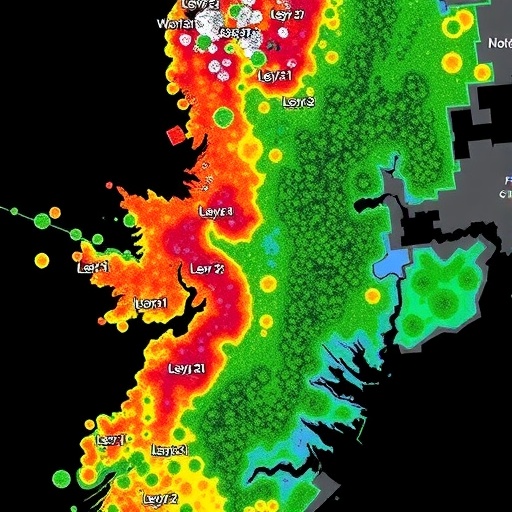
The novelty of the FI-R model lies in its sophisticated integration of spectral indices to exploit the unique floral characteristics exhibited during the flowering phenological stage of angiosperms. Flowering, distinguished by conspicuous changes in spectral reflectance due to floral pigments and morphology, presents an ideal temporal window for the delineation of vegetation types. The model strategically incorporates a “yellowness index,” derived from blue and green bands, signaling the dominant yellow coloration in rapeseed flowers. Complementing this, the “peak index,” encompassing inputs from the red, near-infrared (NIR), and shortwave infrared 1 (SWIR1) spectral bands, captures canopy structural and physiological features. The normalized difference vegetation index (NDVI) further enhances the model’s robustness by attenuating spectral interference contributed by complex backgrounds, enabling precise isolation of flowering rapeseed pixels.
Extensive validation efforts underline the FI-R model’s exceptional performance. It was rigorously tested across five distinct rapeseed-growing regions worldwide, each characterized by varied environmental conditions and heterogeneous substrate compositions. Validation datasets utilized high-resolution imagery from GF satellites coupled with the U.S. Cropland Data Layer (CDL) datasets, ensuring benchmarking against reliable ground-truth data. Remarkably, the model achieved overall classification accuracies surpassing 94% in all regions, a testament to its robustness irrespective of varietal differences or background complexities.
Furthermore, the design consideration for sensor compatibility marks a pivotal feature of FI-R. Its reliance on commonly available multispectral bands means that beyond Landsat Operational Land Imager (OLI) data, the model can be adapted seamlessly to other multispectral sensors with similar spectral configurations. This attribute expands the utility and scalability of the FI-R approach, allowing it to be a versatile tool for agricultural monitoring on a global scale.
The implications of such a tool are multifaceted. Beyond rapeseed, the FI-R model holds promising potential for mapping a broad spectrum of flowering angiosperm species, which could revolutionize phenological monitoring and agricultural management practices. Accurate flower-stage detection enables optimized harvest timing, pest management, and yield prediction, thereby enhancing resource use efficiency and crop productivity. Moreover, this fine-scale spectral discrimination aids environmental scientists in tracking ecosystem dynamics, biodiversity assessments, and habitat quality evaluations over extensive landscapes.
Professor Taixia Wu of Hohai University, the lead corresponding author, emphasized the importance of the study’s results: “Our approach leverages the spectral uniqueness of the flowering phenotype and counteracts typical spectral confounders found in remote sensing data. This advance is a crucial step toward operational large-scale mapping of flowering crops under real-world conditions.” Co-corresponding author Hongzhao Tang from the Land Satellite Remote Sensing Application Center further accentuated the model’s adaptability, underscoring its prospective applications beyond the initial case study of rapeseed.
Notably, previous spectral indices often struggled to dissociate flowers from other vegetation types or non-vegetative backgrounds, principally under heterogeneous sensor data and complex landscape mosaics. The FI-R model’s methodological innovation circumvents these issues by harnessing multispectral signatures specifically tied to phenological traits rather than generic vegetation greenness or biomass proxies. This paradigm shift represents a major leap forward in remote sensing methodologies applied in agricultural science.
As demand grows for scalable, precise agricultural monitoring solutions in the face of global food security challenges and climate volatility, technologies like the FI-R model are poised to become indispensable. By enabling near real-time, high-accuracy flowering vegetation maps, agricultural stakeholders can implement more responsive and efficient practices. The ability to monitor flowering phases remotely also opens avenues for automated phenological observations that were traditionally labor-intensive and spatially limited.
In summary, the FI-R model exemplifies a cutting-edge integration of spectral analysis, phenological insight, and sensor adaptability. Its demonstrated high accuracy and large-area applicability provide a vital tool for researchers, agronomists, and policy makers. The model’s flexibility to function across diverse sensors and biogeographical settings underscores its transformative potential for the future of crop monitoring and environmental management.
The research team, funded by significant grants from the National Natural Science Foundation of China and the Bureau of Science and Technology of the Inner Mongolia Autonomous Region, reflects a concerted effort to address pressing agricultural challenges through innovative scientific methodology. Their continued work promises to push the boundaries of remote sensing applications in vegetation science, contributing to sustainable agriculture and ecosystem stewardship worldwide.
For further inquiries or collaboration opportunities, interested parties are encouraged to contact the authors directly. This novel approach to flowering vegetation mapping heralds a new era where remote sensing can discern and quantify crop phenology with unprecedented precision and scalability, fundamentally enhancing global agricultural monitoring frameworks.
Subject of Research: Not applicable
Article Title: Development of the FI-R model, a novel remote sensing method for fine-scale extraction of vegetation, using rapeseed as an example
Web References:
Image Credits: Sixian Yin, et al.
Keywords: Agriculture, Ecology, Algorithms
