In recent years, the accelerating pace of environmental degradation has become a critical global concern, with soil erosion emerging as one of the most insidious threats to watershed health and sustainability. Within this context, the Salda Lake basin in Türkiye presents a unique and compelling case study for integrated watershed management and erosion risk assessment. The Salda Lake basin’s diverse topography and climatic variables complicate efforts to curb soil loss, necessitating advanced analytical approaches to identify priority sub-watersheds for conservation interventions. This challenge has been addressed in a groundbreaking study by İbrahim Dursun, published in Environmental Earth Sciences (2025), which introduces a comprehensive analytical framework for sub-watershed prioritization and erosion risk evaluation tailored specifically for this ecologically sensitive region.
The Salda Lake basin is of particular scientific interest due to its distinctive geomorphological characteristics, which contribute to varying degrees of vulnerability across its catchments. Soil erosion in this area threatens not only agricultural productivity but also the water quality and ecological integrity of the lake itself. Understanding how different segments of the basin contribute to sediment yield is critical for developing cost-effective and sustainable soil and water conservation strategies. Dursun’s work leverages an integrated approach that synthesizes geomorphological, hydrological, and land-use data to systematically rank sub-watersheds according to their erosion risk profiles.
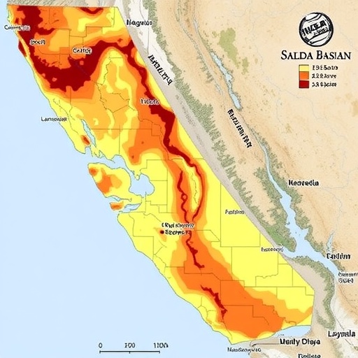
At the core of Dursun’s methodology is the use of advanced GIS-based morphometric analysis combined with multifactorial weighting techniques. By dissecting the basin into smaller hydrological units, the study evaluates each sub-watershed through parameters such as drainage density, slope gradient, soil type, land cover, and rainfall erosivity. These parameters are quantified and normalized into an index that objectively reflects the intrinsic susceptibility of each unit to soil erosion. This method represents a significant enhancement over traditional watershed assessments that often rely on singular or limited datasets without fully capturing the complex interactions influencing erosion processes.
A steep slope combined with sparse vegetation cover inherently predisposes an area to heightened surface runoff and detachment of soil particles. The analysis reveals how these factors dynamically interplay with anthropogenic influences such as land-use change and urban expansion, which compound erosion risks. In particular, Dursun’s approach highlights how improper land development and cultivation on vulnerable slopes amplify sediment fluxes into the Salda Lake, accelerating the sedimentation rate and threatening the lake’s pristine water clarity. These insights underscore the urgent need for targeted erosion control measures that reconcile developmental goals with ecosystem conservation.
Notably, Dursun integrates a prioritization framework that transcends simple risk assessment by emphasizing management urgency. Sub-watersheds identified with the highest erosion potential are flagged as priority zones for immediate conservation efforts. This prioritization is invaluable for resource allocation, ensuring that interventions such as reforestation, terracing, or the installation of check dams are deployed where they can achieve maximal impact. In addition, the approach supports the development of long-term monitoring and adaptive management plans by providing a replicable and transparent decision-making tool.
Field validation forms a critical component of the study’s robustness. The analytical findings are corroborated through targeted field observations and sediment sampling, enhancing confidence in the predictive power of the prioritization model. This empirical grounding also facilitates stakeholder engagement by providing tangible evidence of erosion hotspots. Local communities, policymakers, and conservation agencies can better appreciate the spatial heterogeneity of erosion risk in the basin, leading to more informed and participatory watershed management initiatives.
Dursun’s research exemplifies the growing trend toward integrating multidisciplinary data streams through cutting-edge spatial technologies. The incorporation of high-resolution topographic data, satellite imagery, and rainfall records creates a comprehensive environmental snapshot that traditional methods cannot match. Moreover, the study underscores the importance of leveraging these tools in the context of climate change, which is expected to exacerbate soil erosion through altered precipitation patterns and increased frequency of extreme weather events.
The urgency of addressing erosion in the Salda Lake basin is further amplified by its cultural and economic relevance. The lake is a vital natural resource attracting tourism due to its unique turquoise waters and endemic biodiversity. Soil erosion and consequent sediment deposition risk degrading these attributes, with potential socioeconomic repercussions for local communities dependent on tourism-related income. By establishing a scientifically rigorous prioritization scheme, Dursun’s work offers a pathway to balancing environmental integrity with sustainable economic development.
Land-use planning emerges as a pivotal mechanism informed by the study’s outputs. Decision makers can harness the erosion risk maps and prioritization indices to enforce zoning regulations and promote land management practices that mitigate soil loss. For instance, preserving natural vegetation buffers along waterways and restricting high-impact agricultural practices on vulnerable slopes are viable strategies. Additionally, the research suggests opportunities for ecological restoration initiatives aimed at enhancing soil structure and increasing infiltration rates, which further reduce surface runoff.
Importantly, the study acknowledges the limitations inherent to any modeling framework, advocating for continued refinement through integration of real-time monitoring data and community-based knowledge. Precision agriculture technologies and participatory mapping could complement the current approach, yielding even finer resolution prioritization assessments. This iterative process reflects a broader paradigm shift toward adaptive natural resource management that aligns scientific rigor with societal needs.
The global applicability of Dursun’s integrated analytical framework cannot be overstated. Erosion is a universal environmental challenge, particularly acute in regions with mountainous terrain and complex land use patterns. By demonstrating the efficacy of combining spatial analysis with multifactorial prioritization, this study sets a precedent for similarly complex watersheds worldwide. The methodological innovations detailed here provide a scalable blueprint for addressing erosion in diverse environmental and socio-economic contexts.
Furthermore, the study’s implications extend into hydrological modeling as well. Sediment load directly affects reservoir sedimentation rates, channel morphology, and aquatic habitats. Accurately pinpointing erosion hotspots enhances the precision of hydrological predictions, which is crucial for water resource management and disaster risk mitigation. In this way, the research bridges the gap between soil conservation and broader watershed ecosystem health.
In conclusion, Dursun’s integrated approach to sub-watershed prioritization and erosion risk assessment in the Salda Lake basin embodies a transformative step in environmental science and watershed management. By fusing detailed morphometric analysis with innovative prioritization indices, the study provides a powerful decision-support tool for policymakers, conservationists, and local stakeholders alike. Its comprehensive and replicable methodology paves the way toward more sustainable land use and natural resource conservation in Türkiye and beyond. As soil erosion continues to imperil ecosystem services globally, such pioneering research will prove indispensable in guiding the most effective, science-based interventions to safeguard vulnerable landscapes.
Subject of Research: Sub-watershed prioritization and erosion risk assessment in the Salda Lake basin, Türkiye.
Article Title: An integrated analytical approach to sub-watershed prioritization and erosion risk assessment in the salda lake basin, Türkiye.
Article References:
Dursun, İ. An integrated analytical approach to sub-watershed prioritization and erosion risk assessment in the salda lake basin, Türkiye. Environ Earth Sci 84, 428 (2025). https://doi.org/10.1007/s12665-025-12434-7
Image Credits: AI Generated
