Innovative Imaging Techniques Unveil the Hidden Complexity of Wetland Soil Properties
Wetlands are among the most valuable ecosystems on Earth, playing crucial roles in carbon sequestration, water purification, and biodiversity support. Despite their ecological importance, the intricate processes governing wetland soil dynamics remain poorly understood due to significant spatial heterogeneity. Recent advances in geophysical imaging have opened new frontiers for exploring subsurface environments non-invasively. A groundbreaking study recently published in Environmental Earth Sciences provides compelling insights into wetland soil hydro-biogeochemical properties by combining two powerful geophysical methods—self-potential and electromagnetic imaging. This novel fusion of technologies promises to revolutionize how scientists visualize and interpret the spatial variability of wetland soils.
Traditionally, investigating wetland soil properties involved labor-intensive sampling and laboratory analyses, which are often limited in spatial coverage and resolution. The heterogeneous nature of wetlands, influenced by fluctuating water tables, organic matter content, and microbial activity, demands innovative approaches that can capture subsurface variations in situ without disturbing the environment. Self-potential (SP) imaging, a passive geophysical technique, detects naturally occurring electrical potentials generated by electrochemical and electrokinetic processes in soils. Meanwhile, electromagnetic (EM) imaging actively measures soil electrical conductivity by inducing and detecting responses to electromagnetic fields. The strategic integration of SP and EM modalities unlocks complementary datasets, enabling researchers to infer the complex interplay between hydrological and biogeochemical parameters with unprecedented precision.
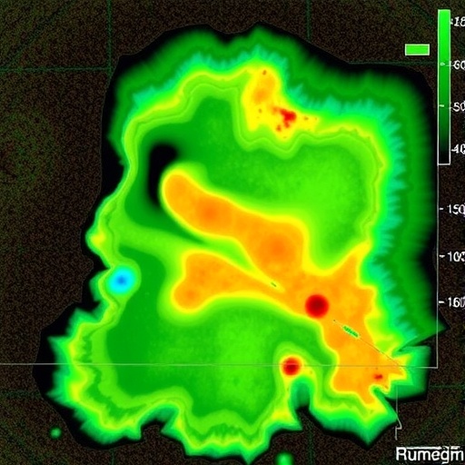
This study meticulously applied combined SP and EM imaging to a representative wetland site, revealing striking geophysical contrasts correlated with soil moisture content, organic matter distribution, and redox conditions. The SP data notably captured electrochemical gradients arising from microbial activity and ion transport, painting a dynamic picture of ongoing biochemical processes within the soil matrix. Simultaneously, EM measurements delineated zones of varying electrical conductivity, reflecting differences in soil texture, salinity, and saturation levels. By overlaying these datasets, the researchers could spatially map intricate patterns of soil heterogeneity that are otherwise invisible through conventional methods.
One of the landmark discoveries in this research emerged from the correlation analyses between SP signals and EM conductivity values. Regions exhibiting elevated self-potential corresponded closely with zones of enhanced electromagnetic response, indicative of active biogeochemical hotspots. These hotspots are likely areas where microbial communities thrive, mediating redox reactions that influence nutrient cycling and greenhouse gas fluxes. The ability to non-invasively pinpoint such biologically active areas within wetlands has profound implications for ecosystem monitoring and management, particularly in the context of climate change mitigation strategies.
Delving deeper into the biophysical mechanisms, the study elucidated how electrokinetic phenomena driven by water flow contribute to self-potential anomalies. As groundwater moves through fine-grained wetland soils, it drags excess ions along, generating streaming potentials measurable by SP imaging. Concurrently, electromagnetic surveys detect variations in soil electrical properties modulated by moisture gradients and ion concentrations. These intertwined physical and chemical processes underscore the complexity of wetland soil environments and the necessity of multi-modal imaging for comprehensive characterization.
The researchers detailed sophisticated data processing techniques to enhance signal interpretation and reduce noise inherent in field conditions. Advanced filtering algorithms and joint inversion frameworks allowed for the synthesis of SP and EM measurements into coherent spatial models depicting soil hydro-biogeochemical states. Such methodological innovations pave the way for future studies aiming to decipher subsurface heterogeneity across diverse wetland typologies and climatic zones, broadening the utility of geophysical imaging in environmental sciences.
Beyond fundamental science, the implications of this research extend to practical applications in wetland conservation, restoration, and management. Understanding the spatial distribution of soil properties informs interventions aimed at optimizing water quality, enhancing carbon storage, and preserving habitat integrity. The combined SP-EM approach offers a scalable, cost-effective tool for continuous monitoring, enabling stakeholders to track ecosystem responses to anthropogenic disturbances and natural fluctuations over time.
Furthermore, the integration of self-potential and electromagnetic techniques represents a significant advancement in non-invasive environmental monitoring. Whereas individual methods provide partial glimpses into soil conditions, their combination synthesizes a holistic view that captures both electrical phenomena and hydrological influences. This synergistic perspective equips researchers and practitioners with nuanced insights necessary for addressing complex ecological challenges associated with wetland environments globally.
The study also underscores the evolving landscape of geophysical instrumentation and computational modeling. Portable, sensitive SP and EM sensors coupled with high-performance computing infrastructures facilitate the rapid acquisition, processing, and visualization of large-scale datasets. These technological strides democratize access to cutting-edge imaging, empowering interdisciplinary collaborations spanning ecology, hydrology, geochemistry, and earth sciences.
Importantly, the authors emphasize the need for ongoing refinement of imaging protocols to enhance resolution and interpretative accuracy. Factors such as soil heterogeneity, surface vegetation, and temporal variations introduce complexities warranting dedicated calibration and validation efforts. Longitudinal studies integrating SP-EM imaging with biogeochemical sampling and remote sensing data stand to deepen understanding of dynamic wetland processes and feedback mechanisms.
As climate change accelerates wetland transformation through altered precipitation patterns, sea-level rise, and temperature shifts, tools capable of detailed subsurface monitoring become indispensable. The demonstrated efficacy of combined self-potential and electromagnetic imaging places it at the forefront of innovative strategies to safeguard wetland ecosystem services. By making the invisible visible, this research charts a compelling path forward in environmental earth science, bridging the gap between geophysics and ecological insight.
In conclusion, this trailblazing exploration of wetland soil properties harnesses the power of combined geophysical imaging to decode spatial variations critical to understanding ecosystem function. The integration of self-potential and electromagnetic methods unveils complex hydro-biogeochemical interactions with remarkable clarity, offering transformative potential for research and environmental stewardship. As the scientific community embraces such innovative methodologies, the future of wetland science holds exciting prospects for discovery and conservation.
Subject of Research: Wetland soil hydro-biogeochemical property variation using combined geophysical imaging techniques.
Article Title: Combined self-potential and electromagnetic imaging provide insights into the spatial variation of wetland soil hydro-biogeochemical properties.
Article References:
Doro, K.O., Kolapkar, A.M. & Emmanuel, E.D. Combined self-potential and electromagnetic imaging provide insights into the spatial variation of wetland soil hydro-biogeochemical properties. Environmental Earth Sciences 84, 617 (2025). https://doi.org/10.1007/s12665-025-12638-x
Image Credits: AI Generated
