In the heart of Central Europe’s temperate forests, the delicate balance of soil moisture plays a pivotal role in maintaining forest health, ecosystem function, and resilience against the mounting pressures of climate change. Recently, a breakthrough study conducted by researchers at the University of Göttingen in Germany, in conjunction with Mendel University in the Czech Republic, has challenged existing paradigms regarding the measurement and interpretation of soil moisture in forest ecosystems. Leveraging a novel integration of ground-based measurements with advanced satellite reanalysis data, this research ushers in a new era of precision in understanding the elusive dynamics of soil moisture variability across forested landscapes.
Forest soils function as dynamic reservoirs for water, carbon, and nutrients—resources vital for the sustenance of trees and the myriad organisms that comprise forest ecosystems. Yet, the complexity of soils—defined by heterogeneous textures, biological activity, and variable topography—has historically complicated efforts to accurately quantify soil moisture over meaningful spatial and temporal scales. Conventional methodologies, which often rely heavily on topographic indices and static terrain-based models, have repeatedly fallen short in capturing the true variability of moisture within forest soils, particularly in upland and undulating terrains characteristic of Central European woodlands.
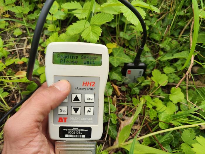
The new study bridges this knowledge gap by deploying a comprehensive experimental design within a beech forest located near Göttingen. Over a full annual cycle, researchers amassed soil moisture data via manual sampling from 236 distinct points, complemented by automated sensors strategically installed at 53 locations across a 900 by 600-meter research plot. However, what sets this effort apart is the integration of ERA5-Land data—a sophisticated climatic reanalysis product generated by the European Centre for Medium-Range Weather Forecasts (ECMWF) that assimilates satellite observations alongside meteorological and terrestrial station data. This fusion of ground truth and remote sensing data yields unprecedented resolution and fidelity in soil moisture characterization.
Analyses revealed that soil moisture patterns are far more influenced by temporal variability—driven by seasonality and meteorological fluctuations—than by spatial differences dictated by terrain features. This insight marks a significant departure from traditional assumptions where topographic indices were considered strong proxies for moisture gradients. The study explicitly demonstrates that while slope, aspect, and microtopography influence water redistribution, their overall impact pales compared to the dynamic influence of weather patterns unfolding throughout the year.
The validation of ERA5-Land’s ability to reproduce soil moisture variations—with minimal site-specific calibration—has profound implications. Satellite-fed reanalysis models were shown to capture moisture and temperature fluctuations with remarkable accuracy, heralding a paradigm shift in forest hydrology monitoring. With reliable, freely accessible, and globally available data streams, forest managers and ecological modelers can now incorporate temporally detailed moisture estimates into management and predictive frameworks, facilitating more adaptive responses to climatic perturbations.
Dr. Simon Drollinger, principal investigator and bioclimatologist at the University of Göttingen, underscores the critical importance of temporal dynamics in forest moisture studies. According to Dr. Drollinger, “Our findings emphasize that tracking soil moisture development over time yields better insights for forest management than focusing solely on spatial distribution. Such a temporal lens aligns closely with the challenges posed by climate-induced extremes such as droughts and unseasonal rainfall.”
Further insights from first author Marian Schönauer highlight that the utilization of satellite-derived soil moisture data need not be restricted to research contexts. Instead, this data can become a mainstay tool in operational forestry and environmental monitoring. The synergy between field measurements and satellite data unlocks a scalable approach to assessing water availability—empowering stakeholders with actionable intelligence to optimize forest health, productivity, and carbon sequestration potential under evolving climatic conditions.
Crucially, the researchers advocate for expanding the network of ground-based moisture observations to continuously calibrate and validate satellite models. This integrated methodology mitigates the limitations inherent in either data source alone—in situ readings provide precise local details, while satellite observations enable expansive spatial coverage—combining to form a comprehensive understanding of soil moisture dynamics.
From an ecological perspective, the ability to map soil moisture reliably influences predictions of tree stress responses, microbial activity, and nutrient cycling—all of which are tightly coupled to water availability. This enhanced understanding not only advances forest ecology but also informs climate change mitigation strategies, especially those centered on maintaining forest carbon sinks and biodiversity under shifting hydrological regimes.
Moreover, the approach championed by this research transcends geographical boundaries and could be adapted for diverse forest types globally. By demonstrating the efficacy of utilizing model reanalysis adjusted with empirical data, this work sets a precedent for scalable environmental monitoring systems capable of informing policy and management decisions in both temperate and tropical forests.
Finally, as climate variability intensifies, forest managers face unprecedented uncertainty. Harnessing the precise and temporally sensitive soil moisture information elucidated by this study enables proactive measures—such as drought risk assessments, targeted silvicultural interventions, and water resource planning—thereby bolstering forest resilience and ecosystem services amidst environmental change.
This groundbreaking research, slated for publication in the Journal of Hydrology: Regional Studies, paves the way for the integration of cutting-edge climate data with traditional fieldwork, marking a transformative moment in forest science and environmental management.
Subject of Research: Not applicable
Article Title: Topographic indices and ERA5-Land data to describe soil moisture variability in a Central European beech forest
News Publication Date: 30-May-2025
Web References: https://doi.org/10.1016/j.ejrh.2025.102456
References: Marian Schönauer et al. “Topographic indices and ERA5-Land data to describe soil moisture variability in a Central European beech forest.” Journal of Hydrology: Regional Studies, 2025.
Image Credits: Simon Drollinger
Keywords: Biogeochemistry, Environmental management, Agroforestry, Silviculture, Forest resources, Climate change, Climate data, Climate sensitivity, Climate stability, Climate systems, Climate monitoring, Climate policy, Soil science, Soil moisture, Ecological processes, Hydrology, Fluid dynamics
