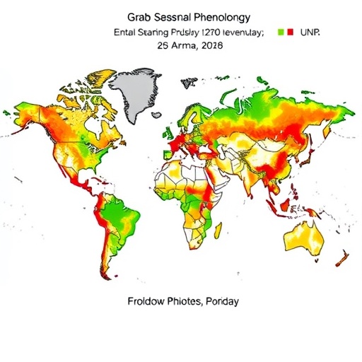
A groundbreaking study published in Nature unveils the most comprehensive global map of plant seasonal cycles to date, shedding light on the intricate spatial and temporal variation in vegetation phenology across Earth’s terrestrial ecosystems. By leveraging two independent remote sensing datasets—MODIS-derived Near-Infrared Vegetation Reflectance (NIRV) and satellite-measured Solar-Induced Fluorescence (SIF)—researchers have not only characterized the patterns of seasonal plant productivity worldwide but also elucidated the climatic and environmental drivers behind phenological asynchrony.
This ambitious endeavor integrates advanced geospatial analytics, harmonic regression modeling, and machine learning techniques, harnessed through cutting-edge computational platforms including Google Earth Engine and Python scientific libraries. The core methodology involves analyzing more than two decades of high-resolution satellite data aggregated at approximately 5.5-kilometer spatial resolution, identifying the unique annual phenocycle signatures for every land pixel globally after rigorous quality filtering and land-cover masking.
The study’s innovative use of harmonic regression decomposes temporal vegetation signals into annual and semiannual frequency components, affording a nuanced representation of unimodal and bimodal growth patterns. This approach aptly captures complexities arising from multiple growing seasons typical of certain tropical and subtropical regions. By detrending the data and modeling time series seasonality, the researchers successfully distill the essence of long-term vegetation dynamics, a feat previously hindered by data discontinuities and remote sensing artifacts.
Assessing the reliability of these phenological models involved cross-validation with the complementary SIF dataset and ground-based observational networks such as PhenoCam cameras and FLUXNET eddy covariance towers. The strong congruence between satellite-derived phenocycles and in situ measurements attests to the robustness of the mapping framework across diverse biomes, from temperate forests to savannas and wetlands. Phenocycle quality was quantified through explained variance metrics, confirming that the harmonic regression effectively captures ecological seasonality at global scales.
Central to the study is the expansive mapping of phenological asynchrony—spatial variation in the timing of seasonal vegetation shifts—defined here as the rate of change in phenocycle characteristics within local neighborhoods. Researchers deployed a spatial regression technique that measures Euclidean distances between standardized phenology curves, yielding a quantitative asynchrony index at multiple spatial radii. These maps reveal stark regional contrasts in phenological variability, with pronounced asynchrony in mountainous and tropical zones, underscoring the heterogeneity of environmental controls on plant seasonality.
To unravel the environmental mechanisms behind phenological asynchrony, the team incorporated a suite of covariate datasets encompassing climate variability, topographic ruggedness, vegetation structural complexity, land-use change frequency, and fire occurrence. Random forest machine learning models, complemented by SHAP value explainability techniques, highlighted precipitation and minimum temperature variability as the dominant factors shaping local phenological differences. Topographic and vegetation heterogeneity further modulate this asynchrony, validating long-held ecological hypotheses with unprecedented spatial rigor.
Intriguingly, the researchers conducted a refined ensemble analysis to investigate how the strength of climate–phenology relationships varies with latitude across global hotspots of high phenological asynchrony. By clustering regions of intensified asynchrony and employing matrix regressions that control for geographic distance, the results affirm a weaker dependence on climatic gradients in low-latitude areas. This finding hints at complex drivers of phenological timing in tropical ecosystems, including biotic interactions and fine-scale microclimatic heterogeneity, challenging conventional assumptions about climate as the universal phenology regulator.
Beyond ecological mapping, the study embraces evolutionary implications by linking remote sensing-derived phenological patterns to the genetic structure of species exhibiting asynchronous reproductive cycles. Utilizing publicly available genomic datasets for anurans in Brazil and tropical bird species, the authors demonstrate that geographic variation in remotely sensed phenology aligns with genetic differentiation that cannot be solely explained by geographic or environmental distance, supporting the concept of “allochrony by allopatry” as a speciation mechanism.
The potential applications of this comprehensive phenology mapping extend to agriculture as well, exemplified by a corroborative test with coffee harvest seasonality in Colombia. Here, phenocycle clusters derived from satellite data significantly corresponded with locally documented harvest calendars, offering a scalable and objective tool for agronomic planning and phenological management under climate change.
Public accessibility is another key aspect of this study. The authors developed an interactive Google Earth Engine application to visualize phenology and phenological asynchrony maps globally, inviting researchers and stakeholders to explore these rich datasets. The accompanying open-source code and data repositories ensure reproducibility and encourage further innovation in phenology research.
This landmark research advances our capacity to understand vegetation seasonality within a global ecological context, bridging remote sensing technology and ecological theory. It offers new insights into how climatic variability, landscape complexity, and human disturbance shape the temporal patterns that underpin ecosystem processes. Moreover, by linking seasonal plant dynamics to evolutionary and agricultural outcomes, it sets the stage for integrative approaches to biodiversity conservation and food security in a rapidly changing world.
The methodological rigor, comprehensive data integration, and multilayered analyses presented in this work underscore a new era in phenology science—one that leverages big data to unravel the temporal fabric of life on Earth. As phenological shifts continue under the influence of anthropogenic climate change, such global, high-resolution insights are essential for predicting ecosystem responses and guiding adaptive management strategies.
In sum, this publication represents a significant leap forward in understanding the drivers and consequences of plant phenological asynchrony at global scales. Its fusion of remote sensing datasets, innovative modeling, and cross-disciplinary applications offers a powerful template for future studies aimed at unraveling the complex interplay between environment, phenology, and species evolution.
Subject of Research:
Global spatiotemporal mapping and modeling of vegetation phenology and phenological asynchrony on terrestrial ecosystems using satellite remote sensing data.
Article Title:
Global phenology maps reveal the drivers and effects of seasonal asynchrony
Article References:
Terasaki Hart, D.E., Bùi, TN., Di Maggio, L. et al. Global phenology maps reveal the drivers and effects of seasonal asynchrony. Nature (2025). https://doi.org/10.1038/s41586-025-09410-3
Image Credits:
AI Generated
