As global climate patterns shift and sea levels steadily rise, understanding coastal vulnerability has become an urgent priority for scientists, policymakers, and communities worldwide. In a landmark study published recently in Nature Communications, a multinational team of researchers led by Basnayake, Duong, and Ranasinghe offers the most comprehensive global assessment of coastal vulnerability to date. Their findings not only map the susceptibility of coastlines around the world but also unpack the complex interplay of natural and anthropogenic factors that drive this vulnerability. This study arrives at a pivotal moment, as rising threats demand informed strategies to safeguard some of the earth’s most dynamic and socioeconomically critical regions.
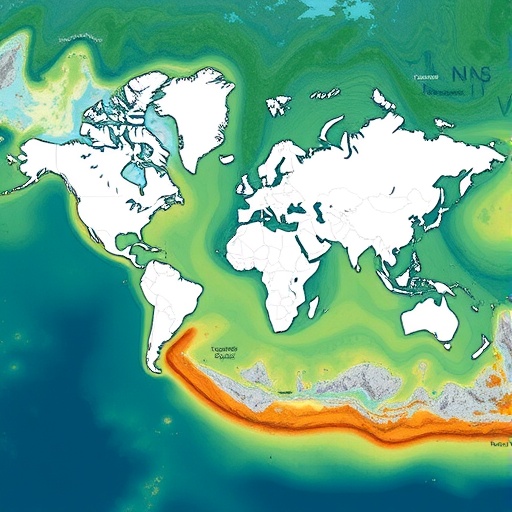
Coastal areas are home to nearly 40% of the global population and are hubs of biodiversity, commerce, and culture. However, these regions face an escalating cascade of environmental threats—ranging from accelerated sea-level rise and increasingly intense storms to human-driven changes like urbanization, land subsidence, and habitat degradation. The novel assessment uses an integrated approach combining satellite data, oceanographic models, and socioeconomic indicators to codify vulnerability metrics for coastlines across every continent and island nation.
The study leverages advances in remote sensing technology, coupling high-resolution digital elevation models with dynamic wave and tide simulations. This fusion enables unprecedented precision in quantifying exposure—measuring how much land area is subject to inundation under various sea-level scenarios—as well as sensitivity, which considers physical shoreline characteristics such as geomorphology and sediment supply. By integrating socioeconomic data, the analysis also measures adaptive capacity, reflecting community resilience based on factors like infrastructure robustness and governance quality.
One of the most striking revelations from this global mapping exercise is the geographic concentration of extreme vulnerability hotspots. Low-lying deltas, such as the Ganges-Brahmaputra, Mekong, and Nile, emerge as epicenters of peril due to a confluence of factors: high population density, subsidence from groundwater extraction, and reduced sediment delivery caused by upstream damming. These areas face not only permanent land loss but also increasingly frequent and severe flood events, posing existential risks for millions of inhabitants.
The research also identifies small island developing states as disproportionately susceptible to coastal hazards. Limited land area, dependence on tourism and fisheries, and limited financial and technical resources severely constrain their adaptive capacity. Projected sea-level rise threatens to exacerbate saltwater intrusion into freshwater lenses and degrade coral reef ecosystems that provide natural coastal defense, thus further amplifying vulnerability.
Intriguingly, the study uncovers that anthropogenic factors often overshadow purely climatic drivers in dictating coastal vulnerability patterns. For instance, coastal armoring and seawalls, while intended to protect, sometimes exacerbate erosion downstream or hinder natural sediment flows, thereby undermining long-term resilience. Urban expansion frequently replaces natural buffers such as mangroves and wetlands with impervious surfaces, increasing runoff and reducing storm surge dissipation. The nuanced understanding afforded by this analysis underscores the imperative to integrate natural and engineered solutions.
Underlying this work is a sophisticated modeling framework that simulates future scenarios by coupling projected climate change impacts with plausible socioeconomic pathways. By differentiating between natural and human-influenced changes, policymakers can prioritize interventions that synergistically address immediate threats and foster sustainable adaptation. Notably, the study advocates for a paradigm shift from purely defensive infrastructure toward nature-based solutions including mangrove restoration, coral reef rehabilitation, and re-engineered floodplains.
The methodological rigor of the assessment is bolstered by its interdisciplinary collaboration, combining expertise from coastal geomorphologists, climate scientists, social scientists, and economists. This comprehensive lens molds a holistic depiction of vulnerability that transcends traditional hazard mapping to include social justice considerations. For example, marginalized coastal communities with limited access to resources and participation in decision-making processes are frequently the most exposed yet the least equipped to adapt. The study highlights the need for inclusive adaptation policies that prioritize equity.
Another compelling aspect of this research is its global yet locally nuanced perspective. While broad macro patterns of vulnerability are catalogued at continental scales, the fine spatial resolution of data allows for identification of critical micro-regions—even within generally less vulnerable countries—that warrant immediate attention. This underscores the heterogeneity of coastal risk and the futility of one-size-fits-all solutions.
Moreover, the study’s temporal analysis offers critical insights into vulnerability trajectories. Some areas currently considered moderately threatened are projected to deteriorate substantially over the coming decades unless significant mitigation and adaptation efforts are implemented. Conversely, regions with proactive land-use planning and conservation efforts demonstrate potential pathways toward resilience, validating the efficacy and necessity of forward-thinking policies.
Communication of the findings is designed to empower diverse stakeholders. The publicly accessible interactive maps and scenario tools allow policymakers, community leaders, and citizens to visualize vulnerabilities specific to their locale and explore the outcomes of different intervention strategies. This democratization of data is essential for fostering collective action and prioritizing investments.
The implications of this work are profound. As the frequency and magnitude of coastal hazards amplify, the study provides a critical scientific foundation for international climate adaptation frameworks, disaster risk reduction strategies, and sustainable urban development plans. Its results reinforce the urgency of concerted global efforts to reduce greenhouse gas emissions to curb long-term sea-level rise while simultaneously accelerating localized adaptation measures that integrate both engineering innovations and ecosystem restoration.
While this study represents a major leap forward, the authors stress the importance of ongoing monitoring and model refinement. Coastal systems are inherently dynamic and subject to tipping points that may accelerate vulnerability beyond current projections. Continual integration of emerging data and adaptive management protocols will be pivotal for effective stewardship of these vital, yet vulnerable, coastal environments.
Ultimately, Basnayake, Duong, Ranasinghe, and colleagues provide a clarion call for a unified and science-driven response to the global challenge of coastal vulnerability. Their meticulous and multidimensional assessment lays the groundwork for more informed, equitable, and sustainable coastal resilience strategies. As countless communities stand on the frontline of climate impact, this research underscores that the choices made today will decisively shape the fate of our shared coastlines for generations to come.
Subject of Research: Global assessment of coastal vulnerability and contributors to coastal risk
Article Title: A global assessment of coastal vulnerability and dominant contributors
Article References:
Basnayake, V., Duong, T.M., Ranasinghe, R. et al. A global assessment of coastal vulnerability and dominant contributors. Nat Commun (2026). https://doi.org/10.1038/s41467-025-67275-6
Image Credits: AI Generated
