In a groundbreaking study that sheds new light on the rapidly changing cryosphere of the Western Himalaya, researchers have harnessed the power of remote sensing technology to unravel the subtle yet profound shifts in glacier albedo over the past two decades. This research leverages the comprehensive capabilities of Google Earth Engine to analyze satellite imagery spanning from 2001 to 2022, offering a panoramic view of how the reflective properties of benchmark glaciers in the region have evolved. Their findings not only illuminate the nuanced dynamics of glacier surfaces but also carry significant implications for understanding glacier mass loss amid accelerating climate change.
Glacier albedo—the fraction of solar energy reflected back into the atmosphere—plays an essential role in determining glacier health and longevity. High albedo surfaces, often characterized by fresh snow or clean ice, reflect a substantial portion of sunlight, thereby reducing surface melting. Conversely, lower albedo surfaces absorb more solar radiation, accelerating melt rates and contributing to glacier recession. This study meticulously quantifies the temporal and spatial variations in albedo, highlighting trends that could expedite glacier mass loss in this critical Himalayan region.
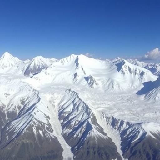
The Western Himalaya stands as a crucial water tower, feeding some of the world’s largest rivers and sustaining millions of people downstream. Its glaciers are particularly sensitive to climatic fluctuations, and changes in their albedo have cascading effects on regional hydrology and ecosystem stability. By integrating Google Earth Engine’s cloud-based computational framework with satellite datasets, the researchers demonstrate an innovative methodology that transcends traditional field-based limitations, enabling a robust, consistent, and cost-effective monitoring system.
Between 2001 and 2022, the analysis reveals a pronounced decline in glacier albedo on several benchmark glaciers, signaling an increase in surface impurities, meltwater exposure, or snowline retreat. These reductions in reflectivity directly correlate with elevated surface temperatures and enhanced melt rates. The spatial heterogeneity in albedo change suggests that local topography, debris cover, and atmospheric deposition patterns modulate the extent and pace of albedo decline, underscoring the complex interplay of factors driving glacier evolution.
The study leverages multi-spectral satellite data, including imagery from Landsat missions, to calculate spectral indices that correlate closely with surface albedo. By automating processing workflows in Google Earth Engine, the researchers achieve a high temporal resolution assessment, capturing seasonal fluctuations and long-term trends. This temporal granularity elucidates inter-annual variability prompted by episodic weather events such as dust storms, which deposit dark material on glacier surfaces, further diminishing albedo.
Understanding the albedo-glacier mass relationship is vital as diminishing glacier mass threatens water security, particularly for arid and semi-arid regions dependent on sustained meltwater input during dry seasons. The study posits that albedo reduction serves as both a symptom and a driver of glacier mass loss, with increased absorption of solar radiation exacerbating melt and contributing to negative mass balance conditions. These insights emphasize the need to factor albedo dynamics into glacier melt models to enhance prediction accuracy.
Equally compelling is the study’s exploration of anthropogenic influences, including increased aerosol emissions and land use changes that may accelerate albedo darkening. The presence of soot, black carbon, and other pollutants deposited on glacier surfaces accelerates ice melt by lowering the albedo. The remote sensing approach vividly captures these changes over time, providing empirical evidence linking human activities to glacier health, thereby bolstering the impetus for regional climate mitigation strategies.
Moreover, by focusing on benchmark glaciers—those selected for ongoing monitoring due to their representativeness and accessibility—the research offers valuable baseline data for future comparative studies. This approach lays a foundation for long-term glacier monitoring programs in the Himalayas, filling significant data gaps that have traditionally hampered understanding in this remote and climatically complex region.
The methodological framework adopted in the study exemplifies the transformative potential of cloud computing in environmental sciences. Google Earth Engine’s scalable infrastructure and extensive data repositories enable the seamless processing of petabytes of satellite data, fostering a democratization of access to high-quality geospatial analyses. This technological advancement equips researchers, policymakers, and stakeholders with actionable intelligence instrumental in crafting adaptive responses to glacier retreat and its broader ecological consequences.
Crucially, the study’s implications extend to glaciological modeling, where incorporating dynamic albedo data can refine projections of glacier volume and runoff under various climate scenarios. Current models often assume static albedo values, potentially underestimating melt rates. This research advocates for integrating temporal albedo variability to enhance the fidelity of climate impact assessments, with far-reaching applications for water resource management and hazard mitigation.
The ramifications of albedo changes are not confined to the glaciers themselves but ripple through downstream ecosystems, agriculture, and human settlements. As glaciers lose mass, seasonal water supply patterns shift, leading to challenges in irrigation planning, hydroelectric power generation, and disaster preparedness concerning glacial lake outburst floods (GLOFs). This study’s comprehensive albedo assessment contributes a crucial layer of knowledge to multidisciplinary efforts aimed at building regional resilience.
Notably, the study also emphasizes the critical need for continued satellite missions and advanced remote sensing technologies to monitor glacier health in real-time. Enhanced spectral resolution sensors and higher revisit frequencies would significantly improve detection capabilities for surface changes, enabling early warning systems to anticipate rapid glacial responses to climatic perturbations.
In summation, this pioneering research encapsulates the convergence of remote sensing, cloud computing, and glaciology to unravel the intricate story of Himalayan glacier albedo changes and their far-reaching impacts. By delineating the link between albedo dynamics and glacier mass loss, the study provides a vital blueprint for future investigations and policy interventions in one of the world’s most sensitive and strategically important mountain landscapes.
As climate change continues to reshape global cryospheres, such innovative and data-driven approaches stand at the forefront of efforts to understand and mitigate adverse outcomes. This research marks a significant stride toward safeguarding Himalayan glaciers, vital not only as reservoirs of freshwater but as key indicators of planetary health in a warming world.
Subject of Research: Remote sensing analysis of glacier albedo changes in the Western Himalaya and its implications for glacier mass loss.
Article Title: Remote sensing-based assessment of albedo changes on benchmark glaciers in the Western Himalaya, India, between 2001 and 2022 using Google Earth Engine: implications for glacier mass loss.
Article References:
Magray, S., Bhat, S.U., & Rashid, I. Remote sensing-based assessment of albedo changes on benchmark glaciers in the Western Himalaya, India, between 2001 and 2022 using Google Earth Engine: implications for glacier mass loss. Environmental Earth Sciences, 85, 54 (2026). https://doi.org/10.1007/s12665-025-12749-5
Image Credits: AI Generated
DOI: https://doi.org/10.1007/s12665-025-12749-5
