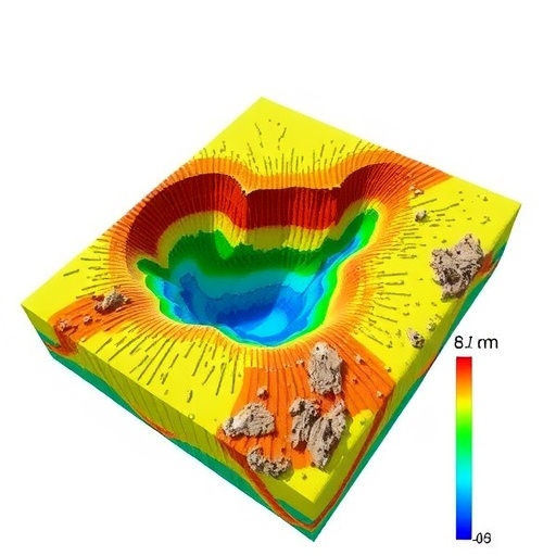
In the ever-evolving field of hydrogeology, addressing the threat of saline intrusion in coastal aquifers has become a critical challenge for sustainable water management. Recent research from Ecuador sheds new light on this issue by applying advanced geoelectric techniques to model, in three dimensions, the saline intrusion dynamics within the Manglaralto coastal aquifer, situated in the province of Santa Elena. This pioneering study not only pushes the boundaries of saline intrusion monitoring but also provides essential insights crucial for managing one of Ecuador’s most vital freshwater resources.
Saline intrusion occurs when seawater encroaches into freshwater aquifers, a phenomenon exacerbated by groundwater over-extraction and sea-level rise. Coastal aquifers like Manglaralto are particularly vulnerable due to their proximity to the ocean and the increasing demand for groundwater from expanding human settlements and agriculture. The geoelectric method, a non-invasive geophysical technique that measures the earth’s resistivity, offers a powerful means of detecting and mapping the distribution of saline water within these subsurface reservoirs.
The application of a 3D geoelectric model to the Manglaralto aquifer marks a significant advance over traditional hydrogeological assessments, which often rely on limited borehole data and two-dimensional representations. By leveraging resistivity measurements acquired through geoelectric surveys, the researchers developed a detailed spatial understanding of where saline water is intruding into the freshwater zone at different depths. This level of precision is essential for implementing targeted mitigation strategies.
Manglaralto’s coastal aquifer is characterized by a complex hydrogeological framework, influenced by variable sedimentary layers, fluctuating ocean tides, and seasonal rainfall patterns. The geoelectric surveys conducted revealed distinct resistivity contrasts corresponding to freshwater zones, brackish interfaces, and fully saline sections. These contrasts enabled the construction of a 3D salinity distribution model, unveiling previously undetected intrusion pathways that threaten freshwater availability.
The study highlights how geoelectric resistivity, linked to the ionic content of pore water, changes drastically between freshwater and saline water environments. Higher salt concentrations decrease resistivity values, thus providing a measurable geophysical signature that the 3D model exploits to differentiate saline intrusion depths and lateral spread. This methodology not only enhances detection accuracy but also reduces costs and environmental disturbance compared to extensive drilling.
Importantly, the comprehensive 3D model reveals an anisotropic pattern of saline intrusion in Manglaralto’s aquifer. Rather than a uniform lateral wedge of saltwater intrusion, the saltwater fronts exhibit complex morphologies influenced by heterogeneities in sediment porosity, permeability, and local hydraulic gradients. Such detailed characterization challenges simplified conceptual models and underscores the necessity for site-specific management plans.
In tandem with geoelectric data, the researchers incorporated hydrochemical analyses of groundwater samples to validate and refine their interpretations. These hydrochemical profiles provided corroborative evidence indicating salinity levels, ion exchange processes, and mixing zones between seawater and freshwater, thereby strengthening the robustness of the integrated 3D intrusion model.
From a technical standpoint, the research team employed state-of-the-art inversion algorithms to convert raw geoelectric measurements into resistivity tomograms. These tomograms then underwent spatial interpolation to compose the subsurface’s 3D resistivity framework. The multi-scale approach allowed the resolution of small-scale features crucial for identifying localized saline intrusion “hot spots” vulnerable to contamination hotbeds.
The implications of this study are profound for water resource management in Ecuador and comparable coastal regions worldwide. By elucidating the three-dimensional nature of saline intrusion processes in unprecedented detail, local authorities and policymakers can develop more effective groundwater extraction regulations, optimize well placements, and prioritize artificial recharge initiatives to counteract saltwater intrusion.
Moreover, this research sets a precedent for integrating geophysical methods with hydrogeological modeling to address anthropogenic impacts on critical aquifer systems. The Manglaralto case study exemplifies how emerging technologies can be harnessed to generate actionable scientific knowledge that supports environmental sustainability and buffers coastal communities against water insecurity.
As climate change accelerates sea-level rise and alters precipitation patterns, the threat of saline intrusion into coastal freshwater reserves intensifies globally. The deployment of geoelectric-based 3D models provides a timely and radical improvement over linear or planar assessments, offering enhanced predictive capability to manage aquifers adaptively in the face of evolving environmental pressures.
Beyond its technical innovations, this research champions a multidisciplinary approach, bridging geophysics, hydrochemistry, and environmental science. Such synergy is pivotal in addressing complex groundwater challenges that intertwine earth sciences with social and economic dimensions, fostering resilient water governance.
In sum, the groundbreaking application of 3D geoelectric modeling to the Manglaralto coastal aquifer stands as a beacon of scientific ingenuity tackling saline intrusion. It reveals intricate subterranean salinity patterns and equips resource managers with precise tools to preserve essential freshwater habitats against the encroaching tides of seawater.
As coastal population centers continue to grow, and climate-driven disruptions mount, the urgency for such innovations cannot be overstated. This research illuminates a path forward—one where advanced geophysical instrumentation and modeling converge to safeguard the planet’s precious groundwater supplies for generations to come.
Future directions inspired by this study might include coupling geoelectric data with real-time monitoring sensors and long-term hydro-climatological models. Such integrations would facilitate dynamic management strategies, allowing water authorities to anticipate and mitigate intrusion events proactively.
In conclusion, the research undertaken in Manglaralto represents a transformative leap in environmental earth sciences. By marrying theoretical rigor with cutting-edge geophysical technology, it provides a replicable blueprint for confronting saline intrusion challenges facing coastal aquifers worldwide, thereby contributing to global efforts for sustainable water security.
Subject of Research: Application of geoelectric techniques to develop a three-dimensional saline intrusion model in the Manglaralto coastal aquifer, Santa Elena, Ecuador.
Article Title: Geoelectric applied to the 3D saline intrusion model of the Manglaralto coastal aquifer, Santa Elena-Ecuador.
Article References:
Sánchez-Zambrano, E., Ramírez, G., Morante-Carballo, F. et al. Geoelectric applied to the 3D saline intrusion model of the Manglaralto coastal aquifer, Santa Elena-Ecuador. Environ Earth Sci 84, 492 (2025). https://doi.org/10.1007/s12665-025-12486-9
Image Credits: AI Generated


