In the ever-evolving landscape of earth sciences, the assessment and prediction of landslides remain a critical challenge. Recent advancements led by Chinese researchers have brought to light groundbreaking methodologies in landslide susceptibility evaluation, particularly focusing on the Xiaowan Reservoir region along the Lancang River. This area, notable for its complex geology and hydrological conditions, presents an ideal case study for advanced predictive modeling of geological hazards. By leveraging fuzzy set theory, a mathematical framework adept at handling uncertainty and imprecision, the research team has pioneered a sophisticated approach that enhances the predictive accuracy of landslide-prone zones with profound implications for disaster mitigation and environmental management.
Landslides are among the most devastating natural phenomena, causing significant damage to infrastructure, ecosystems, and human lives. However, their prediction is inherently complicated by the multifaceted interplay of geological, hydrological, topographical, and anthropogenic factors. Traditional landslide susceptibility models often struggle with the ambiguity and variability intrinsic to these parameters. Here, fuzzy set theory emerges as a powerful tool, allowing for the nuanced representation of uncertainty in environmental variables. Unlike classical binary logic that classifies conditions as either safe or dangerous, fuzzy logic accommodates degrees of membership, thus providing a gradient of susceptibility that can better inform risk assessments.
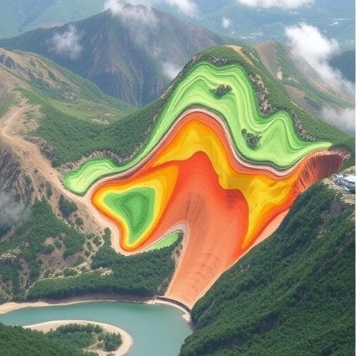
The Xiaowan Reservoir, integral to the Lancang River hydropower project, offers a uniquely challenging terrain characterized by steep slopes, diverse lithological formations, and fluctuating water levels due to reservoir operation. These conditions exacerbate slope instability and highlight the urgency of accurate landslide susceptibility maps. In this context, the researchers integrated fuzzy set theory with Geographic Information Systems (GIS) to process multidimensional spatial data, including slope angle, land use, soil type, precipitation, and proximity to geological faults. This integration enabled a comprehensive model that quantifies the likelihood of landslide occurrence across spatial units with unprecedented granularity.
Central to their methodology was the development of membership functions tailored for each conditioning factor influencing landslides. Membership functions convert crisp input values into fuzzy sets, assigning a degree of belonging between zero and one. For example, slope angles were categorized into gentle, moderate, and steep gradients, each with associated risk levels. By aggregating these fuzzy memberships using fuzzy inference rules, the model synthesized individual factor contributions into a composite susceptibility index. This method mirrors the complexity of natural systems, where risk is rarely dictated by a single parameter but rather by their intricate synergy.
Moreover, the study’s strength lies in its validation technique. By correlating the fuzzy-based susceptibility outputs with known historical landslide occurrences, the researchers assessed the model’s predictive reliability. The results demonstrated significant correspondence, affirming that fuzzy set theory can effectively capture the spatial variability and uncertainty inherent in landslide phenomena. Such validation is critical, especially in regions like the Xiaowan Reservoir, where the socio-economic stakes are high due to extensive human settlement and infrastructure development in potentially hazardous zones.
This innovative approach challenges previous deterministic models that often relied on rigid threshold values and lacked flexibility in handling ambiguous data. Fuzzy logic’s capacity to encompass subjective expert knowledge alongside quantitative measurements enriches the modeling landscape, making it more adaptable to different geological settings. The implications extend beyond the immediate reservoir region, proposing a scalable framework for landslide susceptibility mapping applicable to diverse environments worldwide. This adaptability is especially pertinent as climate change introduces new variables into geological risk assessments, such as altered rainfall patterns and increased frequency of extreme weather events.
Furthermore, the integration with GIS technology enhances the practical utility of the model by producing spatially explicit landslide susceptibility maps. These maps serve as crucial tools for urban planners, engineers, and disaster response teams. They facilitate informed decision-making regarding land development, infrastructure placement, and emergency preparedness. The ability to visualize susceptibility gradients allows stakeholders to identify high-risk zones that warrant detailed geological investigations or preemptive mitigation measures such as slope reinforcement and drainage control.
From a technical standpoint, the utilization of fuzzy set theory also allows for the incremental inclusion of new datasets, enabling model refinement as additional information becomes available. This dynamic quality is invaluable in the context of ongoing environmental monitoring and adaptive hazard management strategies. By continuously updating the membership functions and inference rules, the model can evolve with changing landscape conditions, improving predictive accuracy over time.
The authors highlight the importance of interdisciplinary collaboration in this research. Combining expertise from geotechnical engineering, hydrology, computer science, and environmental management was pivotal in crafting a model that is both scientifically robust and pragmatically relevant. Such cooperation underscores a broader trend in environmental sciences, where complex challenges necessitate holistic approaches integrating diverse perspectives and methodologies.
In conclusion, the fuzzy set theory-based landslide susceptibility assessment conducted in the Xiaowan Reservoir–Lancang River region represents a significant advance in natural hazard prediction. By embracing uncertainty and leveraging spatial data analytics, the research offers a nuanced, scalable, and empirically validated tool for managing landslide risks. Given the increasing pressure on geomorphologically sensitive zones worldwide, this study sets a precedent for future investigations aiming to harmonize technological innovation with environmental stewardship.
As landslides continue to threaten vulnerable communities and critical infrastructure globally, approaches like this inspire confidence in science’s ability to mitigate such risks proactively. The convergence of fuzzy logic, GIS, and field validation presents a compelling paradigm shift, moving landslide susceptibility assessment from rigid deterministic frameworks toward flexible, data-informed decision support systems. This transition is critical for enhancing resilience in the face of growing environmental uncertainties and anthropogenic impacts.
Looking ahead, the integration of fuzzy set theory with emerging technologies such as remote sensing and real-time monitoring could further revolutionize landslide susceptibility assessments. Coupling these models with machine learning algorithms may enable automated, predictive analytics capable of anticipating slope failures before their manifestation. Such foresight would transform disaster management from reactive to proactive, ultimately safeguarding human lives and societal assets more effectively.
The progressive work done on the Xiaowan Reservoir site also opens avenues for policy implications. Governments and regulatory bodies can adopt fuzzy logic-based susceptibility maps to refine zoning laws, enforce environmental impact assessments more stringently, and allocate resources for infrastructure resilience. This aligns scientific advancements with governance, ensuring that technological progress translates into tangible community benefits.
In a broader sense, this research embodies the power of mathematics and computational innovation in unraveling complex natural phenomena. By transcending traditional black-and-white categorizations through fuzzy logic, the model mirrors the inherently probabilistic nature of geological processes. Such alignment between methodological innovation and natural system behavior exemplifies the future direction of earth science research.
Overall, this seminal study not only contributes to scientific literature but also paves the way for safer, smarter, and more sustainable interactions with dynamic landscapes. Its implications resonate across disciplines and geographies, reinforcing the vital role of integrated, innovative approaches in confronting the challenges posed by natural hazards in an increasingly uncertain world.
Subject of Research: Landslide susceptibility assessment using fuzzy set theory in the Xiaowan Reservoir–Lancang River region.
Article Title: Landslide susceptibility assessment based on fuzzy set theory: Xiaowan reservoir–Lancang river.
Article References:
Wenyu, H., Wenfei, X., Zhiquan, Y. et al. Landslide susceptibility assessment based on fuzzy set theory: Xiaowan reservoir–Lancang river. Environ Earth Sci 84, 511 (2025). https://doi.org/10.1007/s12665-025-12505-9
Image Credits: AI Generated
