In a groundbreaking study addressing the complex and increasingly precarious flood risks in one of China’s most vital waterways, researchers have meticulously analyzed how land use changes between 2000 and 2020 have reshaped flood vulnerability in the Yellow River Basin. This expansive investigation employs a combination of hydrological modeling and spatial data analysis to unravel the dynamic interactions between human activities and natural flood processes, offering fresh insights crucial for future flood management and environmental planning.
The Yellow River Basin, often referred to as the cradle of Chinese civilization, spans a massive geographic area and sustains millions of people. Over recent decades, rapid urbanization, agricultural expansion, and infrastructure development have significantly altered the basin’s land cover and hydrological characteristics. Such transformations invariably influence the basin’s response to climatic events, especially heavy rainfall that can provoke devastating floods. By examining two decades’ worth of land use data, the study reveals how these alterations have amplified or mitigated flood risks in various subregions.
At the core of the research lies a sophisticated flood risk assessment framework integrating land use change trajectories with hydrological modeling techniques. Sophisticated remote sensing data alongside geographic information systems (GIS) enabled the team to track land cover transitions, including urban sprawl, deforestation, and agricultural intensification. These were then coupled with hydrodynamic models simulating flood propagation and inundation under diverse scenarios. The hybrid approach provides a dynamic view of how human-induced landscape shifts influence flood hazard, exposure, and vulnerability over time.
One of the most striking findings from the analysis is the spatial heterogeneity in flood risk trends corresponding to differential land use patterns across the basin. Regions witnessing rapid urban growth, especially in mid to lower reaches of the river, showed an alarming increase in flood-prone areas. Impervious surfaces like roads, buildings, and pavement reduce natural infiltration and accelerate surface runoff, thereby intensifying peak flood flows. Conversely, the study identifies certain areas where reforestation efforts and wetland restoration have improved natural water retention capacities, modestly counterbalancing flood hazards.
Furthermore, the temporal evolution of flood risk aligns closely with economic development phases and policy implementations aimed at land management. For instance, large-scale agricultural mechanization led to drainage modifications destabilizing natural water storage systems. Similarly, expansive infrastructure projects, while beneficial for transportation and energy, have inadvertently constrained river channels, exacerbating floodwater buildup during peak events. These findings underscore the critical need for integrated land use planning that harmonizes development goals with ecosystem services vital for flood mitigation.
The Yellow River Basin’s flooding dynamics are also intricately linked with climatic variations during the study period. The paper contextualizes land use changes against patterns of increased precipitation intensity and frequency, attributed to shifting regional climate regimes. By incorporating meteorological datasets, the researchers highlight how combined stressors compound flood risk, rendering mitigation efforts more challenging but also more urgent.
Importantly, the study does not merely provide a retrospective evaluation but also projects future flood risks based on observed land use trends and potential socio-economic trajectories. Simulated scenarios suggest that without strategic intervention, flood hazard zones could expand by significant proportions, especially under climate change scenarios predicting more extreme hydrological events. This predictive capacity adds an invaluable tool for policymakers striving to balance development with disaster resilience.
Technically, the study’s modeling approach exemplifies state-of-the-art integration of multidisciplinary data streams. The hydrological models were calibrated using historical flood records and satellite-derived flood extents, ensuring high accuracy in simulating floodplain dynamics. Advanced machine learning techniques helped classify land use from multi-temporal satellite imagery, overcoming common challenges related to spectral confusion and seasonal variability. This methodological rigor boosts confidence in the findings and sets a benchmark for similar basin-scale flood risk assessments worldwide.
The implications of this research reach far beyond regional boundaries. As many parts of the globe grapple with the dual pressures of urban expansion and climate change, this study’s insights resonate universally. It serves as both a cautionary tale and a roadmap, demonstrating the pitfalls of unregulated land modifications and the benefits of ecosystem-based management approaches to flood reduction. Notably, the emphasis on wetlands and natural floodplains as buffers could inspire analogous conservation efforts elsewhere.
Moreover, the comprehensive dataset and analytical tools developed in this research provide a foundation for ongoing monitoring and adaptive management. Decision-makers can harness these resources to design flood defense infrastructure with a nuanced understanding of local hydrological variability and future risk patterns. Such informed strategies are indispensable for safeguarding vulnerable populations and critical economic assets along the Yellow River.
Another critical dimension explored in the paper is the socioeconomic vulnerability of communities within the flood-prone zones. The research highlights how land use change often intersects with human settlement patterns, influencing exposure and resilience. Rural communities dependent on agriculture face different but equally severe risks compared to densely populated urban centers. The interplay of land dynamics and social factors calls for tailored risk reduction measures that address diverse needs and capacities.
The study also flags potential feedback loops where flood events could in turn drive further land use changes, perpetuating a cycle of vulnerability. For example, repeated inundations might prompt shifts toward less flood-sensitive crop types or even abandonment of certain agricultural lands, leading to secondary environmental and economic effects. Recognizing such feedbacks is essential for crafting long-term, sustainable adaptation policies.
From a policy perspective, the research advocates for coordinated land use governance spanning multiple administrative levels. The Yellow River Basin’s complexity—with overlapping jurisdictions—necessitates integrated frameworks that harmonize urban planning, agricultural policies, and environmental protection mandates. Enhanced data sharing and collaborative platforms could foster such synergy, ensuring that flood risk considerations become an integral part of development decisions.
In conclusion, this seminal work by Liu, Sun, Wang, and colleagues fundamentally advances our understanding of how human-induced landscape changes interact with natural hydrological processes to shape flood risk in one of the world’s most significant river basins. By merging detailed land use dynamics with robust hydrological simulations, the study not only deciphers past and present vulnerabilities but also equips stakeholders with predictive insights crucial for safeguarding the Yellow River Basin against future flood threats. Its methodological innovations and findings bear crucial lessons for global flood risk science and management amid accelerating environmental change.
Subject of Research: Flood risk assessment under land use dynamics in the Yellow River Basin, China.
Article Title: Flood risk assessment under land use dynamics during 2000–2020 in the Yellow River Basin, China.
Article References:
Liu, T., Sun, S., Wang, N. et al. Flood risk assessment under land use dynamics during 2000–2020 in the yellow river basin, China. Environ Earth Sci 84, 513 (2025). https://doi.org/10.1007/s12665-025-12526-4
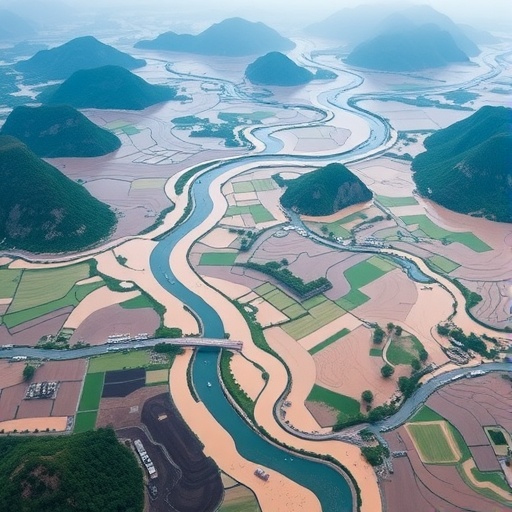
Image Credits: AI Generated
