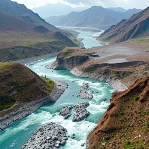
In the remote mountainous terrains of Xinjiang, China, the small village of Qialegeer faces a formidable natural threat that has long eluded comprehensive scientific scrutiny: flash floods. A recent pioneering study by Liu, Yang, Zhao, and colleagues offers an unprecedented deep dive into the catastrophic mechanisms behind these rapid-onset disasters. By crafting a systematic framework for understanding flash floods in ungauged mountainous micro-watersheds, this research sheds vital light on the unpredictable hydrological dynamics in areas previously considered too complex or data-deficient for detailed analysis.
Flash floods pose a unique challenge because of their sudden emergence and devastating impacts, particularly in mountainous zones where elevation, terrain complexity, and micro-climatic variations converge to produce localized yet catastrophic water surges. Traditionally, hydrologists have struggled to quantify flood risks in regions lacking hydrometric stations, where gauging data is unavailable or unreliable. Qialegeer village typifies such an environment, with its intricate topography and sparse instrumental coverage making typical flood prediction models nearly ineffective.
The study’s breakthrough lies in its novel methodological approach: the researchers devised a systematic framework synthesizing geomorphological, meteorological, and hydrological data to unravel the disaster-causing mechanisms at the micro-watershed scale. The framework integrates field observations, remote sensing technologies, and numerical modeling to overcome the absence of direct gauging data. This multi-faceted approach enables the reconstruction and simulation of flash flood events with remarkable precision, offering a replicable blueprint for other data-scarce mountainous catchments worldwide.
Crucial to the framework’s success is its capacity to delineate how subtle variations in local landforms and rainfall patterns interact to trigger flash floods. In Qialegeer, the steep slopes coupled with loose soil composition and episodic intense precipitation create conditions ripe for rapid runoff concentration. The researchers demonstrated that even minor storms, when spatially concentrated and coinciding with vulnerable watershed configurations, can unleash destructive floods within minutes. This insight challenges the conventional wisdom that only large-scale meteorological systems precipitate hazardous floods.
By incorporating high-resolution digital elevation models and satellite-based rainfall estimates, the team surmounted the typical impediment of sparse ground data. Such tools allowed a detailed mapping of flow paths, sediment movement, and accumulation zones, revealing hotspot areas predisposed to flood generation. The detailed hydrological simulations also uncovered critical threshold behaviors—specific intensities and durations of rainfall beyond which the watershed system abruptly shifts from water absorption to overflow. This non-linear response emphasizes the fleeting window for early warning.
Moreover, the study explored the compounding impact of human activities and climate variability on flash flood risk. Qialegeer’s land use patterns, including deforestation and small-scale agriculture, modify surface runoff characteristics by reducing vegetation cover and increasing soil erosion. These anthropogenic changes elevate the vulnerability of micro-watersheds to extreme precipitation events that are growing more frequent under changing climate regimes. The research highlights the urgent need for integrating social-landscape factors into disaster risk management strategies.
This comprehensive, mechanism-focused assessment provides critical implications for hazard mitigation and community resilience. By identifying exact physical processes driving flash floods in ungauged watersheds, authorities and local stakeholders can implement targeted interventions. These might include reforestation, slope stabilization, and the deployment of low-cost sensor networks designed to capture early rainfall thresholds, thus enabling rapid response even in the absence of traditional hydrological stations.
The study’s framework also pioneers a replicable template for adopting advanced remote sensing and modeling technologies in hydrologically challenging environments. It underscores the transformative potential of combining earth observation satellites with fine-scale numerical simulations to bridge the data gap in disaster risk assessment. Importantly, this method transforms previously hidden and complex flood dynamics into actionable intelligence, democratizing hazard knowledge for remote communities worldwide.
Furthermore, the research elucidates the temporal dynamics of flash floods, pinpointing how rapid onset events evolve over timescales of minutes to hours. This understanding shatters previous assumptions that floods in mountainous micro-watersheds could be anticipated only on a long-term basis. The model’s ability to forecast flash flood generation enables the conception of new early warning systems that operate with responsiveness aligned to event timescales—a game-changer for saving lives and property.
Field validation in Qialegeer revealed not only the accuracy but also the practical applicability of the framework. Local reports and geomorphological evidence corroborated model predictions, while community interviews offered nuanced insights into past flood experiences and damage patterns. Integrating scientific rigor with indigenous and local knowledge enhances the relevance and acceptance of flood risk strategies, fostering a holistic approach to disaster resilience.
From a broader scientific perspective, this study exemplifies how bridging disciplinary gaps between hydrology, geomorphology, and climate science can yield breakthroughs in understanding extreme hydrological hazards. It invites the scientific community to rethink methodologies when faced with data limitations and instead embrace hybrid frameworks blending traditional knowledge, technological innovation, and systems thinking. Such approaches are indispensable as mountainous regions worldwide confront intensifying climate stressors.
In conclusion, the comprehensive examination of flash flood mechanisms in Qialegeer village marks a significant leap forward in the field of disaster risk science. By unlocking the complexity within ungauged micro-watersheds, this research provides a critical lens for anticipating and mitigating flash flood disasters in topographically complex, data-poor regions. It offers hope that even in some of the planet’s most challenging environments, predictive science can advance in ways that protect vulnerable communities from nature’s sudden wrath.
As climate change continues to amplify extreme weather events, studies such as this one will grow ever more essential. Effectively managing flash flood risk requires not merely improved technology but also integrated scientific frameworks sensitive to local specifics and grounded in multidisciplinary collaboration. The insightful work conducted on Qialegeer ushers in a new era where science, community knowledge, and innovation converge to reduce disaster losses and safeguard mountain livelihoods.
The implications extend far beyond Xinjiang. Mountainous micro-watersheds from the Andes to the Himalayas can benefit from the methodological innovations presented here. By scaling up such frameworks, global disaster risk reduction efforts can become more inclusive, adaptive, and grounded in the realities of the world’s most vulnerable regions. The study by Liu and colleagues thus represents a foundational step toward more effective flash flood prediction, preparedness, and resilience worldwide.
Subject of Research: Flash flood disaster-causing mechanisms in ungauged mountainous micro-watersheds, with a focus on Qialegeer Village, Xinjiang, China.
Article Title: A Systematic Framework of Flash Floods Disaster-Causing Mechanisms in Ungauged Mountainous Micro-Watersheds: Case Study of Qialegeer Village, Xinjiang, China.
Article References:
Liu, Q., Yang, R., Zhao, L. et al. A Systematic Framework of Flash Floods Disaster-Causing Mechanisms in Ungauged Mountainous Micro-Watersheds: Case Study of Qialegeer Village, Xinjiang, China. Int J Disaster Risk Sci (2025). https://doi.org/10.1007/s13753-025-00675-w
Image Credits: AI Generated
