In a groundbreaking study published recently, researchers have unveiled a sophisticated approach to estimating soil erosion and mapping erosion hazards in the semiarid-arid regions of Central Iran, specifically within the Zayandeh-Rood Dam Watershed. This research leverages the power of state-of-the-art hydrological and soil erosion models — namely, the Soil and Water Assessment Tool (SWAT) and the Revised Universal Soil Loss Equation (RUSLE) — to analyze and predict soil degradation in an environment where water scarcity and climate variability impose severe constraints on agriculture and ecosystem sustainability.
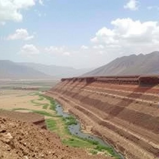
Soil erosion remains one of the most pressing environmental issues globally, exacerbated by both natural processes and anthropogenic factors such as deforestation, overgrazing, and unsustainable agricultural practices. The Zayandeh-Rood watershed is emblematic of these challenges, as it experiences intense climatic stresses characteristic of semiarid and arid zones. To confront these challenges, this study adopted a dual-modelling methodology that combines SWAT’s watershed-scale hydrological simulation capabilities with RUSLE’s established empirical framework for quantifying soil loss, allowing for a nuanced assessment of both soil erosion rates and the spatial distribution of erosion risk.
The SWAT model, renowned for its capacity to simulate water flow, sediment transport, and nutrient cycling at the basin level, was employed to understand the complex interactions between land use, climate, and topography in controlling erosion processes. Meanwhile, RUSLE provided the quantitative framework to estimate annual soil loss by incorporating factors such as rainfall erosivity, soil erodibility, slope length and steepness, vegetation cover, and land management practices. This combined strategy proved instrumental in overcoming the limitations faced by each model when applied independently, thereby generating a more comprehensive and accurate hazard map.
One of the key technical achievements of the research lies in the integration of high-resolution spatial data sets—such as digital elevation models, land use classifications, and soil property databases—with meteorological inputs specific to the Zayandeh-Rood watershed. By incorporating detailed rainfall intensity data and soil texture variability, the models generated erosion estimates with unprecedented precision. This granular level of detail enhances the ability of local environmental managers to make targeted decisions about conservation efforts, infrastructure development, and sustainable land management strategies.
Upon applying the SWAT and RUSLE models throughout the Zayandeh-Rood basin, researchers identified critical hotspots where soil erosion jeopardizes both agricultural productivity and water quality. Their analysis showed that certain sub-watersheds suffer disproportionately high soil loss rates, particularly those characterized by steep slopes, sparse vegetative cover, and vulnerable soil types. These findings underscore the spatial heterogeneity of erosion hazards even within a broadly semiarid climatic zone, reinforcing the importance of site-specific interventions rather than blanket policies.
Intriguingly, the erosion hazard maps generated through this study serve not only as biological and environmental diagnostics but also as strategic tools for long-term watershed management. By offering visualizations of erosion risk under current land use and climate conditions, the research provides a predictive baseline against which the impacts of future climate variability and human activities can be assessed. Consequently, policymakers are equipped with actionable intelligence to prioritize areas where reforestation, terracing, or contour farming would yield the most significant benefits in mitigating soil degradation.
From a methodological standpoint, a vital aspect of the study’s rigor was the calibration and validation of the SWAT model results against observed sediment yield and streamflow data. This benchmarking ensured that simulated outputs mirrored real-world conditions, enhancing confidence in the predictive power of the combined modeling approach. The researchers also performed scenario analysis to examine how different land management practices might alter soil erosion patterns, highlighting the potential effectiveness of conservation measures such as cover cropping or reduced tillage.
The environmental significance of the findings transcends the local context. Globally, semiarid and arid regions face mounting pressures amidst accelerating climate change, which tends to amplify rainfall variability and extreme weather events, thereby exacerbating erosion susceptibility. This study’s coupled SWAT-RUSLE framework, validated in a challenging environment like Central Iran, offers a transferable template for other dryland watersheds confronting the dual threats of degradation and desertification. By showcasing how multi-model integration can bridge gaps between hydrology and soil science, the research paves the way for more resilient ecosystem management globally.
Moreover, the granular erosion hazard maps produced through this study have profound socio-economic implications. In agricultural communities dependent on the highly variable Zayandeh-Rood watershed, soil erosion translates directly into diminished crop yields and food insecurity. With erosion undermining topsoil fertility and water retention capacity, affected populations face escalating vulnerability to drought and land degradation. Consequently, targeted watershed management informed by precise erosion assessments can support sustainable livelihoods by safeguarding soil resources and enhancing agricultural resilience.
The study also addresses knowledge gaps in semiarid region erosion modeling by contextualizing how complex terrain interacts with anthropogenic pressures to modulate erosion dynamics. In contrast with humid regions, where high rainfall often dominates soil loss mechanisms, in semiarid contexts the interplay between vegetation cover, land use intensity, and episodic erosive storms is far more nuanced. The dual use of SWAT and RUSLE allows for capturing these subtleties through a combination of process-based hydrologic simulation and empirical erosion quantification, marking an advance in integrated environmental modeling.
Looking ahead, the authors emphasize the potential to augment this modeling framework with real-time remote sensing inputs, enabling dynamic updating of erosion risk maps in response to changing precipitation patterns, land cover alterations, or extreme events such as flash floods. Incorporating satellite data on vegetation indices or soil moisture levels could bolster the temporal responsiveness of erosion hazard assessments, facilitating adaptive watershed management strategies that keep pace with rapid environmental change.
In addition to environmental applications, this research has critical implications for infrastructure planning. Soil erosion directly threatens the structural integrity of irrigation networks, reservoirs, and roads within the Zayandeh-Rood watershed. By pinpointing areas of maximal soil loss, engineers and planners can prioritize erosion control projects and reinforce vulnerable infrastructure to mitigate maintenance costs and ensure the longevity of vital water resources that sustain millions downstream.
The study’s innovative methodological synthesis affirms the paramount importance of interdisciplinary collaboration in environmental science. Expertise in hydrology, soil science, geomorphology, and geographic information science converged to deliver actionable insights into erosion processes that are critical under conditions of heightened climatic stress. This holistic approach is emblematic of the future trajectory of environmental research, where complex problems mandate the synthesis of diverse data and modeling perspectives.
Significantly, this body of work contributes to the broader discourse on sustainable development in arid lands, where balancing human needs with ecosystem preservation requires rigorous scientific foundations. As water scarcity intensifies worldwide, safeguarding soil resources through accurate erosion assessments is key to ensuring both ecological health and human well-being. The Zayandeh-Rood Watershed study sets a precedent for integrating advanced computational models to inform policies that navigate these trade-offs intelligently.
Ultimately, this research demonstrates that through rigorous application of coupled modeling frameworks, semiarid regions can harness modern technological advances to confront long-standing challenges of soil erosion. By producing detailed, spatially explicit hazard maps and scenario analyses, the study empowers stakeholders at multiple scales—from local communities to regional planners—to enact evidence-based responses that promote land stewardship and resilience amid climate uncertainty. As such, the work represents a seminal contribution to environmental earth sciences with tangible impacts on sustainable land and water management.
Subject of Research: Soil erosion estimation and hazard mapping in a semiarid-arid watershed using integrated SWAT and RUSLE models.
Article Title: Soil erosion estimating and hazard mapping using SWAT and RUSLE models in a semiarid-arid region, Zayandeh-Rood Dam Watershed, Central Iran.
Article References:
Ghavami, M.S., Zhao, S., Ayoubi, S. et al. Soil erosion estimating and hazard mapping using SWAT and RUSLE models in a semiarid-arid region, Zayandeh-Rood Dam Watershed, Central Iran. Environ Earth Sci 85, 45 (2026). https://doi.org/10.1007/s12665-025-12794-0
Image Credits: AI Generated
