In an era marked by the relentless expansion of infrastructure and the ever-increasing demands placed upon bridges worldwide, a groundbreaking study has emerged that revolutionizes the way engineers and scientists assess geo-hazard risks associated with long-span bridges. This pioneering research, led by a consortium of international experts, ushers in a new epoch of structural safety using advanced remote sensing technologies, notably Interferometric Synthetic Aperture Radar (InSAR). The study, recently published in the prestigious journal Nature Communications, introduces a global geo-hazard risk assessment framework for long-span bridges that is meticulously enhanced by the availability of InSAR data, providing an unprecedented level of insight and precision in identifying vulnerabilities threatening these critical infrastructures.
For decades, the engineering community has grappled with the challenge of accurately monitoring and assessing threats from natural hazards such as earthquakes, landslides, flooding, and soil subsidence—phenomena that can severely compromise the integrity of long-span bridges. Traditional methods, reliant on ground-based inspections and sporadic sensor networks, have often fallen short in delivering comprehensive, continuous, and real-time data at the scale necessary for the increasing lifespan and complexity of modern bridges. The integration of InSAR within this global assessment strategy represents a quantum leap, harnessing satellite-based radar interferometry to detect millimeter-level ground displacements over expansive geographic regions.
The technique of InSAR utilizes the phase difference between two or more radar images captured at different times to precisely measure ground deformation patterns. This capacity, while already established in geophysics and earth sciences, is now being ingeniously adapted to the realm of infrastructure health monitoring on a planetary scale. The research team effectively bridges the gap between geohazard detection and structural health diagnostics by overlaying these deformation measurements with bridge location data obtained from global infrastructure inventories. This synergy not only identifies existing risks but also predicts emerging threats before they evolve into catastrophic failures.
Central to the study is the creation of a comprehensive global dataset that synthesizes bridge vulnerability profiles with high-resolution InSAR displacement time series. This dataset encompasses thousands of long-span bridges distributed worldwide, capturing a spectrum of geological settings from tectonically active zones to subsidence-prone deltas. By correlating ground movement signals directly beneath or adjacent to these bridges, the researchers reveal alarming trends that were hitherto concealed by limitations in traditional monitoring systems. Many bridges exposed to slow-moving, creeping landslides or gradual soil compaction are flagged as high risk, labeled as “silent alarms” due to the subtlety of their deformation patterns.
One of the remarkable outcomes of this research is the delineation of distinct hazard typologies linked to geographical and geological contexts. Bridges situated in seismically volatile regions like the Pacific Ring of Fire show episodic displacement spikes associated with earthquake sequences, while those in river delta systems experience chronic settlement influenced by hydrological changes and sediment deposition. This multidimensional hazard characterization enables infrastructure managers to tailor mitigation strategies with location-specific precision, optimizing resource allocation for maintenance and reinforcement interventions.
The methodological innovation extends beyond hazard identification; it also involves risk quantification through probabilistic modeling calibrated with InSAR-derived displacement metrics. The team integrates these geospatial datasets with structural parameters such as bridge age, design typology, and material properties, producing a robust vulnerability index that informs risk prioritization at scales previously unattainable. This holistic approach ensures that both natural hazard intensity and structural resilience are accounted for in assessing overall safety.
Perhaps most notably, the implementation of this global assessment framework carries transformative implications for resilience planning amidst accelerating climate change. With the planet experiencing rising incidences of extreme weather events and shifting geological patterns, dynamic risk monitoring tools like the InSAR-enhanced system offer a proactive defense mechanism. By continuously updating risk profiles, authorities can anticipate the cumulative impacts of hazards and enact timely measures to safeguard both human lives and economic assets dependent on bridge infrastructure continuity.
The study also underscores the democratization of disaster risk management facilitated by open-access satellite data archives. The widespread availability of InSAR imagery from constellations such as Sentinel-1 empowers not only centralized agencies but also local planners, researchers, and even citizen scientists to engage in bridge monitoring initiatives. This inclusivity promotes a collective vigilance culture that can catalyze quicker responses to emerging threats and foster innovation in hazard mitigation technologies.
Not confined solely to risk assessment, the researchers illustrate novel applications of InSAR for post-event disaster response. By rapidly mapping deformation fields following seismic or hydrological catastrophes, emergency responders gain valuable situational awareness on the structural health of bridges vital for evacuation routes and supply chains. This capability enhances decision-making under critical conditions, potentially saving lives and minimizing economic disruption.
Beyond immediate hazard contexts, the research points to long-term infrastructure stewardship benefits. Integration of InSAR data into asset management systems enables the detection of cumulative damage mechanisms such as fatigue induced by persistent micro-movements. This foresight facilitates the scheduling of preventive maintenance, extending bridge service life and reducing lifecycle costs while maintaining safety standards.
The interdisciplinary nature of the study also exemplifies a model for future geotechnical and civil engineering research. Bringing together remote sensing experts, structural engineers, geologists, and data scientists, the collaborative effort demonstrates how convergent technologies can unlock complex hazard phenomena often obscured by disciplinary silos. Such synergistic approaches are indispensable in addressing the global infrastructure vulnerabilities of the 21st century.
Ultimately, this transformative research harnesses the unparalleled spatial and temporal resolution of satellite radar interferometry to illuminate the often invisible geohazard landscapes impacting long-span bridges worldwide. It empowers stakeholders with actionable intelligence grounded in cutting-edge science and reinforces the imperative for integrating advanced remote sensing within infrastructure risk management paradigms. As bridges stand as critical arteries of modern civilization, safeguarding their integrity through innovative monitoring technologies is not merely an academic exercise but a societal imperative with profound consequences.
In conclusion, the integration of InSAR data into the global geo-hazard risk assessment framework for long-span bridges signifies a paradigm shift in infrastructure monitoring and disaster risk reduction. By leveraging satellite-based measurements capable of detecting subtle ground movements on a worldwide scale, this methodology offers unprecedented foresight into the vulnerabilities of essential structural assets. Its multifaceted applications in preventive maintenance, emergency response, and resilience planning mark a substantial leap forward in protecting bridges against the increasing challenges imposed by natural hazards and climate change. The implications of this work extend far beyond the scientific community, promising tangible benefits for societies dependent on resilient, safe, and sustainable infrastructure networks.
Subject of Research: Geo-hazard risk assessment of long-span bridges using satellite radar interferometry (InSAR).
Article Title: Global geo-hazard risk assessment of long-span bridges enhanced with InSAR availability.
Article References:
Malinowska, D., Milillo, P., Reale, C. et al. Global geo-hazard risk assessment of long-span bridges enhanced with InSAR availability. Nat Commun 16, 9048 (2025). https://doi.org/10.1038/s41467-025-64260-x
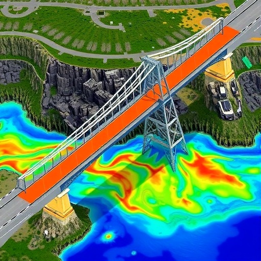
Image Credits: AI Generated
