In a groundbreaking study published in Environmental Earth Sciences, researchers have illuminated the profound impacts of channel bottlenecking and anthropogeomorphic interventions on flood dynamics and wetland conditions within the Lower Gangetic floodplain, a critical ecological and hydrological region in South Asia. This comprehensive investigation reveals the escalating complexities that human alterations impose on a naturally intricate floodplain system, underscoring urgent calls for sustainable management practices to preserve biodiversity, hydrological balance, and the livelihoods of millions dependent on these wetlands.
The Lower Gangetic floodplain, situated in the deltaic region of the Ganges River, functions as a hydrological nexus where riverine waters disperse into multiple wetlands and distributaries before reaching the Bay of Bengal. This floodplain’s ecological significance is matched only by its socio-economic importance, hosting diverse habitats alongside complex agricultural and habitation systems. However, rapid anthropogenic changes such as construction of embankments, channel narrowing, and land reclamation have dramatically altered its geomorphology and hydrodynamics in recent decades.
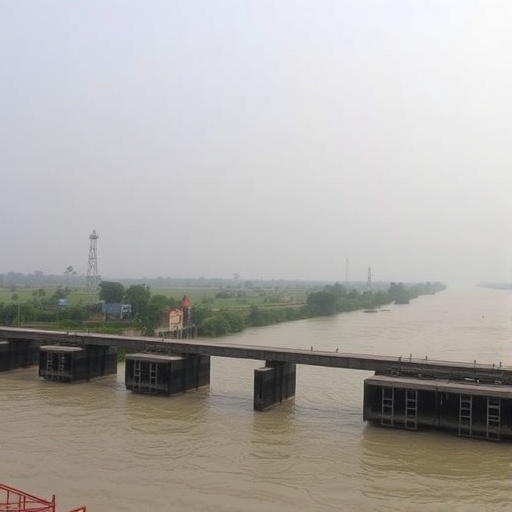
At the heart of the study is the phenomenon of channel bottlenecking, a process characterized by the constriction of natural watercourses due to human interventions including the erection of levees, bridges, and urban expansion. This constriction severely hampers water flow during the monsoon season when the Ganges witnesses massive discharge volumes. The researchers utilized a multidisciplinary approach combining remote sensing, hydrological modeling, and field surveys to quantify how these bottlenecks modulate floodwater movement, exacerbate inundation extents, and disrupt sediment transport processes.
One of the prominent findings is that bottlenecking concentrates floodwaters upstream of the constricted channel sections, leading to elevated flood peaks and prolonged inundation durations. This not only intensifies flood hazard for human settlements and farmlands but also destabilizes the delicate wetland ecosystems dependent on seasonal flooding cycles. The accumulation of floodwaters upstream often triggers anomalous sediment deposition patterns, further altering channel morphology and wetland hydrology over time.
The study equally emphasizes anthropogeomorphic alterations—changes to the landform induced by human activities—that compound the flood risks by disrupting the natural connectivity between river channels and adjoining wetlands. For instance, embankments built to protect agricultural lands disrupt the natural overflow of floodwaters into wetlands, effectively isolating these habitats and altering their ecological functions. These modifications curtail the wetlands’ ability to act as natural buffers and flood absorbers, thereby exacerbating downstream flooding severity.
Furthermore, the research reveals that anthropogenic land-use changes like deforestation and urban sprawl increase surface runoff and decrease infiltration capacity, compounding the flood intensity and frequency. These human-induced surface alterations have cascading effects, amplifying the vulnerability of the entire floodplain to extreme hydrological events exacerbated by climate change, such as more intense monsoon rains.
Hydrodynamic simulations presented by the authors demonstrate that increase in peak discharges caused by channel narrowing coincides with reduced floodwater evacuation efficiencies downstream, highlighting the critical need for integrated floodplain management practices. Their models also show that strategic removal or modification of some bottlenecks can significantly restore natural flood regimes and improve wetland health, suggesting a path forward for mitigating flood risks.
The interplay between sediment transport dynamics and anthropogeomorphic interventions unveils yet another layer of complexity. The study documents that channel constrictions lead to sediment trapping, which modifies riverbed elevations and leads to localized aggradation upstream. This sediment accumulation, in turn, threatens channel conveyance capacity and exacerbates flood hazards. Meanwhile, downstream reaches experience sediment starvation that jeopardizes delta stability and wetland formation processes.
Underscoring the ecological ramifications, the research highlights that changes in flooding regimes jeopardize the life cycles of several wetland-dependent flora and fauna species. Seasonal inundation is crucial for nutrient cycling, fish spawning, and habitat connectivity. Interruptions to these cycles risk biodiversity losses and weaken ecosystem resilience in the face of environmental change.
Crucially, the authors advocate for implementing nature-based solutions alongside engineered interventions. Restoring floodplain wettability through controlled breach of embankments, revitalizing natural flow paths, and conserving upstream forest cover can markedly improve hydrological functions and reduce anthropogenic stress. Such integrated, holistic approaches hold promise for maintaining the delicate equilibrium of floodplain environments.
This investigation also draws attention to the socio-economic dimensions of altered flood dynamics. Disrupted wetland ecosystems directly impact agricultural productivity, fisheries, and water resources, essential to millions living in the region. Flooding of extended duration causes economic losses, health risks, and displacement, amplifying the need for participatory flood management and inclusive policy frameworks that consider the needs of vulnerable communities.
Moreover, the study situates these localized changes within the broader context of climate variability and human development pressures. Increasing precipitation intensity combined with infrastructural expansion without due regard for geomorphological responses compounds the risks of catastrophic flooding events. The integration of geomorphic understanding into regional planning thus emerges as an imperative for sustainable resilience.
The scientists emphasize advancing monitoring technologies for continuous assessment of channel morphology and hydrology, leveraging satellite data, and real-time hydrodynamic modeling. Such innovations can inform adaptive management strategies, enabling policymakers and stakeholders to anticipate and mitigate emerging flood threats proactively.
In conclusion, the research presents a stark reminder that the intertwined fates of natural riverine systems and human societies demand respect for ecological processes and informed, adaptive interventions. Channel bottlenecking and anthropogeomorphic modifications, if unchecked, threaten to unravel the intricate balance that sustains the Lower Gangetic floodplain’s rich biodiversity and the livelihoods of millions. This study catalyzes a critical discourse on the need for science-driven, collaborative floodplain governance integrating geomorphology, hydrology, ecology, and socio-economic realities to foster resilience in one of the world’s most vital deltaic landscapes.
Subject of Research: Impact of channel bottlenecking and anthropogeomorphic interventions on flooding and wetland ecology in the Lower Gangetic floodplain.
Article Title: Impact of channel bottlenecking and anthropogeomorphic interventions on flood and wetland conditions in the lower gangetic floodplain.
Article References:
Ghosh, R., Mukhopadhyay, S., Debanshi, S. et al. Impact of channel bottlenecking and anthropogeomorphic interventions on flood and wetland conditions in the lower gangetic floodplain. Environ Earth Sci 84, 604 (2025). https://doi.org/10.1007/s12665-025-12616-3
Image Credits: AI Generated
