In a groundbreaking advancement set to redefine the field of geophysical monitoring, researchers B.C. Kara and K.Ö. Hastaoğlu have introduced an innovative AI-augmented Synthetic Aperture Radar (SAR) system designed to detect and analyze ground deformation with unprecedented accuracy. This cutting-edge technology, termed the Adaptive Regional AI System (ARAIS), melds artificial intelligence with remote sensing methodologies to revolutionize how scientists observe the subtle and often elusive movements of the Earth’s surface.
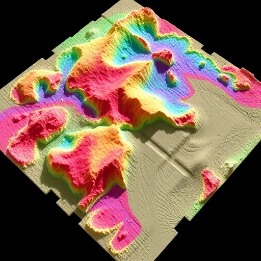
Synthetic Aperture Radar has long been a cornerstone technology for monitoring ground deformation, offering all-weather, day-or-night imaging capabilities that are critical in tracking phenomena such as earthquakes, landslides, and subsidence. However, while SAR data acquisition has advanced, the interpretation process has remained labor-intensive and prone to uncertainties due to the complex nature of surface deformation signals. ARAIS aims to overcome these challenges by integrating adaptive AI algorithms directly into the SAR data processing workflow, boosting both the resolution and reliability of deformation measurements.
The fundamental innovation in ARAIS lies in its adaptive learning capability, which allows the system to self-optimize based on regional characteristics and evolving deformation patterns. Unlike traditional SAR imaging that relies on static models and predefined parameters, ARAIS continuously refines its analytical models using machine learning techniques, effectively tailoring its sensitivity and detection thresholds to the specific geophysical context. This ensures that subtle deformations, once obscured by noise or environmental interference, are now detectable with a higher level of confidence.
Central to ARAIS is the incorporation of advanced neural network architectures trained on vast datasets encompassing diverse geological scenarios. These AI models leverage convolutional and recurrent layers to not only identify deformation patterns but also predict their temporal evolution. This predictive capability is vital for proactive risk mitigation, enabling authorities and communities to receive earlier warnings and prepare accordingly for events ranging from volcanic eruptions to infrastructure destabilization.
Furthermore, the system’s regional adaptability addresses an intrinsic limitation faced by global SAR applications: the variability in atmospheric conditions, land cover, and surface properties that often distort radar signals. By dynamically analyzing regional metadata and incorporating environmental feedback loops, ARAIS calibrates its sensing algorithms to minimize errors such as ionospheric delays or decorrelation effects, which traditionally hinder the accuracy of ground displacement measurements.
The implications of this technology extend far beyond academic research. Urban planners, disaster management agencies, and environmental monitoring organizations stand to benefit immensely from ARAIS’s real-time, high-fidelity ground deformation maps. This is especially crucial in densely populated regions prone to seismic activity, where early detection of micro-deformations can save lives by informing evacuation plans and infrastructure reinforcements.
In addition to enhancing the technical precision, ARAIS also offers significant improvements in data processing speed. By embedding AI modules that can autonomously interpret incoming SAR data streams, the system reduces the latency typically associated with manual analysis. This near-instantaneous processing pipeline ensures that stakeholders have access to the latest ground deformation insights, transforming the traditional reactive response model into a proactive and anticipatory framework.
The development of ARAIS also reflects a broader trend in Earth sciences towards the convergence of remote sensing and artificial intelligence. The team’s novel approach exemplifies how cross-disciplinary innovation can unlock new dimensions of environmental understanding, potentially inspiring further applications across climate monitoring, hydrology, and soil stability assessments.
Notably, Kara and Hastaoğlu validated their system through extensive field tests and historical data analyses, demonstrating its efficacy in detecting both gradual subsidence due to groundwater extraction and sudden shifts caused by tectonic movements. These validation efforts confirm that ARAIS not only matches but frequently surpasses existing state-of-the-art SAR techniques in both sensitivity and reliability.
As the global community grapples with the increasing impacts of natural hazards exacerbated by climate change, tools like ARAIS are invaluable. They empower scientists and decision-makers with granular, timely, and actionable knowledge about the earth’s dynamic crust, facilitating more effective interventions that can mitigate economic losses and safeguard human lives.
Looking ahead, the research team envisions enhancements to ARAIS that incorporate multi-sensor data fusion, integrating satellite optical imagery, GPS readings, and ground-based sensors. This holistic approach could further augment the system’s diagnostic precision, providing a comprehensive picture of ground deformation phenomena across multiple spatial and temporal scales.
The introduction of ARAIS marks a significant leap towards smarter, AI-driven geospatial intelligence, showcasing the transformative potential of technology when applied to one of the most critical challenges on our planet. The ability to monitor ground deformation adaptively and accurately not only advances scientific inquiry but also strengthens societal resilience against geological threats.
This pioneering work has been detailed in the article “AI-Augmented Synthetic Aperture Radar (SAR) for ground deformation: Introducing the Adaptive Regional AI System (ARAIS)” published in Environmental Earth Sciences. It heralds a future where artificial intelligence and earth observation systems coalesce to create more responsive, precise, and reliable tools that monitor our planet’s restless surface with unparalleled sophistication.
Subject of Research: AI-augmented Synthetic Aperture Radar for detecting and analyzing ground deformation using an adaptive regional AI system.
Article Title: AI-Augmented Synthetic Aperture Radar (SAR) for ground deformation: Introducing the Adaptive Regional AI System (ARAIS).
Article References:
Kara, B.C., Hastaoğlu, K.Ö. AI-Augmented Synthetic Aperture Radar (SAR) for ground deformation: Introducing the Adaptive Regional AI System (ARAIS). Environ Earth Sci 85, 77 (2026). https://doi.org/10.1007/s12665-025-12797-x
Image Credits: AI Generated
