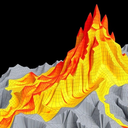
In the complex and critical field of geotechnical engineering, the foundation of any structure is paramount to its overall stability and safety. The depth of the bearing layer, which is the subsurface stratum capable of supporting structural loads, plays an indispensable role in foundation design. Understanding this depth accurately is even more crucial in earthquake-prone regions such as Tokyo, where soil liquefaction—a phenomenon where saturated soil temporarily loses strength and stiffness during seismic activity—presents a significant risk. Traditionally, geotechnical engineers have relied on laborious and costly methods, like the Standard Penetration Test (SPT), to assess the bearing layer depth. However, emerging from the intersection of data science and civil engineering, recent advancements led by researchers at the Shibaura Institute of Technology (SIT) in Japan suggest a transformative alternative: applying machine learning (ML) techniques to predict bearing layer depth effectively and efficiently.
Professor Shinya Inazumi and his team embarked on this pioneering study against the backdrop of Tokyo’s seismic vulnerability and dense urban landscape. Recognizing the limitations of traditional subsurface investigation methods, they leveraged a large geological dataset comprising 942 survey records, including SPT data sourced from within the Tokyo metropolitan area. The novelty of their approach lies in integrating geographic variables such as latitude, longitude, elevation, alongside stratigraphic classification data of underground soil layers, as key inputs to train advanced ML models. These models included Random Forest (RF), Artificial Neural Networks (ANN), and Support Vector Machines (SVM), each widely recognized for their predictive capabilities in various scientific domains.
Their extensive comparative analysis revealed a clear frontrunner: the Random Forest algorithm significantly outperformed both ANN and SVM in predicting the bearing layer depth. Quantitatively, RF achieved a mean absolute error (MAE) as low as 0.86 meters when stratigraphic classification was included among input variables—a marked improvement over the 1.26 meters MAE recorded without this additional data. This highlights not only the superior accuracy of RF but also emphasizes the critical influence of detailed subsurface geological information in refining model predictions. Moreover, RF exhibited remarkable resilience to data noise, a common challenge in geotechnical datasets, showcasing its robustness for real-world applications.
The inclusion of stratigraphic data into the predictive models represents a significant innovation. Stratigraphy, essentially the characterization and categorization of sedimentary layers and soil types beneath the surface, provides contextual insights into the subsurface environment. By integrating this dimension, the ML models gain a more nuanced understanding of the geological variability, which directly impacts the stability and bearing capacity of soil layers. The researchers’ bifurcated approach—Case-1 using only geographic coordinates and elevation, and Case-2 adding stratigraphy—brought to light the pronounced benefits of incorporating multi-faceted geological data.
Beyond accuracy, the study also delved into spatial data density’s role in enhancing ML model performance. The researchers intelligently varied the density of data points per square kilometer across six discrete levels, from 0.5 to 3.0 points/km², observing tangible improvements in prediction outcomes as data density increased. This finding is critical for urban planners and engineers tasked with optimizing resource allocation—they affirm that gathering more spatially dense datasets fortifies model reliability, underscoring the value of comprehensive geological surveys coupled with advanced data analytics.
The implications of these findings extend far beyond mere academic inquiry. With machine learning models like RF demonstrating cost-efficiency and speed advantages over traditional SPT methods, the potential to revolutionize disaster risk assessment and infrastructure planning in seismically active regions is profound. SPT, while reliable, demands extensive fieldwork, expert labor, and significant temporal investment—all of which can constrain rapid urban development and disaster preparedness efforts. By contrast, ML-driven approaches can harness existing geological databases and computational power to deliver quick, scalable predictions without compromising accuracy.
Professor Inazumi’s team envisions this technological progression enabling more resilient urban development strategies in earthquake-prone cities. By deploying machine learning models that seamlessly integrate spatial and stratigraphic variables, stakeholders can simulate various foundation design scenarios rapidly and optimize site selections for critical infrastructure projects—ranging from skyscrapers and bridges to subways and utilities. Not only does this promise enhanced structural safety, but it also aligns with sustainable urban growth principles by reducing unnecessary excavation and construction delays.
Furthermore, the research emphasizes the transformative potential of real-time data integration and advanced computing architectures. As computational capabilities continue to evolve—with faster processors, cloud computing, and AI-powered platforms—there lies an opportunity to embed such ML models into urban monitoring systems. These real-time frameworks could continuously update bearing layer depth predictions using fresh geological data inputs, thus providing dynamic risk assessments essential for disaster management and civil engineering operations.
The success of this research is particularly poignant given Tokyo’s historical challenges with seismic events, notably the devastating 1923 Great Kanto Earthquake. The urban fabric of Tokyo and many similar metropolitan regions depends heavily on the ability to anticipate and mitigate geotechnical hazards through precise subsurface understanding. This study not only bridges a critical gap between data science and geotechnical engineering but also exemplifies how interdisciplinary approaches can foster smarter, safer cities.
It is important to note that while the Random Forest algorithm excelled in this context, the study’s holistic evaluation of ANN and SVM laid a foundation for future explorations into ensemble learning methodologies and hybrid modeling frameworks. These directions could capitalize on strengths across algorithms, further driving the precision and applicability of ML in geotechnical evaluations. Additionally, refinement of input features, such as incorporating soil moisture content, seismic wave velocity, or groundwater levels, could augment model capabilities in subsequent research phases.
This work also addresses broader challenges within disaster management and risk assessment practices. By providing a scalable toolset capable of regional assessment, urban infrastructure planners can prioritize investments, design resilient foundations, and enforce building regulations with greater confidence. In regions with sparse geological data, the findings advocate for strategic data collection campaigns to enrich datasets, which in turn would empower predictive algorithms to operate optimally.
Concluding their groundbreaking study published in the July 2025 issue of Machine Learning and Knowledge Extraction, the SIT research team underscores a visionary outlook: integrating machine learning with established geotechnical frameworks will not only reduce reliance on expensive, time-consuming physical testing but also catalyze innovation across civil engineering disciplines. Their research paves the way for adaptive infrastructure systems capable of withstanding the geopolitical reality of natural disasters, simultaneously fostering societal safety and economic efficiency.
In sum, the pioneering fusion of machine learning and geotechnical engineering heralds a new era in urban safety and engineering practice. As these predictive tools continue to mature, the promise of smarter, more resilient cities becomes increasingly attainable, marking a significant leap forward in humanity’s quest to build not only taller buildings but also safer communities.
Subject of Research: Civil Engineering, Geotechnical Engineering, Machine Learning Applications in Earth Sciences
Article Title: Prediction of Bearing Layer Depth Using Machine Learning Algorithms and Evaluation of Their Performance
News Publication Date: July 21, 2025
References: DOI: 10.3390/make7030069
Image Credits: Credit: Shinya Inazumi from Shibaura Institute of Technology
Keywords: Civil Engineering, Urban Planning, Seismology, Earthquakes, Machine Learning, Artificial Intelligence, Natural Disasters, Disaster Management, Risk Assessment
