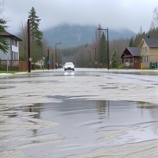
A groundbreaking study conducted by researchers at the University of British Columbia (UBC) is reshaping our understanding of flood risks in the era of climate change. The study underscores that even modest increases in river flows, historically overlooked, can significantly escalate the frequency of flooding events, posing urgent challenges for infrastructure resilience and community safety. This revelation calls for a paradigm shift in flood risk management—it is no longer sufficient to focus solely on the magnitude of rare catastrophic floods. Instead, emphasis must be placed on tracking the recurrence interval of floods, which are becoming alarmingly more frequent.
Dr. Younes Alila, a professor at UBC’s faculty of forestry and co-author of the study, highlights the alarming trend, stating, “Floods that were once considered extraordinary ‘once-in-100-year’ events are now happening once or twice every decade.” This shift in flood frequency demands an evolution in both hydrological modeling approaches and the strategies employed by flood risk managers. Traditional models that prioritize peak flood sizes do not account for the nuanced risks posed by the changing temporal patterns of flooding events, which this study captures in stark detail.
The research, spearheaded by master’s student Samadhee Kaluarachchi alongside Dr. Alila, critically examines the limitations of established flood management paradigms—particularly those relying on static return periods like the “200-year flood.” By performing an extensive literature review of international watershed data, the study reveals that these conventional benchmarks are underestimating the increasingly dynamic flood risks amplified by human activities and climate pressures. This calls into question the efficacy of current infrastructure design and emergency preparedness protocols.
A key insight emerging from this research is that many flood events originate far upstream in headwater regions, often several hundred kilometers from downstream urban centers. The study emphasizes how land-use changes, particularly forestry practices such as clear-cutting, have a pronounced effect not only on the magnitude but also the frequency of flooding events. Clear-cutting disrupts soil integrity and vegetation cover, which diminishes the watershed’s natural capacity to absorb and regulate stormwater runoff, thereby exacerbating flood peaks and frequency downstream.
Working collaboratively with natural systems offers a promising avenue for flood mitigation. B.C.’s intricate landscape of lakes, wetlands, and forested areas inherently buffers against flood surges by storing precipitation and releasing it slowly over time. The study’s findings suggest that sustainable forestry practices that protect these natural hydrologic components can meaningfully reduce flood risk. For instance, logging upstream of lakes has significantly less impact on increasing flood frequency than harvesting activities conducted below such water bodies, where alterations directly affect runoff volumes.
The research further notes that high-elevation logging can have unintended consequences by intensifying snowmelt-driven floods, a critical consideration in mountainous regions where snow accumulation and melt cycles are sensitive to climate variability. This complex interplay between forest management and hydrology underscores the necessity for adaptive, site-specific policies rather than one-size-fits-all solutions.
Urban planning must also evolve to address flood risks that are compounded by impervious surfaces and stormwater infrastructure designed under outdated assumptions. The study highlights innovative “sponge city” initiatives aimed at restoring the ground’s ability to absorb rainfall, thereby reducing runoff and mitigating downstream flooding. These nature-based solutions, such as tree planting and wetland restoration, have been met with some skepticism in the past but are now gaining empirical support as effective, scalable interventions.
Another critical finding pertains to the performance degradation of existing flood defense structures. Many dikes, levees, and embankments in the Lower Mainland of B.C. were constructed based on historical data that fails to reflect current hydrological realities. A 2015 assessment revealed that nearly 70% of these structures were in only fair or poor condition, underscoring a systemic vulnerability as moderate floods—occurring more frequently under the new norms—cause incremental but cumulative damage such as riverbank erosion, foundation scouring, and sediment clogging.
The erosion of infrastructure is particularly concerning because failures are more likely triggered by these moderate recurrent events than by extreme, record-breaking floods. Consequently, current engineering standards and maintenance regimes need urgent revision to incorporate the increased frequency of moderate floods alongside rare extremes. Climate change’s role in making extreme events more common only amplifies the urgency of this recalibration.
Economically, the surge in flood events has already manifested in escalating flood-related litigation and insurance claims, a trend that Dr. Alila warns will continue without a science-based overhaul of regulations and floodplain management policies. The study urges governments, planners, and engineers to integrate flood frequency metrics into risk assessment models and infrastructure design to preempt failures and safeguard communities more effectively.
Published in Frontiers in Environmental Science, an open-access peer-reviewed journal, this study not only identifies the multifaceted challenges posed by increased flood frequency in the Anthropocene but also offers a robust, stochastic-physics-based framework for managing extremes in the context of evolving environmental and anthropogenic pressures. Its open-access status ensures that flood managers, policymakers, and stakeholders worldwide can readily apply these insights to local flood risk governance.
As rivers respond dynamically to upstream disturbances, the research fundamentally challenges the entrenched focus on extreme flood magnitudes alone. Instead, by capturing the causal mechanisms and stochastic variability in flood recurrence, it equips flood risk professionals with a more realistic, predictive understanding of contemporary flood hazards. This represents a crucial step forward in aligning hydrological science with the pressing realities posed by climate change and land-use transitions.
The collective message from the UBC research team is clear: managing flood risk in today’s changing environment requires integrated strategies that embrace the complexity of natural systems, incorporate dynamic flood frequency analysis, and prioritize adaptive infrastructure and land management. As the frequency of flooding shifts into new territory, so must our approaches to safeguarding communities and ecosystems.
Subject of Research: Not applicable
Article Title: Managing extremes in the Anthropocene: A causal, stochastic physics approach
News Publication Date: 7-Oct-2025
Web References: https://www.frontiersin.org/journals/environmental-science/articles/10.3389/fenvs.2025.1643416/full
References: UBC faculty of forestry, Frontiers in Environmental Science publication
Image Credits: Photo credit: Samadhee Kaluarachchi
Keywords: Hydrology, Floods, Flood control
