In a groundbreaking advancement for hydrological science and remote sensing technology, a recent study published in the Journal of Remote Sensing unveils a novel multisensor methodology designed to revolutionize the measurement of snow water equivalent (SWE). SWE, a crucial indicator representing the total amount of water stored in snowpack, is foundational for managing water resources, predicting floods, and understanding regional climate dynamics. However, despite its significance, accurately quantifying SWE over mountainous and snow-covered regions has long posed formidable challenges due to the complex interplay of terrain, vegetation, and atmospheric conditions.
This innovative research confronts these challenges head-on by integrating optical snow cover datasets with L-band interferometric synthetic aperture radar (InSAR) observations collected by Uninhabited Aerial Vehicle Synthetic Aperture Radar (UAVSAR). While traditional SWE assessments rely heavily on either ground-based sensors or satellite instruments, the team’s multisensor fusion leverages the complementary strengths of optical and radar techniques to enhance SWE retrieval accuracy significantly. The UAVSAR’s L-band InSAR, known for its sensitivity to snowpack dielectric properties, offers profound promise for SWE estimation but historically suffers from uncertainties linked to snow cover variability and canopy interference.
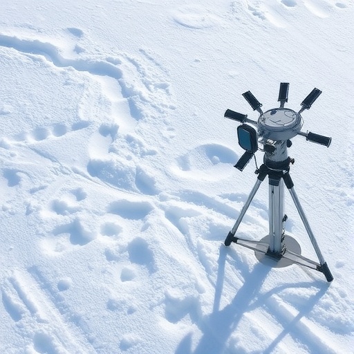
A critical component of this study involves the meticulous evaluation of six distinct optical snow cover products, including Moderate Resolution Imaging Spectroradiometer (MODIS), Visible Infrared Imaging Radiometer Suite (VIIRS), Landsat imagery, and a composite Landsat-MODIS snow product. These datasets provide independent measures of surface snow presence and extent, indispensable for interpreting radar backscatter variations caused by snowpack changes. By juxtaposing these optical datasets with high-resolution L-band InSAR observations obtained during NASA’s SnowEx 2020 campaign over the Sierra Nevada Mountains, the researchers illuminated how snow cover input selection profoundly influences the retrievals of SWE changes derived from radar phase measurements.
The spatial complexity of mountainous regions introduces subtle but significant variations in canopy cover and snow detectability beneath tree canopies, factors that different snow cover datasets handle disparately. MODIS and VIIRS snow products, benefiting from frequent temporal coverage and fine spatial resolutions, demonstrated strong coherence with radar signals and yielded SWE estimates consistent with independently validated spectral unmixing techniques. In contrast, Landsat-based products exhibited notable discrepancies in SWE retrievals, primarily attributable to variances in canopy correction methodologies and temporal sampling frequency. These findings underscore the necessity of understanding the inherent strengths and limitations of each optical product when deploying multisensor SWE retrieval frameworks.
Subcanopy snow detection, a perennial challenge for remote sensing, emerges as a pivotal source of uncertainty within the L-band InSAR SWE retrieval process. Radar signals can penetrate moderate vegetation layers yet are susceptible to phase noise induced by atmospheric disturbances and canopy heterogeneities. The multisensor approach presented here enables partial mitigation of these confounding factors by cross-validating radar-derived SWE change signals against snow cover extent mapped from optical sensors. By applying a moving window analysis over the study site, the researchers quantified the spatial variability and sensitivity of SWE estimates to the choice of snow cover input, thereby identifying systemic biases and local anomalies that could skew hydrological modeling.
Additionally, the study leveraged a western United States snow reanalysis product as an independent benchmark to contextualize the observed discrepancies across datasets. This synthetic blend of model-based and observational data aids in disentangling physical phenomena influencing SWE signals from sensor-specific artifacts. Through this comprehensive intercomparison, the team revealed that atmospheric phase delays—often overlooked in conventional retrieval frameworks—could significantly distort L-band InSAR phase measurements, further complicating SWE estimation. Recognizing and accounting for these atmospheric effects is essential for advancing radar-based snow monitoring to operational maturity.
Dr. Jack Tarricone, the lead investigator from NASA’s Hydrological Sciences Laboratory, emphasizes the far-reaching implications of this research. He notes that accurate snowpack quantification is not only a scientific endeavor but also a socio-economic imperative, as many regions worldwide depend on predictable snowmelt for drinking water, agriculture, and hydropower generation. The fusion of optical and radar data, as highlighted in this study, paves the way for enhanced SWE retrieval methodologies capable of meeting the increasing demand for timely and reliable snowpack information in climate-sensitive water resource regions.
Looking forward, the upcoming NASA-ISRO Synthetic Aperture Radar (NISAR) mission is poised to capitalize on these insights. With unprecedented global L-band radar coverage planned, integrating multisensor data streams as demonstrated in this work could become essential to maximize the mission’s SWE monitoring capabilities. The research advises that mission planners and data users carefully consider the choice and combination of snow cover products to reduce uncertainties and improve the operational utility of spaceborne SWE measurements.
This study also sets a new benchmark for multisensor snow research by leveraging UAVSAR’s airborne platform, which provides finer spatial granularity compared to satellite radar, allowing detailed process understanding and validation. The methodology and findings here can be extrapolated and scaled to satellite platforms, ensuring consistent SWE monitoring across broader geographic regions. This adaptability is critical in light of climate change-induced alterations in snow regimes, which necessitate robust, spatially comprehensive water cycle observations.
Furthermore, the research highlights the potential of combining spectral unmixing algorithms with multisensor datasets to refine SWE estimates within heterogeneous landscapes. Such advances in signal processing and data integration will enhance snow hydrology models’ ability to resolve fine-scale variations, including snow density and layering, thereby bridging the gap between remote sensing observations and ground truth measurements.
In sum, the innovative fusion of optical snow cover data with L-band InSAR observations represents a quantum leap in remotely sensing snow water equivalent. Moving beyond the constraints of individual sensing modalities, this multisensor approach offers a more nuanced and reliable pathway to monitor snowpack dynamics at regional to continental scales. Its relevance transcends pure scientific inquiry, addressing critical challenges faced by water managers, climate scientists, and policymakers tasked with adapting to a rapidly shifting hydrological landscape.
As climate variability continues to exert pressure on water availability worldwide, techniques that can deliver accurate, large-scale SWE measurements will be indispensable. The integration of multispectral optical sensors with polarimetric radar platforms, as evidenced by this study, ushers in a new era of earth observation — one where precision hydrology meets spaceborne technology to safeguard critical freshwater resources for generations to come.
Subject of Research: Not applicable
Article Title: Investigating the Impact of Optical Snow Cover Data on L-Band InSAR Snow Water Equivalent Retrievals
News Publication Date: 3-Jul-2025
References:
DOI: 10.34133/remotesensing.0682
Image Credits: Journal of Remote Sensing
Keywords: Snow
