In the arid expanse of northern Africa, where water resources dictate the fate of agriculture and local communities, a groundbreaking study has harnessed cutting-edge technology to unveil critical insights into groundwater suitability for irrigation. Conducted in Wadi Righ, Algeria, this research delves deeply into the intricate dynamics of underground water reserves, positioning itself at the confluence of hydrology, geospatial analysis, and sustainable agriculture.
Water scarcity in arid and semi-arid regions like Wadi Righ presents enormous challenges for traditional farming practices. With climate change exacerbating drought frequency and intensity, efficient management of irrigation resources is no longer optional but imperative. The latest work by Bettahar, Nezli, and Şener embodies this urgency by employing advanced Geographic Information Systems (GIS) in concert with decision analysis tools to evaluate groundwater quality, distribution, and longevity for agricultural purposes.
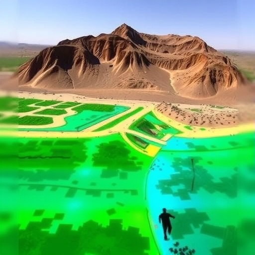
The study leverages the power of GIS to integrate a broad spectrum of environmental data layers, including geological formation, hydrological parameters, soil types, and existing land use patterns. By synthesizing these diverse datasets, the researchers constructed a comprehensive spatial model that reveals zones of varying groundwater suitability with unprecedented resolution. This methodological fusion illustrates the ascendancy of geospatial technology in environmental sciences, particularly in the quest to safeguard limited water resources.
Wadi Righ, situated in a region where rainfall is erratic and surface water bodies are ephemeral, heavily depends on groundwater to sustain agricultural activities. However, indiscriminate extraction, coupled with intrinsic hydrogeochemical characteristics, threatens the potability and irrigation viability of these subterranean waters. The investigation prioritizes parameters such as salinity, sodium adsorption ratio (SAR), and the concentration of harmful ions, which directly influence water’s effectiveness for crop irrigation and soil health.
By integrating decision analysis frameworks, the authors go beyond mere spatial mapping to offer actionable insights. This approach balances multiple criteria, enabling stakeholders and policymakers to identify optimal zones where irrigation would be sustainable and where intervention is necessary to mitigate risks. This decision-oriented paradigm champions resource efficiency, ensuring that both agricultural productivity and ecological integrity are maintained.
One of the striking revelations of this research is the spatial heterogeneity of water quality within the Wadi Righ basin. The data demonstrate pockets where groundwater possesses favorable chemical composition, low salinity, and minimal risk of soil degradation. Conversely, certain sectors reveal high levels of salinity and sodicity, which, if used indiscriminately, could cause soil structure breakdown, crop yield decline, and long-term land degradation. These findings signal the urgent need for precise resource zoning to prevent exacerbating land and water deterioration.
The methodological rigor applied in this study is notable. The use of multi-criteria decision analysis (MCDA) provides a structured mechanism to incorporate varied and sometimes conflicting factors affecting groundwater suitability. Parameters such as electrical conductivity, pH levels, chloride concentration, and bicarbonate levels were meticulously evaluated and weighted to provide a holistic view rather than an isolated assessment. This comprehensive analysis enhances decision-making confidence and fosters adaptive irrigation management strategies.
Furthermore, the visualization of results through detailed GIS maps empowers local farmers, water managers, and regional planners with intuitive tools to strategize irrigation scheduling and crop selection. The graphical outputs facilitate straightforward interpretation, supporting collaborative dialogue among stakeholders and driving community-centered water governance. Such participatory mechanisms are crucial for translating scientific insights into practical and socially accepted solutions.
The implications of these findings ripple beyond Wadi Righ, contributing to a growing corpus of knowledge essential for regions facing similar hydrological constraints globally. The methodological blueprint offers a replicable framework accessible to other semi-arid and arid zones striving to optimize groundwater use under climatic stress. The integration of GIS and decision analysis thus emerges as a beacon for water resource management amidst a rapidly challenging environmental context.
Importantly, the research highlights that sustainable irrigation practices hinge on continuous monitoring and adaptive management, given the inherent variability and vulnerability of groundwater systems in desert environments. The authors advocate for the establishment of comprehensive monitoring networks to track quality parameters over time, enabling timely responses to emerging threats such as salinization or contamination events induced by anthropogenic activities.
Also worth consideration is the socio-economic dimension underscored by the study. Groundwater resources are not merely environmental assets but vital economic lifelines supporting livelihoods. The delineation of suitable groundwater irrigation areas can help prioritize investments in infrastructure, such as drilling wells or installing efficient irrigation technologies, thus maximizing return on finite capital and minimizing social disruptions caused by water shortages or soil infertility.
From a broader perspective, this work exemplifies the synergy of multidisciplinary research and technological innovation to tackle grand environmental challenges. The coupling of geospatial science with decision-support systems sets a new standard in resource assessment, blending data-driven precision with practical applicability. As water security emerges as a defining issue of the 21st century, such integrative approaches will be indispensable in shaping resilient agricultural landscapes.
Moreover, the role of policy frameworks and institutional capacity cannot be overlooked in translating these technical findings into sustainable practices on the ground. The authors imply that stakeholder engagement, regulatory mechanisms, and community education must align with scientific recommendations to realize long-term benefits. This underscores the interdependence between science, governance, and societal behavior in managing critical natural resources.
In light of the escalating pressures on freshwater reserves worldwide, the importance of the study’s contributions resonates profoundly. By fine-tuning the assessment of groundwater suitability for irrigation, the researchers provide a critical tool for mitigating the adverse impacts of over-extraction, salinity intrusion, and unsustainable land use. Their work advances a vision of precision water management tailored to the unique challenges of arid ecosystems.
As the global community seeks pathways toward sustainable development and climate resilience, methodologies exemplified by this study illuminate practical routes forward. The adaptability of GIS and decision analysis enables continuous refinement of water management strategies in response to evolving environmental and socio-economic conditions. This dynamic adaptability is essential to secure food production and preserve ecosystem functions amid growing uncertainties.
Finally, the scientific rigor and clarity achieved in this research set a benchmark for future explorations in hydrological resource assessment. The comprehensive integration of hydrochemical data, spatial modeling, and decision-support techniques marries theoretical robustness with practical relevance. As similar methodologies proliferate, the cumulative impact could redefine agricultural water management, fostering sustainability at local, regional, and global scales.
Subject of Research: Assessing groundwater quality and suitability for irrigation using GIS and decision analysis in an arid environment.
Article Title: Assessing groundwater suitability for irrigation in Wadi Righ, Algeria using GIS and decision analysis.
Article References:
Bettahar, A., Nezli, I.E. & Şener, Ş. Assessing groundwater suitability for irrigation in Wadi Righ, Algeria using GIS and decision analysis. Environ Earth Sci 84, 466 (2025). https://doi.org/10.1007/s12665-025-12476-x
Image Credits: AI Generated
