In a groundbreaking study recently published in Environmental Earth Sciences, researchers have harnessed Geographic Information Systems (GIS) technology to conduct a detailed assessment of geological instability at Canada Hill in Miri, Sarawak, Malaysia. This research addresses a critical yet often overlooked hazard in hilly terrains: bedding-controlled planar failure. By meticulously analyzing the structural geology of the area through state-of-the-art spatial modeling, the team has illuminated not only potential failure zones but the underlying factors governing slope stability in this tropical environment. Their findings have far-reaching implications for infrastructure planning, disaster risk management, and sustainable development across similar geological settings worldwide.
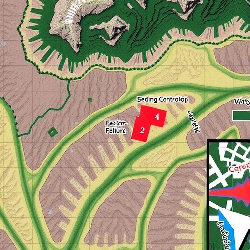
Canada Hill, a prominent natural landmark within the Miri region, has long drawn the attention of geologists due to its unique lithological characteristics and history of instability. The southern edge of this hill is characterized by sedimentary rocks that are deeply stratified, with bedding planes exhibiting distinct orientations. Previous anecdotal evidence and isolated incidents of slope failure hinted at a strong structural control on the stability of the slopes. However, until this recent investigation, no comprehensive GIS-driven analysis had been conducted to quantify potential risks or understand the spatial distribution of failure susceptibility in detail.
GIS technology, often employed in environmental monitoring and urban planning, proved crucial in collating and interpreting an extensive dataset comprising high-resolution topographic maps, digital elevation models, and geological field surveys. By integrating these layers, the researchers constructed a three-dimensional model capable of simulating the mechanical behavior of rock masses under varying conditions. Specifically, the focus was on planar failure mechanisms directly influenced by the orientation and properties of bedding planes—a common mode of failure in sedimentary rock slopes wherein blocks may detach and slide along relatively weak bedding surfaces.
The team’s methodological approach was rigorous. They began by conducting comprehensive field measurements to determine the dip and dip direction of bedding planes at multiple locations across Canada Hill. These structural data were then digitized and overlaid onto the digital elevation model using GIS software. The overlay facilitated identification of areas where slope angles and bedding orientations aligned unfavorably—conditions conducive to planar failure. This spatial correlation was essential, as it pinpointed zones where natural rock joints and bedding planes could act as potential slip surfaces, thereby undermining slope integrity.
Beyond geometric analysis, the researchers incorporated geotechnical parameters such as cohesion and friction angle, derived from rock samples collected on-site. These factors were crucial in probabilistic stability modeling, informing the likelihood that a given slope segment might fail under current or future stress states. By employing a deterministic limit equilibrium analysis within the GIS environment, the team quantified the factor of safety for numerous grid cells covering Canada Hill’s surface, thereby generating a detailed failure potential map.
One of the innovative aspects of this research is its multi-scalar perspective. The model did not simply consider isolated slope sections but accounted for the cumulative geological context influencing mechanical behavior across scales. For instance, zones exhibiting pronounced layering and jointing patterns were found to be especially vulnerable. Moreover, the spatial distribution of failure potential coincided with previously undocumented minor landslide scars and creeping zones, validating the predictive power of the GIS-based methodology.
These insights hold exceptional practical value. In regions like Sarawak, where rapid urban expansion and infrastructure development frequently intersect with complex geological formations, understanding slope failure risks can guide safer construction practices and disaster mitigation strategies. The Canada Hill study provides a clear framework for local authorities and engineers to prioritize monitoring and remediation efforts, potentially averting catastrophic slope failures that could threaten lives and property.
Interestingly, the research also sheds light on how natural erosion processes interact with structural geology over time. As weathering gradually alters rock strength and bedding surfaces evolve, the susceptibility to planar failures may increase or shift spatially. The integration of temporal data into future GIS assessments, building on this foundational work, could enable dynamic hazard modeling that adapts to environmental change and anthropogenic impact.
Further, the authors advocate for the adoption of similar GIS-based structural analyses across other sedimentary terrains subject to monsoonal rainfall and tropical weathering—conditions known to exacerbate slope instability. Their approach exemplifies how cutting-edge geospatial tools can transform traditional geological hazard assessments from static snapshots into nuanced, predictive landscapes.
This research also bridges a crucial gap between academic studies and applied engineering. By translating complex geological structures into actionable risk maps, the study empowers decision-makers with clear, data-driven insights. The integration of field observations with advanced computational modeling thus stands as a model for interdisciplinary collaboration essential to tackling contemporary environmental challenges.
Moreover, the study highlights the potential for integrating remote sensing data, such as high-resolution LiDAR, with GIS models to refine these assessments further. As remote sensing technology becomes more accessible and precise, future analyses could continuously update failure potential maps, enabling real-time hazard monitoring with enhanced accuracy.
The consequences of bedding-controlled failures extend beyond localized slope instability. These events can trigger landslides that disrupt ecosystems, damage infrastructure, and even cause loss of human life. By capturing the spatial complexity of these failure mechanisms, this research enhances our understanding of geohazard distribution in a manner that could inform regional disaster preparedness and resilience frameworks.
Furthermore, the study delves into how spatial heterogeneity in bedding orientations influences failure modes, emphasizing that no single parameter can sufficiently predict slope hazards. Their integration of structural geology with geotechnical analysis and spatial modeling reveals the multifaceted nature of slope stability, pushing the boundaries of conventional hazard mapping.
Throughout the investigation, the researchers acknowledged limitations inherent in GIS modeling, such as the challenges of scale dependence and uncertainty in geotechnical parameters. Nonetheless, their transparent discussion of these constraints underlines the model’s robustness and encourages continuous refinement, inviting future studies to build on this pioneering effort.
In a broader context, this study underscores the transformative power of GIS technology when combined with geological expertise. The ability to visualize and analyze subsurface structures in three dimensions empowers researchers and practitioners alike to tackle longstanding geohazard issues with unprecedented precision and efficiency.
Ultimately, the GIS-based assessment of bedding-controlled planar failure at Canada Hill transcends the local scope, offering a replicable methodology with global relevance. As climate change intensifies rainfall patterns and human land use continues to alter landscapes, such integrated geospatial analyses will become indispensable tools in safeguarding communities and ecosystems from geological hazards.
Subject of Research: Bedding-controlled planar failure potential and slope stability assessment using GIS at Canada Hill, Miri, Sarawak, Malaysia.
Article Title: GIS-based assessment of bedding-controlled planar failure potential at Canada Hill in Miri, Sarawak, Malaysia.
Article References:
Daniel, M.T., Ng, T.F., Abdul Kadir, M.F. et al. GIS-based assessment of bedding-controlled planar failure potential at Canada Hill in Miri, Sarawak, Malaysia. Environ Earth Sci 84, 454 (2025). https://doi.org/10.1007/s12665-025-12447-2
Image Credits: AI Generated
