In a groundbreaking study set against the rapidly evolving urban landscape of Addis Ababa, Ethiopia, researchers have unveiled an advanced approach to assessing the suitability of green and grey infrastructure using sophisticated Geographic Information System (GIS)-based multi-criteria analysis. The vibrant capital city, characterized by its fast-paced urbanization and environmental challenges, is at a pivotal moment where sustainable development must be balanced with burgeoning infrastructural demands. This latest research not only offers an innovative framework for urban planners but also provides essential insights into harmonizing natural and built environments for resilient city futures.
At the heart of this study lies the critical need to evaluate infrastructure through the lens of environmental sustainability and urban functionality. Addis Ababa is emblematic of many growing cities in sub-Saharan Africa, where rapid population growth exerts immense pressure on urban systems. The authors’ use of GIS technology allows for the integration of diverse spatial data, enabling a nuanced understanding of where green infrastructure — such as parks, wetlands, and urban forests — can best support ecosystem services alongside traditional grey infrastructure comprising roads, drainage systems, and utilities.
This methodology’s significance cannot be overstated. Multi-criteria analysis (MCA) serves as a powerful decision-making tool that synthesizes environmental, social, and technical factors into a unified spatial framework. By incorporating parameters such as land use, topography, soil conditions, hydrology, and population density, the researchers have constructed a layered tapestry that highlights terrain-specific infrastructure suitability. Their approach exemplifies how data-driven urban planning can transcend simplistic infrastructural designs, instead fostering systems that respond intelligently to local ecological contexts.
One of the most remarkable outcomes of this research is the identification of zones within Addis Ababa that exhibit high synergy potential between green and grey infrastructures. Strategically integrating these infrastructures can substantially enhance urban resilience against climate-related threats such as flooding and heat waves. For instance, the article reveals how certain low-lying areas prone to flooding could benefit immensely from green infrastructure interventions like constructed wetlands, which complement the city’s conventional drainage networks by naturally attenuating stormwater runoff.
The authors also delve into the pivotal issue of urban heat island effects, a formidable challenge for cities emerging under harsh climatic conditions. The study’s spatial analysis highlights how expanding green cover in densely populated inner-city zones can drastically mitigate localized temperature spikes. This blend of ecological restoration with engineered solutions sets a precedent for sustainable urban ecosystems where infrastructure investments amplify both social welfare and environmental health.
Technically, the study illustrates meticulous data assimilation and GIS modeling techniques. Elevation data obtained through Digital Elevation Models (DEMs), satellite imagery, and existing land-use maps are layered systematically. Each data set is assigned weighted values reflecting criterial importance, a statistical process grounded in expert consultation and literature review. This rigorous method ensures that the final suitability maps are both accurate and contextually relevant, guiding policymakers toward evidence-based infrastructure planning.
A striking feature of this research is the inclusion of stakeholder engagement in shaping the criteria weightings within the multi-criteria analysis. Recognizing the multifaceted nature of urban development, the researchers incorporated inputs from municipal planners, environmental scientists, and local communities. This inclusive approach ensures that the infrastructure planning outcomes are not merely technical exercises but resonate with the socio-economic realities of Addis Ababa’s residents.
The authors shed light on the challenges of integrating green and grey infrastructures in rapidly expanding urban environments where land scarcity and informal developments pose complex constraints. Their findings underscore a critical paradigm shift, advocating for adaptable, multifunctional urban spaces where green infrastructure roles transcend beautification to encompass stormwater management, air quality improvement, and biodiversity conservation — all indispensable for sustainable urban living.
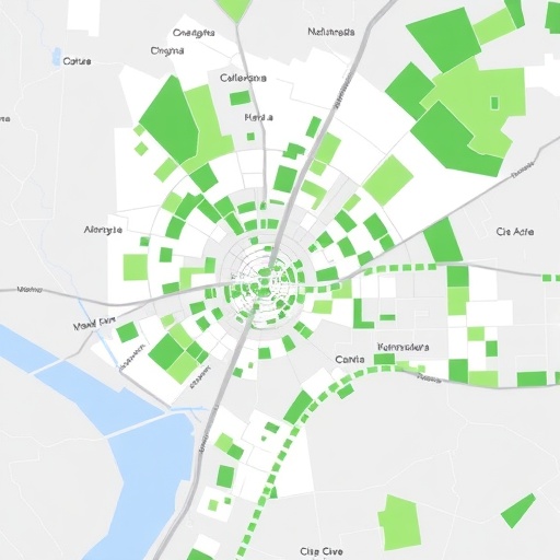
Emerging from this study is a comprehensive suitability map that delineates priority zones for immediate intervention, medium-term development, and conservation within Addis Ababa’s urban fabric. This spatial tool is poised to revolutionize urban planning by enabling the identification of precise sites where investments in infrastructure will yield the greatest returns in ecological and social capital.
Critically, the researchers highlight that the methodology is scalable and transferable to other African cities grappling with similar urbanization pressures and climatic threats. This positions their work at the forefront of global urban sustainability discourse, offering a replicable model that can catalyze green and grey infrastructure harmonization worldwide.
The study also revisits the long-term implications of these urban infrastructure choices on public health and economic development. By promoting green infrastructure, the city can alleviate pollution-related health burdens and bolster green job creation — factors that fundamentally intertwine environmental stewardship with human well-being and prosperity.
In practical terms, this research advocates for a policy framework that incentivizes green infrastructure adoption alongside grey infrastructure modernization. Addis Ababa’s municipal government can leverage the findings to inform zoning regulations, infrastructure budgets, and urban equity programs, thus fostering more resilient and inclusive cityscapes.
Furthermore, the interplay between technology and tradition is evident in this study’s approach. It elegantly balances cutting-edge GIS spatial analytics with indigenous knowledge about local environmental conditions and urban dynamics, thus reinforcing the critical role of context-specific solutions in sustainable development strategies.
In conclusion, this landmark research not only charts a viable pathway for sustainable urban development in Addis Ababa but sets a new benchmark for integrating multi-criteria GIS analyses in infrastructure planning. As many cities worldwide confront the dual crises of climate change and urban sprawl, the lessons gleaned from this study serve as a beacon of hope and a practical guide toward greener, more resilient urban futures.
As urban populations swell and climate unpredictability intensifies, the imperative for science-driven, inclusive, and ecologically attuned infrastructure planning becomes ever more pressing. The innovative GIS-based multi-criteria analysis elucidated here embodies the kind of cross-disciplinary, forward-looking research essential to navigating the complexities of 21st-century urbanism. It invites urban planners, policymakers, researchers, and citizens alike to envision cities where nature and infrastructure coalesce, enhancing both human livelihoods and planetary health.
Subject of Research: The assessment of green and grey infrastructure suitability in Addis Ababa, Ethiopia using GIS-based multi-criteria analysis.
Article Title: Assessing green and grey infrastructure suitability in Addis Ababa, Ethiopia using GIS-Based multi-criteria analysis.
Article References:
Kemal, B., Hailu, D., Fekersillassie, D. et al. Assessing green and grey infrastructure suitability in Addis Ababa, Ethiopia using GIS-Based multi-criteria analysis. Environ Earth Sci 84, 455 (2025). https://doi.org/10.1007/s12665-025-12441-8
Image Credits: AI Generated
