In recent years, the global scientific community has intensified its focus on understanding the dynamics of carbon storage and biomass distribution across diverse landscapes. A groundbreaking study led by Ramalingam, Sekar, and Moorthi, published in Environmental Earth Sciences, sheds new light on the spatial quantification of biomass and carbon stocks in the distinct land use systems of Kallakurichi and Villupuram districts in Tamil Nadu, India. This research provides crucial insights into how different land management practices influence carbon sequestration potential and biomass productivity, offering pivotal data for climate change mitigation strategies and sustainable land use planning.
The significance of this research lies in its regional specificity, as Kallakurichi and Villupuram represent areas experiencing rapid land use changes due to urbanization, agricultural expansion, and forest degradation. Tamil Nadu, a biodiverse state with varied ecosystems ranging from tropical forests to agricultural landscapes, presents a complex laboratory to study carbon dynamics. The researchers adopted advanced spatial analysis techniques combined with field measurements to generate highly precise biomass and carbon stock estimations. This combination of methods enables a comprehensive understanding of carbon storage patterns that traditional sampling alone cannot deliver.
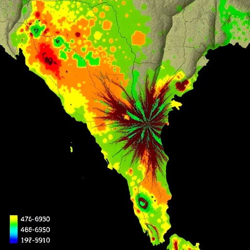
Central to this study was the use of geospatial tools integrated with remote sensing data that mapped land use patterns and vegetation cover at high resolutions. The researchers utilized satellite imagery alongside on-ground biomass inventories to classify land into categories such as dense forests, scrublands, agricultural fields, and plantations. This spatial classification allowed for a detailed assessment of how biomass is distributed spatially, revealing heterogeneous carbon stocks influenced by land use practices and ecological settings. The use of Geographic Information Systems (GIS) became instrumental in visualizing and quantifying these variations accurately.
Another technical cornerstone of the research was the allometric modeling employed to estimate biomass from tree measurements. By measuring parameters like diameter at breast height (DBH), tree height, and wood density, the team could infer above-ground biomass with greater accuracy. The generated biomass data were then converted into carbon stock using established carbon conversion factors. These calculations provide a more reliable mechanism than blanket estimations often used in carbon accounting models, thus enhancing the precision needed for regional carbon budgeting.
The findings indicated significant variability in biomass density and carbon stocks among different land use categories. Dense forest patches unsurprisingly held the highest levels of carbon, reflecting the importance of forest conservation for climate regulation. However, the results also highlighted the considerable carbon stored in some agroforestry systems and plantation areas, suggesting that such land use types could play a complementary role in carbon sequestration efforts. Conversely, degraded lands and fallow areas showed markedly lower biomass values, underscoring the urgent need for restoration initiatives in these landscapes.
Importantly, the spatial patterns uncovered in Kallakurichi and Villupuram illustrated how localized environmental conditions and human activities influence carbon storage. Soil fertility, moisture availability, and microclimate conditions contributed to the spatial heterogeneity observed in biomass measurements. Human interventions such as selective logging, agricultural intensification, and plantation establishment created a mosaic of carbon stocks that can have profound implications for regional carbon accounting and ecosystem service evaluations.
From a climate change mitigation perspective, the quantification of carbon stocks under different land use systems provides evidence-based recommendations for land management policies. The study reinforces the global agenda of promoting forest conservation and sustainable agroforestry as viable pathways to enhance carbon sinks. Moreover, the regional carbon stock data serve as critical inputs for India’s national greenhouse gas inventory and its commitments under the Paris Agreement, helping to track progress and tailor interventions locally.
To address the methodological challenges of measuring biomass in highly fragmented and heterogeneous landscapes, the study employed a stratified sampling approach. This technique ensured that samples represented the variability of land use types adequately, minimizing bias and improving the extrapolation of biomass estimates across the districts. The integration of field data with remote sensing offered a model for future studies aiming to balance methodological rigor with practical feasibility in carbon stock assessment.
In addition to above-ground biomass, the research touched on carbon dynamics below ground, including root biomass and soil organic carbon pools. Though technically challenging to measure, these below-ground carbon stocks are critical components of total ecosystem carbon. While the primary focus remained on above-ground biomass, the study acknowledges the necessity of including soil carbon data in comprehensive carbon accounting frameworks, a future direction for research in the region.
The application of the study stretches beyond academic knowledge generation. Land managers, policymakers, and conservationists stand to benefit from spatially explicit data that identify carbon-rich zones deserving protection and degraded lands ripe for restoration. By highlighting hotspots of carbon storage alongside vulnerable areas, the research facilitates targeted interventions that maximize ecological and climatic benefits. It also creates opportunities for carbon offset initiatives and sustainable land use certifications that rely on robust biomass and carbon data.
Technological advancements in remote sensing played a pivotal role in enabling this study. The use of high-resolution multispectral and LiDAR data provided vegetative structural details previously unattainable at the landscape scale. These data support finer discrimination between land use categories and enhance biomass modeling accuracy, demonstrating how modern technologies are transforming ecological research. Such integration of technology and ecology heralds a new era where climate action can be informed by real-time spatial monitoring and data-driven decision-making.
In the broader context of global carbon cycles, the insights garnered from Tamil Nadu’s land use systems contribute to understanding tropical ecosystems’ roles as carbon sinks and sources. Tropical regions worldwide are under pressure from land degradation and climate variability; hence localized studies such as this inform regional carbon dynamics and their feedbacks to the atmosphere. These findings feed into global climate models seeking to predict future carbon fluxes and their impacts on planetary warming trajectories.
Beyond climate mitigation, the research underscores the co-benefits of maintaining high-biomass ecosystems. Biodiversity conservation, soil erosion control, and livelihood sustainability are closely linked to the health of forest and agroforestry systems. By quantifying biomass and carbon stocks, the study indirectly promotes these ecosystem services, advocating for integrated land management strategies that marry environmental and socioeconomic objectives.
This study exemplifies the importance of interdisciplinary collaboration, combining expertise in forestry, ecology, geospatial analysis, and climatology. Such cross-cutting approaches are essential to untangle the complexities of ecosystem carbon storage, especially in regions experiencing dynamic land use changes. The methodology and findings set a precedent for similar studies across India and other tropical regions, providing a replicable framework adaptable to various ecological and sociopolitical contexts.
Finally, the research further encourages incorporation of local knowledge and community participation in land use planning initiatives. Sustainable carbon management hinges not only on scientific data but also on the engagement of local stakeholders whose livelihoods depend on these landscapes. Empowering communities with information on carbon stocks and ecosystem health can drive more effective stewardship and foster mutually beneficial outcomes for climate and development goals.
In conclusion, the spatial quantification of biomass and carbon stock conducted in Kallakurichi and Villupuram districts stands as a significant advancement in landscape-level carbon science. Through sophisticated methodological approaches and context-sensitive analysis, this study enriches the understanding of carbon storage patterns that underpin climate resilience and sustainable land management. As the world intensifies efforts to curb carbon emissions, such region-specific and technologically enhanced studies are invaluable tools in the global fight against climate change.
Subject of Research: Spatial quantification of biomass and carbon stock across different land use systems in Kallakurichi and Villupuram districts, Tamil Nadu, India.
Article Title: Spatial quantification of biomass and carbon stock for different land use systems of Kallakurichi and Villupuram districts of Tamil Nadu, India.
Article References:
Ramalingam, K., Sekar, P. & Moorthi, N.R. Spatial quantification of biomass and carbon stock for different land use systems of Kallakurichi and Villupuram districts of Tamil Nadu, India. Environ Earth Sci 84, 324 (2025). https://doi.org/10.1007/s12665-025-12302-4
Image Credits: AI Generated
