


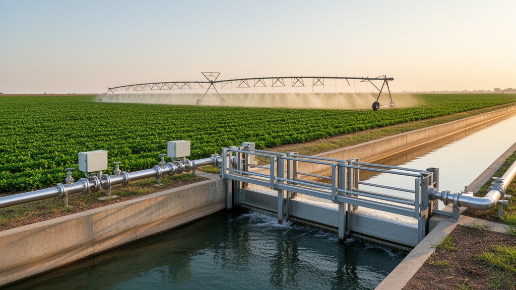
Virtual geographic environments configured for agricultural infrastructure increasingly depend on digital twin systems to support precision water scheduling, facility inspection routines, and predictive operational management across regional canal networks. However, virtual models that simultaneously track fluctuating water bodies, moving field vehicles, human patrol units, and expansive earthen topography frequently encounter severe visual and geometric anomalies when altering resolution based on viewing distance. Standard graphics engines rely on level-of-detail mechanisms that simplify distant ground meshes solely to reduce computational overhead, yet conventional geometric decimation routines disrupt the spatial constraints that anchor physical structures to the underlying soil. To solve the resulting problems of mobile objects floating in midair, sinking below ground surfaces, or tearing along water boundaries during scale transitions, a research team from Nanjing Xiaozhuang University, Chuzhou University, and Nanjing Normal University formulated a semantically driven dynamic integration framework. Tested within the Zhuluoba Irrigation District in Jiangsu Province, China, the framework extends conventional level-of-detail management from a pure graphics optimization tool into a comprehensive spatial constraint regulation mechanism that dynamically coordinates operational states, geometric shapes, and terrain dependencies.
Constructing realistic three-dimensional representations of modern irrigation networks requires accommodating vast spatial expanses alongside microscopic infrastructure details. In an active district, static assets such as concrete pump houses, diversion gates, standardized culverts, and open channels must remain tightly positioned against high-resolution elevation models, while dynamic elements like inspection crews, service vehicles, and changing water levels continuously shift across time and space. Conventional engineering methods typically execute a single, static geometric alignment during the initial 3D modeling stage, completely omitting temporal dimensions and active constraint maintenance. Consequently, when viewing positions shift or when water surfaces rise and fall, the rigid geometric alignment collapses, producing visible anomalies including surface penetration, boundary discontinuities, and severe pose distortion. Because different types of hydraulic infrastructure feature vastly divergent behaviors and degrees of soil engagement, a universal geometric decimation method cannot adequately balance visual realism, operational responsiveness, and geometric fidelity without explicit semantic guidance across changing observation scales.
To overcome the fragmented approaches of previous single-object integration pipelines, the investigators introduced a unified semantic description system that classifies every feature within an irrigation district using a structured three-dimensional vector. This semantic categorization defines each object across three independent operational dimensions: operational status, geometric form, and terrain dependency. Under operational status, features are designated as either static installations or time-varying dynamic entities, establishing whether their positions and shapes demand continuous temporal refresh cycles. Geometric form divides assets topologically into discrete points, continuous linear networks, or expansive surface patches. Crucially, the terrain dependency dimension classifies items as terrain-dependent, terrain-independent, or weakly terrain-dependent. Terrain-dependent features, such as natural stream banks and open channels, demand strict morphological coupling and local mesh reconstruction at their edges. Terrain-independent entities, such as rigid patrol trucks or elevated pump house superstructures, require posture estimation and base alignment without internal shape deformation. Weakly terrain-dependent features, such as staff gauges and distant patrol personnel, anchor their ground contact points to local surface elevations while preserving their unaltered internal structures.
The central innovation of the architecture connects this semantic vector to viewing-distance thresholds through a dynamic mapping function implemented in Unreal Engine 5.0. Rather than treating level of detail as a mechanism that merely switches polygon counts, the framework uses distance thresholds to govern geometric resolution, spatial constraint types, and update frequencies simultaneously. For the experimental implementation, researchers established observational boundaries at distances below 50 meters for close-range LOD0, between 50 and 150 meters for medium-range LOD1, and beyond 150 meters for long-range LOD2. When a dynamic point object enters the close-range LOD0 window, the engine enforces high geometric resolution paired with full elevation tracking and trajectory constraints. At medium distances under LOD1, the system scales back noncritical calculations to evaluate elevation alone, while at distances exceeding 150 meters in LOD2, processing shifts strictly to coarse horizontal position updates. Similar tiered strategies govern linear trajectories and expanding surface meshes, drastically lowering unnecessary calculations without introducing perceptible visual pops or geometric misalignments.
Dynamic point and line integration relies on a structured four-stage workflow that discretizes continuous field movement into ordered time slices and static geometric skeletons. When monitoring walking inspectors or linear movement paths, the framework retrieves the corresponding ground triangle within the active terrain mesh using line-of-sight analysis. An elevation-matching pipeline identifies the precise height: if a path point intersects a mesh vertex, the stored elevation is extracted directly; if it falls on an edge, linear interpolation determines the vertical coordinate; and if it lands inside a triangle face, barycentric coordinates compute the exact surface elevation. Dynamic line objects then generate continuous route ribbons whose cross-sections, colors, and line widths convey operational statuses without requiring repetitive, costly mesh rebuilds. Interframe continuity controls interpolate elevation and horizontal coordinates across consecutive time intervals, ensuring that path representations transition smoothly between levels of detail without abrupt visual jumps, surface clipping, or floating artifacts as camera angles shift across the virtual landscape.
Handling rigid, terrain-independent mobile objects such as inspection utility vehicles requires an adaptive pose-estimation pipeline to prevent wheels and chassis sections from clipping through rolling terrain. The framework discretizes vehicle motion into discrete temporal steps, constructing a local interaction envelope on the ground beneath the vehicle based on its coordinates and forward heading. The system extracts local terrain sampling points from the active level-of-detail mesh to fit a contact plane using least-squares numerical regression. By deriving normal vectors from this fitted plane, the algorithm calculates adaptive pitch and roll orientations while preserving the forward travel heading, aligning the base structure seamlessly with local ground undulations. To eliminate internal rendering conflicts, the local interaction footprint undergoes constrained triangulation to excise buried ground triangles directly beneath the undercarriage. Seamless transitions are maintained by joining ground perimeter vertices to vehicle base edges, supported by interframe pose smoothing that prevents angular vibration and visual jitter during rapid camera moves or resolution shifts.
Representing dynamic water surfaces presents unique challenges because fluid extents continuously expand or contract across irregular terrain while demanding tight boundary coupling. The researchers addressed this by abstracting the water body into a coupled two-layer system consisting of a horizontal surface plane and a submerged earthen substrate driven by time-series water gauge data. The system compares local ground mesh elevations against the prescribed stage height, classifying all vertices falling below the current water elevation as submerged terrain and modifying their geometric properties accordingly. At the boundary zone, the algorithm computes line intersections where the horizontal water plane slices through the sloping ground triangulation network, extracting closed water-land boundaries. Local terrain triangles bordering this perimeter are clipped and subdivided to form watertight geometric seams, preventing gaps between shoreline soil and simulated water sheets. By updating only localized border triangles rather than recomputing the entire riverbed, the system maintains efficient frame execution during continuous stage fluctuations.
Experimental validation of the framework took place across the Zhuluoba Irrigation District, an expansive 342.2-square-kilometer agricultural plain located within Huaiyin District in Huai’an City, Jiangsu Province. Featuring a designed irrigation command area of 210.7 square kilometers and an extensive 49.5-kilometer canal network, the district provided an ideal proving ground characterized by flat topography, average surface elevations of 11.5 meters, gentle slopes between 1/5,000 and 1/8,000, and dense hydraulic installations. The software platform integrated multiresource datasets gathered from the National Earth System Science Data Center, local administrative authorities, and specialized field campaigns. Primary inputs included high-resolution digital elevation models, digital line graphs, orthophoto imagery, structural facility engineering drawings, continuous hydrological discharge logs, and field validation data. To rigorously evaluate dynamic positioning, researchers conducted field surveys during the 2024 and 2025 flood seasons, using dual GPS and inertial measurement unit tracking sets to supply independent input streams for virtual driving alongside separate physical reference positions for rigorous spatial validation.
Performance benchmarks executed on an engineering workstation equipped with an Intel Core i7-8700K processor, an NVIDIA GeForce GTX 1080 Ti graphics card, and 32 gigabytes of memory demonstrated that the framework maintained stable spatial consistency and responsive execution across diverse operational scenarios. Static channel boundaries and channel centerlines exhibited mean horizontal errors of 0.343 meters and 0.395 meters, respectively, when compared against high-resolution remote sensing baselines, verifying that static waterways remained tightly registered to digital elevation models. For dynamic elements, patrol personnel and vehicle locations showed a planimetric mean error of 0.492 meters and an elevation fitting mean error of 0.245 meters relative to surveyed GPS trajectories. Dynamic patrol routes achieved an average positional offset of 0.700 meters with a high trajectory smoothness metric of 0.92, while dynamic water surfaces registered a boundary conformity index of 0.930 alongside a vertical matching error of only 0.185 meters against field monitoring stations. Across all tests, the visualization environment preserved a position update latency below 100 milliseconds and achieved continuous display rates between 34 and 52 frames per second.
Stratified evaluations across individual level-of-detail tiers revealed how the architecture balances geometric precision against rendering throughput. In close-range LOD0 scenarios, dynamic models operated at 34 frames per second while maintaining a tight horizontal positional error of 0.41 meters, vertical error of 0.18 meters, boundary conformity of 0.950, and a transition severity score of 0.06. Under medium-range LOD1 conditions, execution speed climbed to 41 frames per second as horizontal error moved to 0.49 meters, vertical error reached 0.24 meters, boundary fit measured 0.931, and transition severity registered 0.10. At long-range LOD2 viewing distances, rendering performance expanded to 52 frames per second, accommodating an intentional trade-off that allowed horizontal error to reach 0.58 meters, vertical error to reach 0.31 meters, and water boundary conformity to settle at 0.909, with transition severity recorded at 0.14. These progressive shifts verify that the semantic framework successfully regulates visual fidelity according to viewing scale, preserving overall structural relationships without squandering computational cycles on imperceptible distant details.
In evaluating the practical significance of these findings, the authors emphasized that the reported precision levels are specifically tailored to interactive spatial exploration, virtual facility inspection, and supervisory decision support within digital twin environments. The system does not claim to deliver sub-centimeter survey-grade engineering measurement or control safety-critical emergency shutdowns. Furthermore, the researchers acknowledged several core limitations inherent to the current study design. The framework relies on empirical distance rules calibrated for plain irrigation environments, which may require adaptive reconfiguration when deployed across steep mountainous terrain where elevation changes are abrupt. Additionally, because the experimental trials evaluated the unified framework as an integrated whole, they did not feature isolated ablation tests comparing the semantic scheduler against conventional unconstrained level-of-detail decimation methods. Future research efforts will focus on deploying data-driven adaptive scheduling algorithms, validating performance across varied geographic topographies, and directly coupling the 3D visualization layer with hydrodynamic simulation engines and real-time sensor networks.
Subject of Research: Semantic integration of multiscale terrain and dynamic hydraulic objects in digital twin irrigation districts
Article Title: Semantic-driven dynamic integration of multi-LOD terrain and hydraulic objects for digital twin irrigation districts
Article References: Chen, L., Liu, W., He, L., Wei, H., & Cao, X. (2026). Semantic-driven dynamic integration of multi-LOD terrain and hydraulic objects for digital twin irrigation districts. Frontiers in Earth Science, 14, Article 1995345. https://doi.org/10.3389/feart.2026.1995345
Image Credits: AI Generated
DOI: 10.3389/feart.2026.1995345
Keywords: digital twin irrigation districts, multiscale 3D terrain modeling, level of detail transitions, hydraulic engineering facilities, semantic constraint regulation, Zhuluoba Irrigation District, dynamic water surface modeling, patrol trajectory tracking, Unreal Engine 5 simulation, elevation interpolation, spatiotemporal consistency, boundary reconstruction, geographic information systems, runtime rendering performance, canal network visualization, spatial matching accuracy
Cite Scienmag News
Violet Maxwell. (November 11, 2026). Semantic Framework Integrates Dynamic Hydraulic Objects Across Multi-Scale Digital Irrigation Twins. Scienmag. https://scienmag.com/semantic-framework-integrates-dynamic-hydraulic-objects-across-multi-scale-digital-irrigation-twins/
Violet Maxwell. "Semantic Framework Integrates Dynamic Hydraulic Objects Across Multi-Scale Digital Irrigation Twins." Scienmag, 11 November 2026, https://scienmag.com/semantic-framework-integrates-dynamic-hydraulic-objects-across-multi-scale-digital-irrigation-twins/. Accessed 11 November 2026.
Violet Maxwell. "Semantic Framework Integrates Dynamic Hydraulic Objects Across Multi-Scale Digital Irrigation Twins." Scienmag. November 11, 2026. https://scienmag.com/semantic-framework-integrates-dynamic-hydraulic-objects-across-multi-scale-digital-irrigation-twins/




