


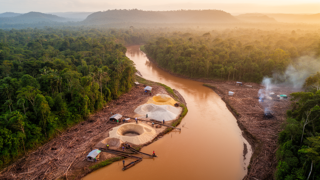
The Combeima river basin, the main source of drinking water for the city of Ibagué in Tolima, Colombia, is under pressure from a cluster of human activities, and a new assessment has now ranked those threats in detail. Using the Driver-Pressure-State-Impact-Response framework, researchers evaluated the protected areas of the watershed and found that of sixteen ecological threats assessed, six received a high score, nine a medium score and one a low score. The most significant threats to aquatic ecosystems were subsistence mining activities and biodiversity loss driven by deforestation, with pesticide use, soil erosion, livestock farming and unsustainable tourism also flagged as requiring urgent attention.
The study, published in the journal Nature Conservation, covers a basin of 27,421 hectares and 57.7 kilometres in length on the eastern flank of Colombia’s central Andean mountain range. Altitudes range from 1,400 to 4,200 metres above sea level, average annual rainfall is 1,816 millimetres, and the average temperature is 17 degrees Celsius. The basin comprises the districts of Cay, Villa Restrepo and Juntas, home to more than 25 hamlets, and its landscape spans tropical forests, humid forests, Andean forests and páramos. Five groups of protected areas within the Combeima Canyon cover a total of 15,101.29 hectares, located in Juntas, Villa Restrepo, the northern hills of Ibagué and a civil society nature reserve.
The research team applied the DPSIR model, a management tool that traces how social, demographic and economic driving forces generate pressures on ecosystems, how those pressures alter the state of the environment, and what impacts and policy responses follow. In the Combeima basin, the identified driving forces behind adverse effects include pollution from subsistence mining, river bathing, pesticide use in agriculture, road saturation, souvenir collecting, tourism, urbanization, soil erosion and deforestation.
Three components of the system were evaluated: the ecological status of aquatic ecosystems, weighted at 35 percent; habitat alteration, also weighted at 35 percent; and biodiversity loss, weighted at 30 percent. In the habitat alteration category, road saturation and the collection of souvenirs scored highest, with excessive tourist influx, tourism overdevelopment, off-road driving and noise pollution rated as medium. Under biodiversity loss, deforestation from logging scored three, described as frequent, while hunting and fishing received the single low score of one, classified as subsistence-level.
The DPSIR analysis also documented the consequences flowing from these pressures. According to the study, the factors identified have generated a decrease in ecosystem services, a decrease in water flows, a reduction in biodiversity and loss of territory, along with reductions in forest cover, generating problems for the protected areas of the basin and compromising food and water security, health, and traditional knowledge in the region. The causal network developed for the basin links pressures such as visitor and vehicular influx, changes in animal behaviour, tour package offerings, facility development, chemical and microbiological contamination, forest fires and erosion to impacts ranging from damage to vegetation cover and habitat reduction to shortages of drinking water and disease risks.
Waste and wastewater records cited in the paper illustrate the scale of visitor-related pollution. Before Holy Week in March 2017, a cleanup campaign in the southern sector of Los Nevados National Natural Park collected 388.3 kilograms of waste, and 250 kilograms were collected in February 2018. Common items included plastics, tents, camping mattresses, clothing and footwear, packaging, plastic, metal and glass containers, and sanitary waste. Up to 400 kilograms of waste discarded by visitors have been recorded in the protected area during the low season, and up to 25 cubic metres of waste in the area influenced by the road axis between the villages of Juntas and Villa Restrepo. The authors identify lack of knowledge of responsible consumption practices, weak capacity for waste separation and management, insufficient equipment and signage, and weak institutional monitoring capacity as leading causes of waste pollution in the area.
Water quality data add a public health dimension. Microbiological contamination from wastewater discharges during the periods 2008 to 2012 and 2014 did not comply with acceptable limits for total coliforms, set at 1,000 MPN, and faecal coliforms, set at 200 MPN, for recreational use under Decree 1594 of Colombia’s Ministry of Agriculture. The study states this implies a health risk for visitors and a critical impact on water quality for human consumption for both the local community and the urban population of Ibagué. The basin’s waters are used for consumption, sport, industry and irrigation, and the discharge of wastewater and sewage is described as causing impairment of aquatic ecosystems, alteration of pH, eutrophication and sludge deposition.
Tourist traffic itself is substantial. On weekends and holidays, unrestricted access and mobility produce road congestion, air pollution, noise pollution and increased accident risk. The study reports that at least 1,863 means of transportation circulate in the area on Sundays: 100 public collective motorized vehicles, 1,042 private motorized vehicles including cars and motorcycles, and 721 individual non-motorized means such as bicycles and walking, with numbers increasing during vacation periods. The basin contains about 26 tourist sites where visitors can engage in nature-based tourism, including thermal waters, creeks and waterfalls, and the growth of tourism has produced a dynamic occupation and transformation of the territory, with alterations in vegetation composition, fragmentation of natural vegetation and changes in soil structure.
On the response side, the paper reviews public policy instruments for tourism management in the basin, including Ibagué’s development plan, CONPES 3570 on mitigating risk in the Combeima basin to guarantee the city’s water supply, and departmental competitiveness programmes. Current measures include reforestation and conservation programmes, awareness campaigns, stricter regulation of mining with requirements for environmental impact studies and constant monitoring, and controls on tourist activity such as registration points, access control to the Alto Combeima Forest Reserve and Los Nevados National Park, verification of technical requirements for visitors, and motorized police patrols. Only small-scale subsistence miners are allowed to extract materials such as sand, stone, slate and gold through artisanal methods, under the supervision of CORTOLIMA, the Tolima Governor’s Office and the Ibagué Mayor’s Office. Decree 1480, issued in 2007, prioritized planning and intervention of the Combeima basin because of its high environmental contribution to the municipality.
The authors conclude that the DPSIR model is useful for identifying behaviours that generate pressures on the system, but they caution that the lack of quantitative data limits the ability to understand cause-effect relationships more fully, affecting the assessment of issues such as water pollution and health impacts from pesticide use. They argue the results indicate the need to prioritize rigorous governmental measures for conservation of the basin reserve, particularly through sustainable development approaches that effectively involve local communities and their traditional ecological knowledge, and they call for deconcentrating and redistributing visitor influx to preserve the basin’s ecological role in providing hydraulic resources and ecosystem services for Ibagué. The assessment of threats in the protected areas, the study notes, shows that most threats, especially subsistence mining and deforestation, received high and medium ratings, indicating a significant impact on aquatic ecosystems and highlighting the need for management and conservation strategies that address both human activities and their effects on biodiversity and water resources.
Subject of Research: An environmental threat assessment of the Combeima river basin in Tolima, Colombia, using the DPSIR framework
Article Title: Impact associated with water sources: An environmental analysis
Article References: Huepa Briñez, J. A., & Florez-Yepes, G. Y. (2025). Impact associated with water sources: An environmental analysis. Nature Conservation, 58, 311-337. https://doi.org/10.3897/natureconservation.58.151037
Image Credits: AI Generated
DOI: 10.3897/natureconservation.58.151037
Keywords: Combeima river basin, DPSIR framework, Colombia, water quality, subsistence mining, deforestation, pesticides, ecotourism, biodiversity loss, soil erosion, protected areas, Ibagué
Cite Scienmag News
Violet Maxwell. (October 27, 2026). Subsistence Mining and Deforestation Top the List of Threats to a Colombian River Basin. Scienmag. https://scienmag.com/subsistence-mining-and-deforestation-top-the-list-of-threats-to-a-colombian-river-basin/
Violet Maxwell. "Subsistence Mining and Deforestation Top the List of Threats to a Colombian River Basin." Scienmag, 27 October 2026, https://scienmag.com/subsistence-mining-and-deforestation-top-the-list-of-threats-to-a-colombian-river-basin/. Accessed 27 October 2026.
Violet Maxwell. "Subsistence Mining and Deforestation Top the List of Threats to a Colombian River Basin." Scienmag. October 27, 2026. https://scienmag.com/subsistence-mining-and-deforestation-top-the-list-of-threats-to-a-colombian-river-basin/


