


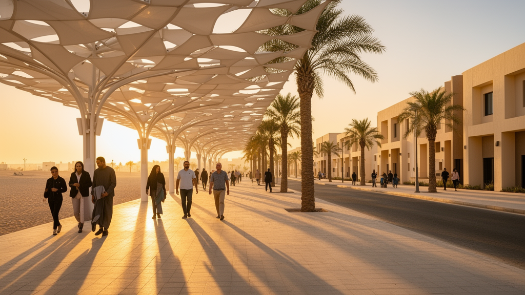
The X-minute city has become one of the most influential ideas in contemporary urban planning, promising residents access to work, school, shops and green space within a short walk, bicycle ride or transit trip. Popularized by Carlos Moreno in 2016 and adopted by cities from Paris to Shanghai, the concept rests on a simple principle: urban proximity reduces car dependence, improves quality of life and makes cities more sustainable. But in the Arabian Gulf, the model faces a paradox that temperate cities never encounter. Bahrain is small and densely urbanized enough for proximity-based planning to work in theory, yet its hot desert climate, with summer daytime temperatures frequently exceeding 40 °C and high humidity from the surrounding sea, suppresses outdoor activity for much of the year. Short distances do not automatically translate into practical walkability when extreme heat, strong solar radiation and limited shade make even brief walks physically uncomfortable.
A new open-access study published in Discover Cities addresses this gap by developing a Climate-Responsive X-Minute City, or CRXMC, framework tailored to Bahrain’s climatic and socio-spatial conditions. The research, led by Nazish Abid with Sagarika Nayak, Samskruthi S Prabhu and Somi Sareen, argues that the conventional X-minute benchmark is insufficient on its own in hot-arid environments. Instead, accessibility must be reinterpreted through what the authors call climatic usability: the extent to which streets and public spaces remain comfortable and safe to use under seasonal thermal stress. The framework treats the number of minutes as a flexible guideline rather than a rigid standard, extending the concept beyond spatial distance to include adaptation measures such as shade, cooling, greening and transit integration. In this vision, shaded walkways and cooled waiting areas are not aesthetic additions but core infrastructure that determines whether proximity is real.
The study is primarily conceptual and analytical, built on an integrative review of minute-city scholarship, climate-responsive urbanism and Gulf urbanism, drawing on databases including Scopus, Web of Science and Google Scholar. The authors identify four elements essential to minute-city effectiveness: physical proximity to essential services, land-use mix, active transportation infrastructure and public transit linkages. They also warn against the deterministic application of a single time standard, noting that critics argue suitable timeframes should be adapted to local density, morphology, socio-economic factors and environmental constraints. Recent work on Gulf cities reinforces this caution. Studies in Abu Dhabi and Dubai have shown how modular and superblock street networks shape pedestrian flow and perceived proximity, often constraining walkability despite nominally short distances between destinations. Research on cooled pedestrian infrastructure, such as Doha’s cooled parks and Riyadh’s tree-planting schemes, demonstrates that shading and microclimatic design can reduce heat and improve walkability, but at the expense of energy and water.
The resulting CRXMC framework identifies six interconnected planning dimensions: neighbourhood accessibility, land-use diversity, active-mobility infrastructure, public transport integration, climate-adaptation measures, and governance and implementation. These dimensions emerged from the thematic review rather than from isolated case studies, and they feed directly into the study’s analytical tools, including a Barrier–Solution–Actor matrix and a set of Key Performance Indicators. The barriers to transforming Bahrain are classified as infrastructural, social, governance and resource issues, and the proposed solutions are deliberately interlinked. Pedestrian infrastructure works best in combination with land-use enhancements, cultural change is supported by visible improvements such as shaded walkways that make walking more attractive, and governance measures coordinate and sustain all of the others. The authors frame the shift using sustainability transitions theory, viewing Bahrain’s car-dominated mobility system as a locked-in socio-technical regime that must be unlocked through protected niche experiments, cross-sector governance and iterative learning.
To demonstrate how the framework can be operationalized, the team conducted an illustrative GIS-based accessibility diagnostic for Salman City, a massive housing development on reclaimed land in northern Bahrain intended to eventually house more than 100,000 people. Using network-based service-area analysis in ArcGIS Pro, the researchers mapped walking access to four essential services, namely grocery, basic health, primary education and public open space, along with transit stops, within 5-, 10- and 15-minute thresholds. A base walking speed of 1.2 metres per second, roughly 72 metres per minute, was used to interpret time–distance equivalences, a value consistent with traffic engineering practice while acknowledging that slower speeds may be appropriate for vulnerable users. The analysis compiled a pedestrian-capable street network, building footprints, mapped tree points as an indicative shading layer and point locations for amenities from secondary datasets.
The mapped results reveal uneven proximity performance across service types. Public open space appears comparatively well distributed across the western and parts of the eastern segments of the study area, whereas basic health access, measured through a pharmacy or clinic proxy, is substantially more spatially concentrated, leaving extensive areas where residents fall beyond the walking threshold for this essential function. Primary education accessibility is similarly constrained by a limited facility distribution relative to the study area’s extent, while grocery access is distributed across various locations but uneven along the development’s linear island form. A bundled accessibility grid, which classifies each grid cell by whether all four essentials are reachable within 10 minutes, within 15 minutes or not at all, shows that coverage of areas with all essentials within 10 minutes is limited and spatially clustered. Bundled underperformance is governed by the least accessible essential, illustrating why proximity planning should prioritize service redistribution rather than single-amenity improvements alone.
The authors are careful to specify what the analysis does and does not show. The GIS component is explicitly illustrative and limited to time-based accessibility under simplified walking conditions; it does not include land-surface-temperature retrieval, land-cover classification, outdoor thermal-comfort modelling or seasonal pedestrian-behaviour analysis. Climate-related principles in the CRXMC framework are derived from the reviewed literature and documented planning responses in hot-arid cities, and the study cannot determine whether particular surface materials increase or reduce route-level heat exposure. The authors acknowledge that the framework should be interpreted as a conceptual planning model rather than a statistically validated predictive tool, and that future validation should involve expert panels, stakeholder workshops, longitudinal pilot implementation and quantitative thermal-comfort assessment, including climate-penalized accessibility modelling that accounts for how heat stress influences route choice and perceived distance.
Despite these limitations, the study outlines a concrete 12-month pilot blueprint for Salman City, spanning 2026 to 2027. The first three months are devoted to planning and community engagement, with workshops where residents mark walking paths, problems and missing facilities on maps, alongside coordination with a new commercial development to ensure safe pedestrian access between residential zones. Months four to six focus on infrastructure rollout, including sidewalks connecting residential blocks to facilities, shade structures on more than one kilometre of walkways, irrigated fast-growing trees and high-visibility pedestrian crossings. Months four to eight add mobility measures, such as a neighbourhood electric shuttle connecting the island’s far end to its centre, a small air-conditioned cooling hub at the town centre, 200 native shade trees along major routes and a pop-up bike lane. Months nine to twelve are reserved for evaluation, with data collection on footfall, user surveys, shopping patterns and temperatures under the new shade, feeding into interim reviews and a formal audit.
The proposed KPI framework assigns each indicator to a responsible institution, from the urban planning agency to the transportation and health ministries, with aspirational targets such as increasing walking mode share from near zero to over 20 percent and expanding shaded sidewalks from negligible lengths to tens of kilometres. The authors stress that these are transformative ambitions rather than precise forecasts, and that some indicators are also affected by external factors such as economic conditions. Beyond the pilot, the study presents a phased transition pathway extending to 2050. In the short term, from 2025 to 2027, Bahrain would introduce one to three pilot X-minute districts and establish a coordinating taskforce, aligned with Vision 2030 and the first metro line. In the medium term, from 2028 to 2035, successful measures would be scaled and integrated into mainstream planning, with metro operations in the early 2030s supporting transit-oriented development around stations. By 2036 to 2050, the vision is that proximity and climate-resilient planning would become the new standard, with a child born in 2040 walking to school, cycling to friends and using the metro to college in a way a child born in 2000 never could.
The study’s ultimate contribution is prospective rather than empirical. It establishes a structured framework through which Bahrain and comparable hot-arid cities can examine the relationship between proximity, pedestrian infrastructure, climatic usability, health, equity and governance, and it argues that sustainable urban change is as much a governance issue as a design one. Pilot neighbourhoods require political support, intersectoral coordination and an equity commitment to ensure that benefits reach all communities, not only new developments. The authors note that other Gulf cities, including Doha, Dubai and Abu Dhabi, are already experimenting with walkability in heat, and that Bahrain possesses the scale and policy impetus to move from talk to action. Until future research combines network analysis with thermal-comfort indices, pedestrian behaviour data and distributional equity analysis, the CRXMC framework should be understood as a conceptual basis for climate-responsive proximity planning, not a validated model. Yet its central claim is clear: in a warming Gulf, shade strips, cooled transit stops and greened streetscapes are the very conditions that make short distances walkable at all.
Subject of Research: Climate-responsive urban planning and walkability in hot-arid cities
Article Title: Developing a climate responsive X minute city framework for walkability planning in Bahrain
Article References: Abid, N., Nayak, S., Prabhu, S. S., & Sareen, S. (2026). Developing a climate responsive X minute city framework for walkability planning in Bahrain. Discover Cities, 3(1), Article 208. https://doi.org/10.1007/s44327-026-00388-9
Image Credits: AI Generated
DOI: 10.1007/s44327-026-00388-9
Keywords: X-minute city, walkability, Bahrain, urban heat, Salman City, GIS accessibility, climate adaptation, Gulf urbanism, Developing, climate, responsive, minute
Cite Scienmag News
Courtney Benton. (October 26, 2026). Climate-responsive X-minute city framework rethinks walkability for Bahrain’s extreme heat. Scienmag. https://scienmag.com/climate-responsive-x-minute-city-framework-rethinks-walkability-for-bahrains-extreme-heat/
Courtney Benton. "Climate-responsive X-minute city framework rethinks walkability for Bahrain’s extreme heat." Scienmag, 26 October 2026, https://scienmag.com/climate-responsive-x-minute-city-framework-rethinks-walkability-for-bahrains-extreme-heat/. Accessed 26 October 2026.
Courtney Benton. "Climate-responsive X-minute city framework rethinks walkability for Bahrain’s extreme heat." Scienmag. October 26, 2026. https://scienmag.com/climate-responsive-x-minute-city-framework-rethinks-walkability-for-bahrains-extreme-heat/


