


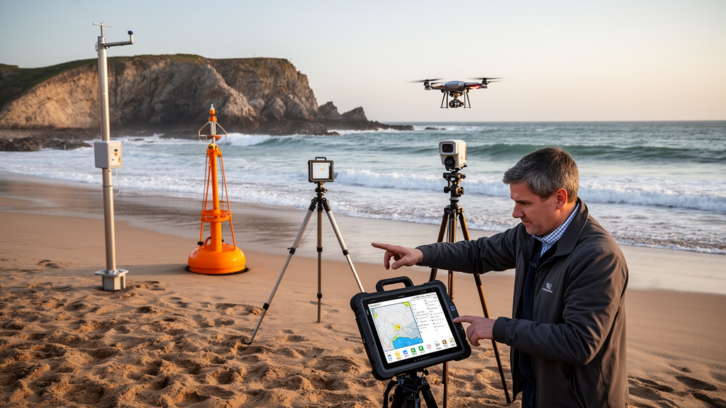
Coastal monitoring becomes useful when observations can be translated into reliable assessments and timely decisions, according to an editorial in Frontiers in Marine Science examining five contributions spanning offshore aquaculture, shoreline evolution, port water-level forecasting, marine hazards and coastal economic modelling. The collection focuses on a shared challenge: how heterogeneous observations can support decisions across different spatial scales, timescales and levels of uncertainty. It does not present a universal coastal monitoring system.
Instead, the studies show that innovation depends on maintaining the meaning, provenance and limitations of geodata as information moves from measurement through analysis to application. Nidzieko and Hoel extend side-scan sonar from underwater imaging to quantitative monitoring of offshore kelp cultivation. Using image registration and sonar geometry, they reconstruct the spatial structure of a commercial installation and estimate kelp length, from which biomass is inferred.
Comparison with in situ measurements supports the approach, while also identifying the need for site-specific calibration and improved resolution of farm lines. The method could enable repeatable, spatially extensive measurements without relying exclusively on labour-intensive sampling. Its practical value, however, depends on calibration and survey geometry matching the conditions of the monitored site.
The study therefore illustrates why an apparently direct image-to-biomass workflow still requires field-based checks before its estimates can become routine monitoring products. Zorlu and Kusak examine a complementary timescale in their analysis of shoreline evolution along the western Mersin coast between 1985 and 2022. They combine Landsat imagery, Google Earth Engine, the Digital Shoreline Analysis System and fuzzy C-means clustering to connect shoreline-change rates with spatial patterns and land-cover context.
The coexistence of erosion and accretion within the same coastal setting shows why coastal change should not be reduced to one regional headline. Their multi-decade analysis also demonstrates how satellite records can place shoreline positions in a broader spatial and land-cover context. Together with the kelp-sonar work, the study shows that automated feature extraction alone does not make a geodata product scientifically useful: observations must be interpreted in relation to acquisition geometry, spatial resolution and the environmental setting.
Wang and colleagues address predictions needed at shorter lead times by combining empirical mode decomposition, particle swarm optimization and a radial basis function neural network to predict port water levels. The model is evaluated using observations from four ports, with assessment at lead times of 6, 12 and 24 hours. The authors report favourable performance relative to the neural-network approaches used for comparison, indicating that signal decomposition and model optimization can complement one another in an operationally relevant prediction task.
This finding applies to the tested records and comparison methods rather than establishing equivalent performance everywhere. In particular, skill under ordinary conditions should not be confused with performance during exceptional events. The authors identify additional environmental drivers and longer prediction horizons as directions for further development, leaving uncertainty about performance across unusual conditions, ports or periods not represented in the evaluation data.
Agharroud and colleagues shift attention from predicting environmental variables to assessing their consequences. Their northern Morocco case study integrates hazard, exposure and vulnerability information to map tsunami-related and climate-related coastal risks, while distinguishing potential losses of property from potential losses of life. The approach identifies overlapping risk hotspots that can provide a basis for geographically targeted preparedness and protection.
Yet the overlap of co-occurring hazard zones is not equivalent to a coupled simulation in which one hazard alters the effects of another. The study explicitly leaves the superposition of tsunami impacts and sea-level rise for future work, so the mapped risks should not be presented as a complete representation of interacting coastal hazards. The distinction is crucial for interpreting multi-risk maps: they can locate combined exposure and vulnerability while still leaving important interactions between physical processes unresolved.
Dong and colleagues broaden the discussion from environmental prediction to resource allocation through the Coastal Adaptive Economic Dynamics Model and the Resilient Coastal Economic Optimization Strategy. Their framework links multimodal learning with spatial economic-environmental dynamics and adaptive optimization. It invites a shift from asking only whether monitoring improves prediction to asking whether better information improves management outcomes.
These are related but distinct questions, because benchmark performance by itself cannot demonstrate realized economic or ecological benefits. The authors acknowledge the computational demands of their framework and the incomplete representation of extreme disruptions. Further evaluation would need to connect model outputs with observed decisions, implementation costs and local social responses, as well as address the practical demands of applying the framework.
The contribution consequently provides a conceptual route for examining resource allocation rather than proof that coastal monitoring already produces net economic gains. Across the five contributions, integration emerges as a scientific challenge as well as a technical one. Sonar-derived biomass estimates, satellite-derived shoreline positions, water-level forecasts and composite risk indices describe different quantities and inherit different limitations.
Future geodata systems should retain information about reference frames, acquisition dates, calibration, processing choices and model versions so downstream users can assess whether an output is fit for purpose. Numerical compatibility allows datasets to be combined, but it does not ensure that they measure compatible things or carry equivalent uncertainty. Preserving provenance is therefore essential whenever an observation passes through multiple processing stages before informing an operational, planning or policy decision.
Integration should not erase the distinctions among source material, derived estimates, forecasts and scenario-based indices; it should make those relationships visible. Validation must also match the decision that the data are expected to support. Biomass estimates require appropriate field calibration, shoreline trends need independent checks on positional accuracy, and forecasts require genuinely prospective testing rather than evaluation only on records already used to develop or tune a model.
Risk and economic models should be examined against alternative scenarios and stakeholder needs. Comparisons across sites, seasons and unusual conditions would help distinguish local success from transferable capability. These requirements are especially important because a lower error statistic, a finer map or a more elaborate algorithm is not automatically more useful if relevant uncertainty has been concealed.
The studies instead show that each product has a defined evidentiary scope: kelp estimates depend on field comparison, shoreline histories depend on spatial interpretation, port forecasts depend on the conditions represented in their records, and risk or economic outputs depend on the assumptions and interactions their models include. Monitoring design should begin with the management question rather than with the most sophisticated available instrument or algorithm. Port operations, shoreline planning and aquaculture management may require different update frequencies, tolerances and levels of explanatory detail.
A highly complex model is not necessarily the most useful when data availability, system maintenance and interpretability constrain implementation. The workflow that best fits a decision may be the one that preserves traceable information, communicates uncertainty clearly and produces usable evidence within the relevant time and resource requirements. This approach also means that innovation can arise through better integration and validation, not only through more advanced sensors or computational methods.
Reliability depends on the complete chain from observation to application, including acquisition, calibration, metadata, processing, model evaluation and interpretation. Monitoring that begins with the decision can therefore make trade-offs visible that a general-purpose model may conceal. Taken together, the five contributions locate innovation at the interfaces between sensing, modelling and use rather than in any single type of geodata management.
They offer complementary methods: sonar-based estimation for cultivated kelp, satellite-based reconstruction of shoreline change, short-range port water-level prediction, multi-hazard risk mapping and an economic optimization framework. They do not demonstrate that these components can be merged into one seamless system or that any one approach is universally transferable. Instead, the editorial argues that progress should be judged not only by finer maps or lower prediction errors, but also by whether evidence remains traceable, uncertainty remains visible and outputs suit their context.
The central opportunity is to connect coastal observations to decisions responsibly, preserving what each measurement can establish and making clear what it cannot.
Subject of Research: Editorial review of coastal zone monitoring, geodata management, forecasting, risk assessment and economic modelling
Article Title: Editorial: Innovative approaches to coastal zone monitoring and geodata management
Article References: Wlodarczyk-Sielicka, M., Polap, D., & Damaševičius, R. (2026). Editorial: Innovative approaches to coastal zone monitoring and geodata management. Frontiers in Marine Science, 13, Article 2022031. https://doi.org/10.3389/fmars.2026.2022031
Image Credits: AI Generated
DOI: 10.3389/fmars.2026.2022031
Keywords: coastal monitoring, geodata management, side-scan sonar, kelp biomass, shoreline change, water-level forecasting, coastal risk mapping, economic modelling, marine hazards, editorial, Innovative, approaches
Cite Scienmag News
Violet Maxwell. (October 20, 2026). Editorial reviews five coastal-monitoring approaches for management decisions. Scienmag. https://scienmag.com/editorial-reviews-five-coastal-monitoring-approaches-for-management-decisions/
Violet Maxwell. "Editorial reviews five coastal-monitoring approaches for management decisions." Scienmag, 20 October 2026, https://scienmag.com/editorial-reviews-five-coastal-monitoring-approaches-for-management-decisions/. Accessed 20 October 2026.
Violet Maxwell. "Editorial reviews five coastal-monitoring approaches for management decisions." Scienmag. October 20, 2026. https://scienmag.com/editorial-reviews-five-coastal-monitoring-approaches-for-management-decisions/


