


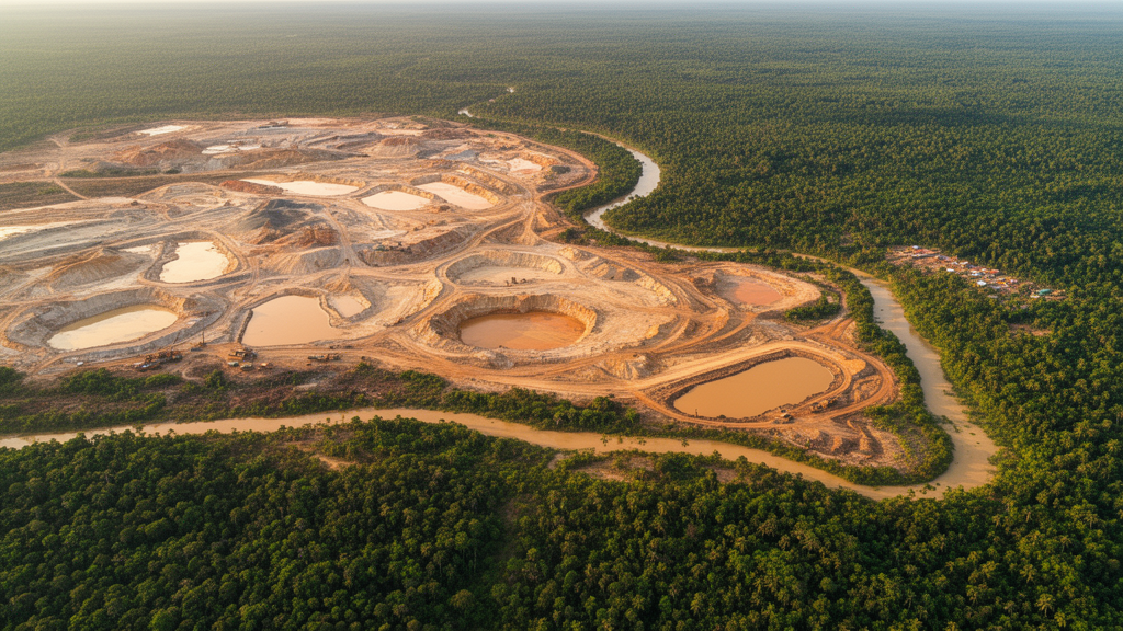
In the gold-rich hills of Kintinian, a sub-prefecture in Guinea’s Siguiri region, the ground itself tells a story of transformation. A new study published in Environmental and Sustainability Indicators has used more than a quarter-century of satellite imagery to quantify, pixel by pixel, how industrial and artisanal gold mining reshaped the local landscape between 1990 and 2016. The findings paint a picture of a frontier landscape in flux: forests and farmland giving way to exposed soil, vegetation health collapsing during the peak of mining expansion, and only partial recovery in recent years.
The research team, led by Mohamed L. Traore with Opeyemi S. Aniramu and Oluwagbenga O.I. Orimoogunje, focused on an area of roughly 33 square kilometers within the Upper Guinea savannah zone, lying between latitudes 11°20′ and 11°50′ North and longitudes 9°10′ and 10°10′ West. Guinea ranks among Africa’s leading gold producers, and Siguiri hosts some of the country’s most extensive mining operations, including the industrial ventures Société Anglogold Ashanti de Guinée (SAG) and Société Minière de Dinguiraye (SMD). Since industrial mining began in 1996, the landscape has undergone substantial environmental change, making Kintinian an ideal natural laboratory for studying mining-induced degradation.
What sets this study apart methodologically is its integrated analytical framework. The researchers adopted the Geographical Pathways to Environmental Sustainability (GPES) framework, which links human-induced pressures to environmental outcomes across spatial and temporal scales. Rather than relying on a single satellite snapshot, they combined multi-temporal Landsat imagery from 1990, 2000, 2010, and 2016 with Sentinel-1 radar data, high-resolution Google Earth Pro imagery, and extensive field validation. The team deliberately chose the Soil-Adjusted Vegetation Index (SAVI) over the more commonly used Normalized Difference Vegetation Index (NDVI) because SAVI incorporates a soil adjustment factor that corrects for the bright, exposed ground surfaces characteristic of mining landscapes—conditions under which NDVI’s readings become unreliable.
The land-cover classification itself was performed using a supervised Random Forest algorithm, a machine-learning approach that builds hundreds of decision trees from bootstrap samples and assigns classes by majority vote. The researchers trained the model on 2,000 sample pixels distributed equally across five land-cover categories—water body, forest, agricultural land, built-up and bare soil, and rock—and validated it against 500 independent samples. Accuracy was impressive: overall classification accuracy rose from 86.4 percent in 1990 to 92.7 percent in 2016, with kappa coefficients climbing from 0.82 to 0.89, indicating strong agreement between satellite-derived maps and ground truth.
The temporal analysis revealed dramatic shifts. In 1990, six years before industrial mining commenced, forest and agricultural land together covered more than 60 percent of the study area—539.24 and 537 square kilometers respectively. By 2000, just four years after mining began, built-up and bare soil had nearly doubled from 271.48 to 569.46 square kilometers, a gain of roughly 298 square kilometers in a single decade. Agricultural land, meanwhile, lost about 80 square kilometers during that same period as people abandoned farming for mining. The trend intensified between 2000 and 2010, when farmland plummeted by 346 square kilometers—a striking illustration of what the authors describe as the socio-economic
The choice of SAVI deserves closer attention, because it reflects a broader methodological debate in remote sensing science. NDVI, which exploits the contrast between red-light absorption by chlorophyll and near-infrared reflectance from leaf structure, has been the workhorse vegetation index since the earliest satellite missions. Yet in landscapes where vegetation is sparse and soil brightness varies widely, NDVI tends to conflate genuine plant vigor with the reflectance of the ground beneath. SAVI addresses this by introducing a soil-brightness correction factor into its formulation, damping the influence of exposed mineral surfaces. In a mining landscape scarred by excavated pits, tailings, and freshly turned laterite, that correction is not a technical nicety but a prerequisite for meaningful measurement. The authors’ decision to apply SAVI in a West African gold-mining context also fills a gap: the index has been validated extensively in precision agriculture and viticulture, but its use in assessing the environmental consequences of artisanal and industrial mining in Guinea had remained largely unexplored.
The study period itself was chosen with care. The authors restricted their multi-temporal comparison to 1990, 2000, 2010, and 2016 because persistent cloud cover after 2016 limited the availability of comparable, cloud-free satellite imagery over this part of Guinea. This constraint is a familiar one for remote sensing in the humid tropics, where seasonal cloud and haze can render optical sensors blind for months at a time. By anchoring the analysis to dates with reliable imagery, the researchers ensured that observed changes in land cover and vegetation condition reflect real landscape transformation rather than atmospheric artifacts. The 1990 to 2016 window also captures the full arc of industrial expansion, beginning six years before the establishment of industrial mining in 1996 and extending through two decades of intensive operation.
Field validation formed the third pillar of the methodology. Ground-truthing excursions allowed the team to confirm that pixels classified as bare soil, forest, or farmland corresponded to conditions on the ground, a step that becomes especially important in heterogeneous mining landscapes where spectral signatures can be ambiguous. This combination of satellite observation, radar data, and physical verification reflects a growing consensus in environmental monitoring science that remote sensing is most powerful when paired with local knowledge and direct observation.
The analytical framework also incorporated multi-criteria decision analysis weighted through the Analytic Hierarchy Process, or MCDA-AHP, a structured technique for translating expert judgment into explicit, comparable weights across criteria. Applied here within the GPES lens, the approach allowed the researchers to integrate spectral, thermal, land-cover, and soil-related indicators into a single spatial characterization of environmental vulnerability. Rather than treating vegetation loss, soil exposure, and land transformation as isolated symptoms, the framework maps where these pressures converge, identifying zones of differing vulnerability across the study area. Such spatially explicit vulnerability mapping is a practical tool for land managers, because it directs attention to the places where remediation and restoration efforts are likely to yield the greatest benefit.
The broader context of the findings extends well beyond Kintinian. Gold mining across West Africa has expanded rapidly in recent decades, driven by rising global demand, favorable prices, and the accessibility of alluvial deposits to artisanal miners. In Guinea, gold is extracted in nearly every village of the Kintinian sub-prefecture, and the local population has woven mining into a livelihood portfolio that also includes agriculture, livestock rearing, fishing, trade, and handicrafts. The study notes that these alternative activities are themselves affected by mining, creating a feedback loop in which environmental degradation undermines the very diversification that communities rely upon for resilience. When farmland is converted to mining pits, households lose agricultural capacity; when vegetation cover declines, soil stability and microclimate regulation weaken, further diminishing the productivity of remaining agricultural land.
This dynamic illustrates a central tension in sustainability science: the same extractive activity that generates employment, revenue, and foreign exchange can simultaneously erode the ecological foundations of local livelihoods. The authors frame their work within the three pillars of sustainability—social, economic, and environmental—arguing that understanding their interaction is essential for designing interventions that do not simply restrict mining but redirect it toward more sustainable practices. Their findings offer evidence-based guidance for land restoration strategies and remediation planning in mining-affected landscapes of the Global South, where regulatory capacity may be limited but the ecological stakes are high.
The study also contributes to a methodological frontier. Previous assessments of mining impacts have often been localized, based on single-date observations, or focused on individual environmental components in isolation. By combining land-cover change detection, SAVI-based vegetation assessment, soil-exposure indicators, and spatial vulnerability modelling within one coherent framework, the researchers demonstrate how multiple lines of geospatial evidence can be synthesized into an integrated picture of environmental change. This integration matters because mining-induced degradation operates through interacting pathways: deforestation exposes soil, exposed soil accelerates erosion, erosion degrades remaining vegetation, and the resulting landscape fragmentation reduces ecosystem resilience. Capturing these interactions requires the kind of multi-indicator, multi-temporal approach the study exemplifies.
For the communities of Kintinian, the practical implications are tangible. The quantified baseline of degradation between 1990 and 2016 provides a benchmark against which future change can be measured, enabling evidence-based environmental management rather than reactive crisis response. The identification of spatially distinct vulnerability zones offers a starting point for prioritizing restoration, whether through revegetation of abandoned mining sites, stabilization of exposed soils, or the protection of remaining forest fragments. And the demonstration that SAVI can reliably track vegetation condition in a soil-dominated mining landscape opens the door for routine, low-cost monitoring across other gold-producing regions of West Africa, where similar dynamics of expansion, degradation, and partial recovery are unfolding. As the authors acknowledge, their work establishes a foundation upon which future investigations of post-mining sustainability can build, turning a quarter-century of satellite observation into a roadmap for ecological recovery.
Subject of Research: Remote sensing assessment of gold mining impacts on vegetation and soil degradation in Kintinian, Guinea
Article Title: Assessing the impacts of gold mining on vegetation and soil degradation using multi-temporal remote sensing in Kintinian, Siguiri prefecture, Guinea
Article References: Traore, M. L., Aniramu, O. S., & Orimoogunje, O. O. I. (2026). Assessing the impacts of gold mining on vegetation and soil degradation using multi-temporal remote sensing in Kintinian, Siguiri prefecture, Guinea. Environmental and Sustainability Indicators, 32, Article 101570. https://doi.org/10.1016/j.indic.2026.101570
Image Credits: AI Generated
DOI: 10.1016/j.indic.2026.101570
Keywords: gold mining, remote sensing, SAVI, land degradation, Guinea, Siguiri, soil vulnerability, Landsat, vegetation index, GPES framework, MCDA-AHP, environmental sustainability
Cite Scienmag News
Sloane Callahan. (October 16, 2026). Satellites Reveal How Gold Mining Scarred Guinea’s Kintinian Landscape Over 26 Years. Scienmag. https://scienmag.com/satellites-reveal-how-gold-mining-scarred-guineas-kintinian-landscape-over-26-years/
Sloane Callahan. "Satellites Reveal How Gold Mining Scarred Guinea’s Kintinian Landscape Over 26 Years." Scienmag, 16 October 2026, https://scienmag.com/satellites-reveal-how-gold-mining-scarred-guineas-kintinian-landscape-over-26-years/. Accessed 16 October 2026.
Sloane Callahan. "Satellites Reveal How Gold Mining Scarred Guinea’s Kintinian Landscape Over 26 Years." Scienmag. October 16, 2026. https://scienmag.com/satellites-reveal-how-gold-mining-scarred-guineas-kintinian-landscape-over-26-years/


