


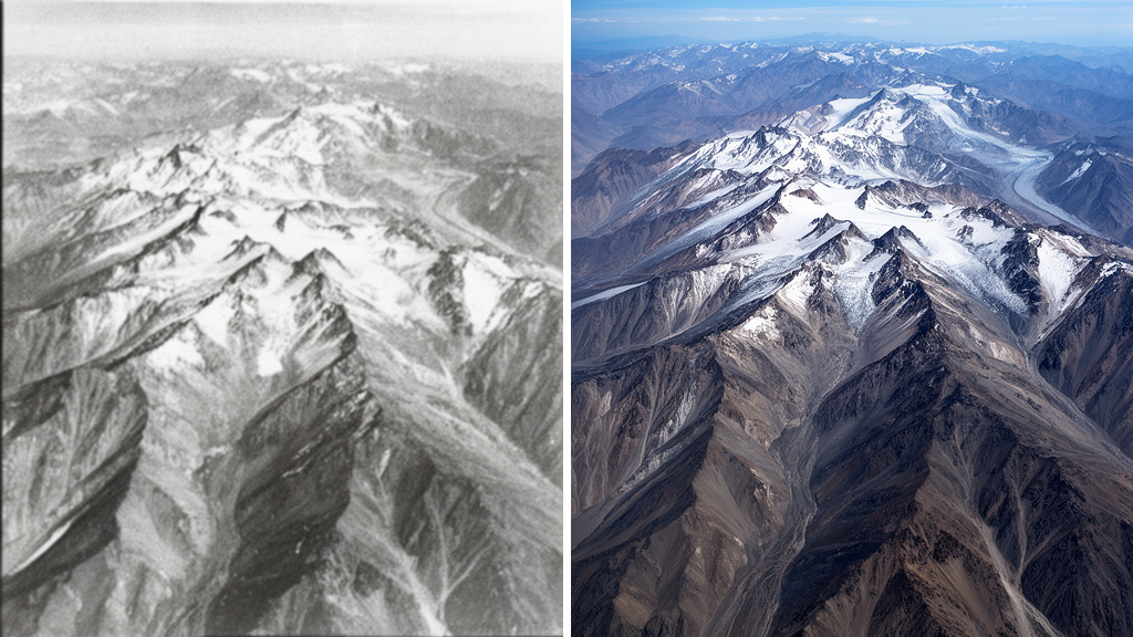
High in the mountains along the Pakistan-Afghanistan border, hundreds of glaciers have been quietly shrinking for more than four decades, and scientists have now managed to measure exactly how much ice they lost in the years before modern satellites kept watch. A new study in The Cryosphere provides the first geodetic mass balance estimates for glaciers in the Eastern Hindu Kush prior to the year 2000, extending the record of glacier change in this poorly observed region back to 1979. The key to unlocking this hidden history was a fleet of declassified American spy satellites, originally designed to photograph Cold War targets, now repurposed to track the fate of mountain ice.
The research team, led by Azka Ramzan and Sajid Ghuffar of the Institute of Space Technology in Islamabad, focused on a region containing the largest concentration of glaciers in the Eastern Hindu Kush, spanning the border between Pakistan’s Chitral district and Afghanistan’s Wakhan corridor. This mountainous area, home to the towering peak of Tirich Mir at 7708 meters, holds nearly 3000 square kilometers of glacier ice. The meltwater from these glaciers feeds the Chitral River, known downstream as the Kunar and then the Kabul River, supplying freshwater to communities in Afghanistan and Pakistan before eventually joining the Indus River. For the millions of people who depend on this water for drinking, agriculture and power generation, understanding how these glaciers respond to climate change is not an abstract scientific question but a matter of water security.
What the team found was striking in its consistency. Between 1979 and 2002, the glaciers they studied lost mass at a moderate rate of -0.14 ± 0.09 meters of water equivalent per year, corresponding to a total loss of roughly 3.4 gigatonnes of ice over the 23-year period. Remarkably, this rate is nearly identical to what post-2000 satellite observations have recorded for the same region, within the uncertainties of the estimates. While other parts of High Mountain Asia, such as the Nyainqentanglha range and the Tien Shan, have seen their glacier mass loss accelerate dramatically in recent decades, the Hindu Kush appears to have maintained a nearly stable rate of mass loss for at least four decades. This sustained, moderate decline sets the region apart and suggests that local factors, particularly precipitation patterns driven by westerly weather systems, have moderated the impact of rising temperatures.
The technical achievement behind these numbers is considerable. Modern glacier mass balance studies typically rely on satellite stereo imagery from sensors launched after 2000, such as ASTER or SPOT-5, which can be compared with radar elevation models to measure how glacier surfaces have thinned or thickened. Extending such measurements back to the late 1970s requires something special: the KH-9 panoramic camera, carried aboard declassified Hexagon reconnaissance satellites, which captured stereo photographs of the Earth’s surface at a spatial resolution of around 60 centimeters. Seven KH-9 stereo pairs from September 1979 covered the study area. The team processed these images using the Corona Stereo Pipeline, automatically extracting ground control points with the LightGlue feature matching algorithm and Sentinel-2 imagery, then performing dense matching with a variant of Semi-Global Matching implemented in the MicMac photogrammetry software. The resulting point cloud was registered to a reference digital elevation model and interpolated into a raster DEM.
To represent the end of the study period, the researchers used stereo images acquired in October 2002 by the High Resolution Stereoscopic sensor aboard SPOT-5, a French satellite with two cameras pointed 20 degrees forward and backward from nadir, capturing panchromatic images at 5 by 10 meter resolution. Processing with the Ames Stereo Pipeline produced digital elevation models at 20 meter resolution. The team then differenced the 1979 and 2002 elevation models, removed implausible values outside ±150 meters, filtered outliers using a sigmoid function and elevation normalization, and filled voids with local hypsometric interpolation. Glacier outlines came from the Randolph Glacier Inventory, which the researchers carefully edited to reflect glacier extents in both 1979 and 2002, since some glaciers had retreated significantly during the interval. Mass balance was computed in 50 meter elevation bins, and uncertainties were estimated by combining random errors measured over stable terrain with systematic errors, then propagating them along with the density conversion factor of 850 ± 60 kilograms per cubic meter and an assumed 10 percent glacier area uncertainty.
The study covered 265 glaciers larger than 0.5 square kilometers, together spanning approximately 1050 square kilometers. Within this sample, the researchers examined how different types of glaciers behaved. Debris-covered glaciers, where rock and sediment blanket the ice and can insulate it from melting, make up nearly 27 percent of the total glacier area in the studied region. The team found that debris-covered and clean-ice glaciers lost mass at nearly identical rates, -0.15 ± 0.08 and -0.14 ± 0.11 meters of water equivalent per year respectively. However, the pattern of retreat told a different story: most of the retreating glaciers were clean-ice glaciers, with the highest retreat reaching 2.4 kilometers at the Noroghikun glacier, a highly crevassed glacier classified as a possible surging type. This retreat caused its terminus to shift from an elevation of 3286 to 3640 meters. The Kotgaz glacier also retreated significantly, by 1.3 kilometers, with its terminus rising from 3450 to 3627 meters, and showed high thinning with a mass loss of -0.22 ± 0.10 meters of water equivalent per year.
Surging glaciers, which undergo periodic episodes of dramatically accelerated flow, added another layer of complexity. Nine surge-type glaciers, classified as verified or probable according to a recent inventory, range in area from 3 to 82 square kilometers. The team found that surging glaciers lost mass at -0.15 ± 0.12 meters of water equivalent per year, while non-surging glaciers lost mass at -0.14 ± 0.08 meters per year, essentially the same rate. Most surging glaciers showed a stable mass balance during the study period, with elevation profiles displaying alternating bands of positive and negative change, a classic signature of surge activity. Thickening at the terminus with concomitant thinning in the upper reaches was common, and the researchers note that this redistribution of ice may increase mass loss in subsequent years, as the thickened lower portions of these glaciers sit at lower elevations where melting is more intense. The Upper Tirich glacier, the largest surging glacier and second largest overall, comprises six tributaries and showed the highest mass loss among the surging glaciers.
Individual glaciers in the region displayed remarkable variability, even as the regional average remained moderate. The Atrak glacier, the largest in the study area at approximately 90 square kilometers, lost mass at -0.23 ± 0.37 meters of water equivalent per year, while the Upper Tirich glacier lost mass at -0.26 ± 0.09 meters per year. The Lower Tirich glacier, crevassed with a distinctive band-like appearance, showed high mass loss at -0.40 ± 0.27 meters per year. In contrast, a few glaciers actually gained mass, including the Kach glacier, which carries 66 percent debris cover and remained close to balance. The North and South Barum glaciers, whose meltwater drains directly into the Barum Gol, showed mass losses of -0.12 ± 0.16 and -0.10 ± 0.18 meters per year respectively. Notably, the team observed that meltwater from one glacier, G-14-02500, which lost mass at -0.52 ± 0.43 meters per year, has created a proglacial lake known as Pindoru chaat that has undergone rapid expansion in recent years, a development with potential implications for glacial lake outburst floods.
The findings suggest that the Hindu Kush glaciers have maintained a moderate rate of mass loss since the late 1970s, in contrast with the accelerated decline observed in other parts of High Mountain Asia. Meteorological records from Chitral show temperatures rising at 0.33 degrees Celsius per decade, while precipitation has remained variable without any significant long-term trend. The researchers propose that the effect of rising temperatures on glacier melting is either moderated by precipitation or by the debris cover that blankets many glaciers. Glacier mass balance in the region shows a strong relationship with precipitation, which depends on westerly weather patterns. The study also re-assessed retreating glaciers and found higher retreat than previously documented, with glacier retreat generally observed at elevations below 4400 meters. As climate change continues to push temperatures upward across the region, the moderate decline recorded here may not persist indefinitely, and the extended four-decade record now available for the Eastern Hindu Kush will help scientists detect any such acceleration in the years ahead.
Subject of Research: Geodetic mass balance of Eastern Hindu Kush glaciers from 1979 to 2002 using declassified KH-9 and SPOT-5 stereo imagery
Article Title: Brief communication: Mass balance of glaciers in the Eastern Hindu Kush from 1979 to 2002 using KH-9 panoramic and SPOT-5 stereo imagery
Article References: Ramzan, A., & Ghuffar, S. (2026). Brief communication: Mass balance of glaciers in the Eastern Hindu Kush from 1979 to 2002 using KH-9 panoramic and SPOT-5 stereo imagery. The Cryosphere, 20(10), 5993-6002. https://doi.org/10.5194/tc-20-5993-2026
Image Credits: AI Generated
Keywords: glaciers, Hindu Kush, climate change, satellite imagery, mass balance, The Cryosphere, declassified satellites, High Mountain Asia, Brief, communication, Mass, balance
Cite Scienmag News
Sloane Callahan. (October 16, 2026). Declassified spy satellite photos reveal how Hindu Kush glaciers have melted since 1979. Scienmag. https://scienmag.com/declassified-spy-satellite-photos-reveal-how-hindu-kush-glaciers-have-melted-since-1979/
Sloane Callahan. "Declassified spy satellite photos reveal how Hindu Kush glaciers have melted since 1979." Scienmag, 16 October 2026, https://scienmag.com/declassified-spy-satellite-photos-reveal-how-hindu-kush-glaciers-have-melted-since-1979/. Accessed 16 October 2026.
Sloane Callahan. "Declassified spy satellite photos reveal how Hindu Kush glaciers have melted since 1979." Scienmag. October 16, 2026. https://scienmag.com/declassified-spy-satellite-photos-reveal-how-hindu-kush-glaciers-have-melted-since-1979/


