


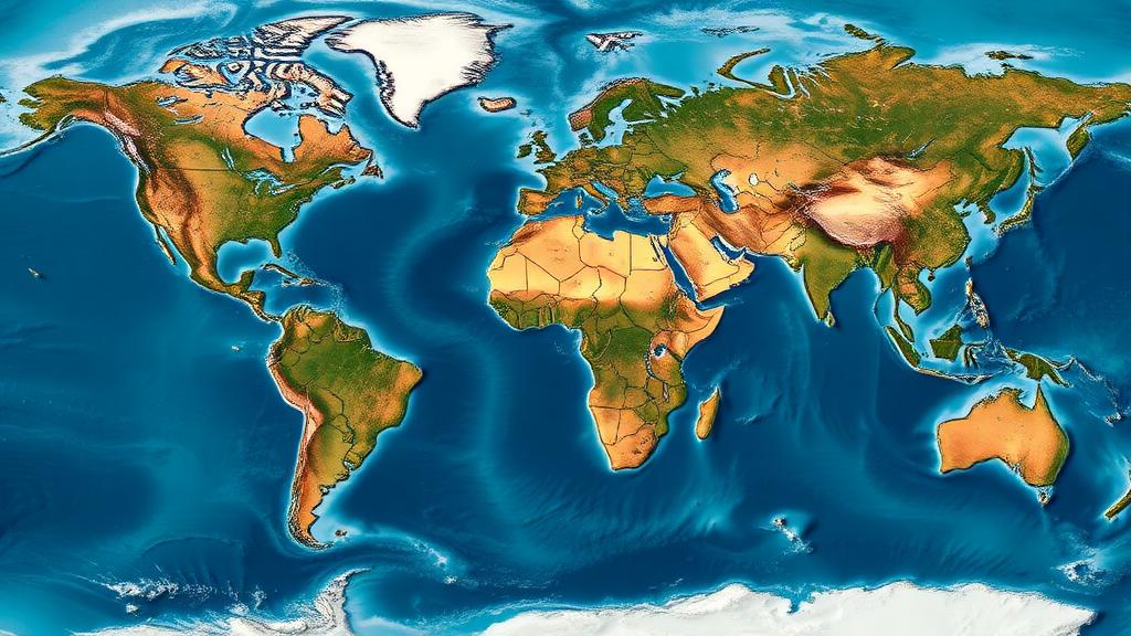
Beneath many of the world’s great cities, the ground is quietly giving way. A new analysis published in Nature Cities has assembled one of the most comprehensive pictures yet of urban land subsidence, using high-resolution satellite radar observations to track how the land surface is moving across 465 major cities worldwide. The findings confirm that sinking ground is not a localized curiosity but a global phenomenon, with the most severe subsidence concentrated in Southern North America, Southeast Asia and West-Central Asia. For coastal megacities, the implications are stark: subsidence compounds the threat of rising seas, meaning that some urban populations face a double burden of relative sea-level rise driven both by the ocean and by the land disappearing beneath their feet.
The study, summarized in a Research Briefing in the same journal, draws on interferometric synthetic aperture radar, or InSAR, a technique that has transformed how scientists measure ground deformation. By comparing the phase of radar signals reflected back to satellites as they pass over the same location on repeated orbits, researchers can detect millimeter-scale changes in the distance between the satellite and the ground. Stacked over months and years, these measurements produce detailed maps of vertical land motion for entire metropolitan regions, at spatial resolutions far finer than any network of ground-based surveying instruments could achieve. The approach has matured rapidly over the past decade, as reviewed in the Earth-Science Reviews literature, and it now underpins national and continental assessments of subsidence in places ranging from the United States coastline to China’s largest cities.
What distinguishes the new work is its global scope and its attention to temporal dynamics. Earlier studies demonstrated that subsidence is widespread in individual countries or regions; this analysis extends the view to 465 major cities across every inhabited continent, ranking them by the severity of their sinking. The results place Southern North America, Southeast Asia and West-Central Asia at the top of the severity ranking, regions where a combination of geology, groundwater extraction and rapid urban growth appears to drive pronounced downward motion. In Southeast and East Asia, the analysis uncovered a more nuanced picture: rather than uniform sinking, many hotspots display a mixture of accelerating and decelerating subsidence, suggesting that local management interventions, changing patterns of water extraction and shifting urban development are actively reshaping the trajectory of ground motion in these cities.
The physical causes of urban subsidence are well understood in principle, even if their global expression is only now being mapped in detail. The dominant driver in most cities is the compaction of unconsolidated sediments when groundwater is extracted faster than it can be replenished. Sandy and silty layers that once supported water in their pore spaces collapse as the water pressure drops, transferring the load to the mineral skeleton and permanently reducing the thickness of the aquifer system. Because this compaction is largely irreversible, subsidence caused by over-extraction cannot simply be undone by later recharging of the aquifer, although the rate of sinking can often be slowed dramatically. Other contributors include the natural consolidation of young deltaic sediments under the weight of buildings and infrastructure, the drainage and oxidation of organic soils, mining activity, and the loading of the crust by massive urban construction.
The regional patterns identified in the study align with these mechanisms. Southern North America includes cities built on soft coastal and deltaic sediments where decades of groundwater pumping have compounded natural compaction, a pattern already documented in detail by InSAR studies of United States coastal cities published in Nature in 2024. Southeast Asia contains some of the world’s most rapidly subsiding urban areas, many of them situated on low-lying deltas where dense populations, intense groundwater demand and soft Holocene deposits coincide. West-Central Asia’s inclusion among the most severely affected regions reflects cities in arid basins where heavy reliance on groundwater has caused aquifer-system compaction on a large scale. In each of these regions, the new global dataset provides a consistent yardstick, allowing the severity of subsidence in one city to be compared directly with that in another using the same satellite-based methodology.
The finding that subsidence dynamics are mixed in Southeast and East Asia deserves particular attention. Accelerating subsidence in a hotspot signals that the underlying drivers are intensifying, whether through increased extraction, continued sediment loading or expanding built-up area, and it flags places where intervention is most urgent. Decelerating subsidence, by contrast, can indicate that mitigation measures are working. Several cities in East Asia have implemented aggressive groundwater management over recent decades, restricting pumping, importing surface water and operating managed aquifer recharge schemes, and the slowing of subsidence in some hotspots is consistent with the success of such policies. The fact that both accelerating and decelerating signals coexist within the same broad region underscores a central message of the study: subsidence is not an inevitable fate but a manageable process, and its trajectory responds to human decisions about water and land use.
For coastal cities, the arithmetic of relative sea-level rise makes subsidence an urgent concern. When land sinks while the ocean rises, the two effects add together, and in many subsiding coastal cities the local rate of relative sea-level rise far exceeds the global average of a few millimeters per year. Research published in Nature Sustainability in 2022 quantified this problem for major coastal cities, showing that subsidence can contribute a substantial fraction, sometimes the majority, of the total relative sea-level rise experienced locally. The new global analysis reinforces that message at scale: cities in Southeast Asia and elsewhere face combined rates of relative sea-level rise that could translate into dramatically earlier thresholds of chronic flooding, saltwater intrusion and storm-surge damage than global projections alone would suggest. For the residents of such cities, what matters is not the global mean but the local sum, and that sum is increasingly dominated by sinking land.
The technical achievement behind the study rests on careful handling of the known pitfalls of InSAR. Atmospheric delays, orbital errors, phase unwrapping ambiguities and decorrelation over vegetated or rapidly changing surfaces can all contaminate the measurements, and comparing results across hundreds of cities requires consistent processing and calibration. The authors built on established calibration strategies that anchor satellite-derived relative land-level subsidence to independent prior knowledge, such as tide-gauge records or GNSS measurements, improving the reliability of cross-city comparisons. They have also made the dataset explorable through a public visualization platform, the Global Urban Subsidence tool hosted on Google Earth Engine, which allows users to examine subsidence patterns for each of the 465 cities. This kind of open infrastructure matters, because subsidence data are most valuable when they reach the planners, engineers and water managers who can act on them.
The study arrives at a moment when related assessments are converging on a shared conclusion. A national-scale analysis of 82 major Chinese cities published in Science in 2024 found that a significant share of urban land in China is subsiding, with particularly rapid motion in some of the country’s largest and most water-stressed metropolitan areas. The United States coastal study reached similar conclusions for North American shorelines. By extending the analysis to a global sample of cities and by explicitly characterizing whether subsidence is accelerating or decelerating, the new work adds the temporal dimension that earlier snapshots lacked. Trajectory matters for policy: a city sinking slowly but steadily needs different investments than one whose sinking is speeding up, and a city where subsidence is decelerating offers evidence that mitigation pays off.
For a century, urban subsidence was documented city by city, famously in places where sinking ground forced costly engineering responses. Satellite radar has now turned that fragmented record into a coherent global picture, and the picture shows that the problem is both widespread and dynamic. The most severe sinking clusters in Southern North America, Southeast Asia and West-Central Asia, but the mixed trajectories across Asian hotspots demonstrate that the future of subsidence is not predetermined. Where groundwater is managed, subsidence slows; where extraction intensifies, it accelerates. As climate change raises the baseline of the sea and urban populations continue to grow in the very deltas and basins most prone to compaction, the new global dataset offers something increasingly precious: a consistent, repeatable measurement of how the ground beneath hundreds of cities is moving, and an early-warning framework for the places where the descent is quickening. The ground under the world’s cities is sinking, but for the first time, humanity can watch it happen in near real time, city by city, and act before the descent becomes irreversible.
Subject of Research: Global satellite-based assessment of land subsidence patterns and temporal dynamics in 465 major cities
Article Title: Global patterns and temporal dynamics of urban subsidence
Article References: Global patterns and temporal dynamics of urban subsidence. (2026). Nature Cities. https://doi.org/10.1038/s44284-026-00528-7
Image Credits: AI Generated
DOI: 10.1038/s44284-026-00528-7
Keywords: urban subsidence, InSAR, satellite radar, groundwater extraction, sea-level rise, Nature Cities, Southeast Asia, West-Central Asia, land motion, coastal cities, aquifer compaction, urban geohazards
Cite Scienmag News
Courtney Benton. (October 12, 2026). Sinking Cities: Satellites Reveal Global Patterns of Urban Land Subsidence. Scienmag. https://scienmag.com/sinking-cities-satellites-reveal-global-patterns-of-urban-land-subsidence/
Courtney Benton. "Sinking Cities: Satellites Reveal Global Patterns of Urban Land Subsidence." Scienmag, 12 October 2026, https://scienmag.com/sinking-cities-satellites-reveal-global-patterns-of-urban-land-subsidence/. Accessed 12 October 2026.
Courtney Benton. "Sinking Cities: Satellites Reveal Global Patterns of Urban Land Subsidence." Scienmag. October 12, 2026. https://scienmag.com/sinking-cities-satellites-reveal-global-patterns-of-urban-land-subsidence/


