


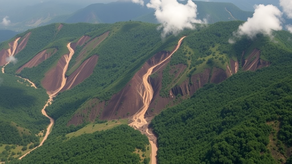
In the steep, densely populated highlands of South Kivu in the eastern Democratic Republic of Congo, the ground is giving way at an accelerating pace. A new ten-year study has produced the most detailed picture yet of landsliding in the Walungu territory and the northeastern part of neighboring Mwenga territory, documenting more than two thousand slope failures between 2015 and 2024 and revealing that the land surface consumed by landslides more than doubled over the decade. The research, published in the journal Environmental Challenges, combines free satellite imagery, local archival records, and demanding fieldwork in a region where armed conflict and chronic data scarcity have long obscured one of the tropics’ most destructive natural hazards.
The study area covers roughly 2,400 square kilometers of mountainous terrain in the Albertine Rift, where altitudes climb from about 810 meters to nearly 3,470 meters from west to east. The climate is tropical with a bimodal rainfall regime: a long rainy season from October to February, a shorter one from March to June, and a dry spell from July to September. Annual rainfall totals between 1,000 and 1,300 millimeters, delivered both by convective storms associated with the Intertropical Convergence Zone and by orographic rain forced upward over the rugged relief. That combination of steep slopes, weathered soils, and intense precipitation makes the landscape inherently unstable, but the researchers emphasize that human activity has dramatically amplified the problem.
Decades of population growth, deforestation for agriculture and fuelwood, artisanal mining, and unregulated rural road construction have stripped hillslopes of their natural protection. Earlier regional studies had already suggested that anthropogenic disturbance interacts with natural controls such as slope gradient, elevation, and rainfall to drive slope failure, but no one had systematically tracked how landslide-affected land actually changed year by year in this part of the rift. The new inventory fills that gap by building a multi-temporal record rather than the single-snapshot surveys that have dominated previous mapping efforts in the eastern Congo.
The team’s primary tool was Google Earth Pro, whose free multi-temporal imagery allowed the researchers to digitize landslide scars as polygons and to distinguish newly initiated failures from the progressive widening of older ones. Because dense vegetation can hide landslide morphology from orbit, the satellite interpretation was cross-checked against archival records from local organizations, including the Action de Développement pour les Milieux Ruraux and the Mission Antiérosive, as well as student theses and field reports from the Institut Supérieur Pédagogique de Walungu. Finally, the researchers validated a representative sample of 904 landslide sites in the field, selected to span the full range of altitude, slope, soil type, land cover, and slope aspect across the study area, within the sectors accessible despite security constraints.
The validation exercise produced strikingly strong results. Of 870 landslides confirmed on the ground, 823 had been correctly identified in Google Earth imagery, while 47 were missed and 34 features were falsely flagged as landslides. That translates into a precision of 96 percent and a recall of 95 percent, figures that held almost identically for both shallow and deep-seated failures. The findings demonstrate that freely available virtual globe imagery, when systematically checked against ground truth, can support reliable landslide inventories in regions that cannot afford commercial very-high-resolution satellite data, although the authors caution that small, partially vegetated failures remain the weakest link in any image-based approach.
The inventory itself catalogued 2,088 landslides covering a total of 528 hectares. Shallow failures, predominantly earth flows, utterly dominate the record: 2,051 events, or 98.2 percent of the total, accounting for just over 79 percent of the affected area, with a mean individual footprint of only 0.20 hectares. Deep-seated landslides are rare, just 37 events, but disproportionately destructive, covering 109 hectares thanks to mean areas of nearly 3 hectares and a maximum of almost 24 hectares. Notably, 81 shallow failures occurred along roads and 46 within active artisanal mining perimeters, underscoring the imprint of infrastructure and extraction on slope stability.
To understand why landslides occur where they do, the team applied a Bayesian Weight of Evidence analysis within a geographic information system, testing seven conditioning factors: slope gradient, slope aspect, curvature, elevation, drainage density, land use and land cover, and soil type. A Chi-square test confirmed that every factor is statistically significantly associated with landslide occurrence, with slope degree showing the strongest dependence. The centered weight values reveal a clear threshold: slopes gentler than 20 degrees are consistently stable, with strongly negative weights, while susceptibility jumps sharply between 25 and 30 degrees, where the positive weight peaks at 3.14. Convex and planar curvatures, higher elevations above 1,800 meters, and positions 400 to 600 meters from stream channels, where fluvial incision undercuts steep valley sides, all show strong positive associations with failure.
The land cover results carry perhaps the most consequential message for policy. Forested and woodland terrain shows a strongly negative weight of minus 3.26, reflecting the protective role of dense root networks, rainfall interception, and evapotranspiration in binding soils together. Cropland and herbaceous cover, by contrast, shows a positive weight of 3.15, and built-up or bare soil surfaces a weight of 2.75. Soil type reinforces the pattern, with shallow Leptosols and deeply weathered Ferralsols both highly susceptible. Together, these relationships describe a coupled natural and human system in which terrain establishes the gravitational framework, drainage controls water movement, soils govern material strength, and vegetation removal dismantles the last line of defense.
The temporal record is equally sobering. The number of mapped landslides grew from 967 in 2015 to 2,088 in 2024, with 1,121 newly initiated failures over the decade and a cumulative net land loss of 278 hectares. The affected proportion of the study area rose from 0.104 percent to 0.220 percent. Activity was strikingly episodic rather than steady: quiet years such as 2017 and 2022 saw only about 3 and 2 hectares of new land loss respectively, while 2019, 2021, and 2024 delivered major pulses of 40, 76, and 100 hectares, the last corresponding to annual area growth of more than 23 percent. Importantly, part of the expansion reflects the progressive widening of existing failures, particularly deep-seated ones that continue deforming long after initial failure, meaning the inventory captures ongoing geomorphic adjustment rather than simply counting isolated new events.
The authors are careful to frame their conclusions as a baseline rather than a definitive predictive model. The Weight of Evidence approach quantifies spatial associations but cannot fully resolve interactions among factors, and the study did not quantitatively analyze rainfall triggers, a task the researchers say will require daily rainfall data and the derivation of local triggering thresholds to support early-warning systems. Armed conflict also prevented exhaustive field validation in some sectors, and the results cannot be directly generalized across the whole of eastern Congo. Still, the study delivers something the region has never had: a field-validated, decade-long, annually resolved account of how a tropical rift landscape is unraveling, and a demonstration that with free imagery, local archives, and determined fieldwork, even the world’s most data-scarce mountains can be brought into the scientific record. As populations keep growing and forests keep receding across the Albertine Rift, that record may prove essential for planning where people can safely build, farm, and live.
Subject of Research: Landslide inventory, dynamics, and predisposing factors in the tropical highlands of eastern Democratic Republic of Congo
Article Title: Landslide inventory and dynamics in the tropical highlands of eastern Democratic Republic of Congo
Article References: Richard, B. C., Jean-Claude, M. M., Léonard, M. K., & Karume, K. (2026). Landslide inventory and dynamics in the tropical highlands of eastern Democratic Republic of Congo. Environmental Challenges, 25, Article 101662. https://doi.org/10.1016/j.envc.2026.101662
Image Credits: AI Generated
DOI: 10.1016/j.envc.2026.101662
Keywords: landslides, Democratic Republic of Congo, South Kivu, Albertine Rift, Google Earth Pro, remote sensing, landslide susceptibility, Weight of Evidence, deforestation, land cover, shallow landslides, deep-seated landslides
Cite Scienmag News
Sloane Callahan. (September 23, 2026). Decade of Satellite Images Reveals Accelerating Landslide Crisis in Eastern Congo Highlands. Scienmag. https://scienmag.com/decade-of-satellite-images-reveals-accelerating-landslide-crisis-in-eastern-congo-highlands/
Sloane Callahan. "Decade of Satellite Images Reveals Accelerating Landslide Crisis in Eastern Congo Highlands." Scienmag, 23 September 2026, https://scienmag.com/decade-of-satellite-images-reveals-accelerating-landslide-crisis-in-eastern-congo-highlands/. Accessed 23 September 2026.
Sloane Callahan. "Decade of Satellite Images Reveals Accelerating Landslide Crisis in Eastern Congo Highlands." Scienmag. September 23, 2026. https://scienmag.com/decade-of-satellite-images-reveals-accelerating-landslide-crisis-in-eastern-congo-highlands/


