


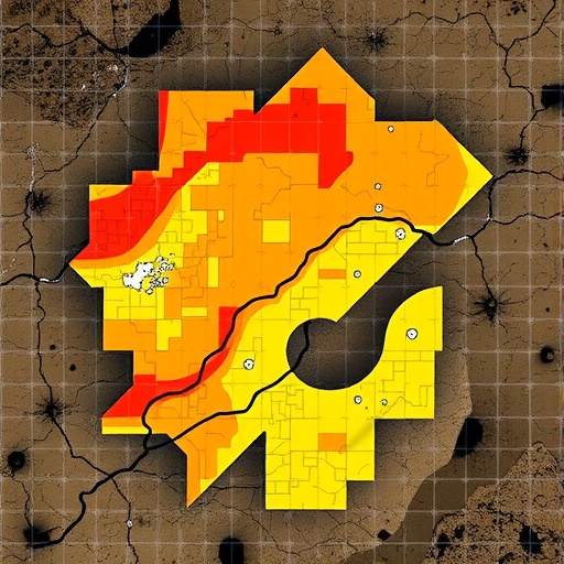
Across the world’s farmlands, floodplains, and industrial peripheries, a vast accounting exercise is quietly underway: measuring how much lead, cadmium, arsenic, nickel, and other potentially toxic elements have accumulated in the soil beneath our feet. Direct measurement is slow and expensive, so scientists increasingly delegate the job of filling in the blanks to machine learning, which infers contamination at unsampled locations from satellite imagery, terrain models, geology, and land-use data. A new synthesis warns that many of the resulting maps are far less trustworthy than their polished accuracy scores suggest. Karzan A. Mohammed Hawrami, of the Department of Medical Laboratory Technique at Halabja Technical Institute, Sulaimani Polytechnic University in Iraq, reviewed the literature from 2020 to 2025 in the peer-reviewed journal Environmental Monitoring and Assessment and found a field that has raced ahead on predictive power while lagging on rigor: models are tested in ways that flatter them, their internal logic often goes unexamined, and their uncertainty—the one quantity decision-makers most need—rarely makes it onto the page.
The stakes are more than academic. Potentially toxic elements, or PTEs, are the heavy metals and metalloids that soils absorb from mining waste, smelter emissions, industrial effluent, traffic, phosphate fertilizers, and wastewater irrigation. Unlike organic pollutants, they do not break down. They persist for decades to centuries, leach slowly into groundwater, bind to crop roots, and climb food chains, where chronic exposure is linked to kidney damage, neurological impairment, and cancer. Because cleanup is enormously costly and land-use decisions hinge on where contamination actually sits, regulators need spatially detailed assessments: not regional averages, but maps showing which fields, neighborhoods, and aquifers exceed safety thresholds. Hawrami’s review, published on 29 August 2026 as Volume 198, Article 1007 of Environmental Monitoring and Assessment, frames the challenge as achieving monitoring-grade assessment—maps reliable enough to justify public spending and land-use restrictions—and distills four requirements that define that grade: spatially honest validation, explainable artificial intelligence, quantified uncertainty, and translation of predictions into decision-ready risk products.
The machine-learning approach descends from digital soil mapping, a discipline formalized in the early 2000s that treats soil properties as functions of environmental covariates. In practice, researchers assemble a training set of geolocated soil samples chemically analyzed for PTE concentrations, then pair each sample with a vector of environmental predictors: elevation, slope, and topographic wetness derived from digital elevation models; distance to roads, rivers, and industrial facilities; parent material and lithology; land cover; climate variables; and spectral bands from satellites such as Sentinel-2. Algorithms like random forests, gradient-boosted trees, support vector machines, and increasingly deep neural networks learn the statistical relationships between covariates and measured concentrations, then extrapolate predictions across every pixel of a study area. Surveys of the field, including Hawrami’s, document an explosion of such studies—national-scale cadmium and arsenic assessments, smelter-adjacent maps built from portable laser-induced breakdown spectroscopy, agricultural risk screens spanning entire provinces. The modeling toolbox, he concludes, has matured rapidly; the discipline surrounding the models—how they are tested, explained, and hedged—has not kept pace.
The review’s sharpest critique targets validation. The default practice is random k-fold cross-validation: split the dataset into ten parts, train on nine, test on the tenth, and rotate until every point has served as a test case. The procedure looks impeccable, but soils defeat it, because concentrations are spatially autocorrelated—samples a few hundred meters apart often behave like near-duplicates, shaped by the same parent rock, the same deposition plume, the same irrigation history. Random splitting scatters these statistical twins across training and test sets, so the model can effectively recognize a test location through its neighbors rather than genuinely predict it. Hawrami concludes that random cross-validation “often overestimates predictive performance when spatial dependence is ignored,” yielding accuracy statistics that evaporate the moment a map is applied to genuinely unsampled terrain. The flaw is not exotic. It is the default setting across much of the literature, and it can convert a marginal model into an apparently excellent one without anyone acting in bad faith.
The corrective is spatially honest evaluation, and a family of methods now exists to deliver it. Block cross-validation carves the landscape into spatially contiguous tiles—squares, hexagons, or watershed boundaries—and assigns entire blocks to folds, guaranteeing that test sites sit a minimum distance away from training sites; the R package BlockCV, introduced by Valavi and colleagues in 2019, popularized the technique for spatial models. Newer variants tune that separation to the task. The kNNDM scheme published in Geoscientific Model Development in 2024 by Linnenbrink and colleagues matches the nearest-neighbor distance structure of the training folds to that of the prediction targets, choosing splits that mimic the conditions under which the final map will actually be used. The Spatial+ method of Wang, Khodadadzadeh, and Zurita-Milla pushes test points toward locations more dissimilar from the training data than typical prediction sites, countering optimistic bias. Hawrami’s synthesis also draws on case studies—from marine remote sensing to Czech farmland—showing that block geometry is not arbitrary: blocks that are too small leak information, blocks that are too large punish good models, and the right choice depends on how the finished map will be deployed.
Accuracy, however honestly measured, still leaves the black-box problem. A random forest that predicts twelve milligrams of cadmium per kilogram of soil says nothing about why, yet remediation strategies differ radically depending on whether the source is a smelter’s smokestack or an underlying mineralized formation. The review assesses the rise of explainable artificial intelligence, above all Shapley Additive exPlanations, or SHAP—a game-theoretic technique that treats each environmental covariate as a player in a coalition and distributes the credit for each individual prediction among them, revealing not just which variables matter on average but which ones drive specific hot spots. Applied to soil data, SHAP is beginning to separate geogenic from anthropogenic drivers. Duan and colleagues used interpretable models in 2024 to expose interactive effects among the spatial drivers of heavy-metal pollution, and Yan and Yang in 2025 uncovered synergistic spatial effects that conventional variable-importance rankings obscure. Suleymanov and colleagues extended the approach to topsoil metals and oxides in 2025, Liu and colleagues paired explainable modeling with spatial cross-validation in 2023, and Liu’s 2024 ensemble framework couples interpretability with geospatial structure. Hawrami’s position is that driver attribution should be a standard deliverable of any monitoring program, not an optional flourish.
The third pillar is uncertainty quantification, and here the review is blunt: a single deterministic number per pixel is an artifact of convention, not a property of nature. Concentration estimates carry error from sparse sampling, noisy covariates, and model misspecification, and decision-makers need to see that error rather than have it averaged away. The emerging tools are probabilistic: quantile regression forests that predict an entire distribution rather than a mean, ensembles whose disagreement serves as a proxy for doubt, and calibrated interval methods that attach honest bounds to every estimate. The most policy-relevant product is the exceedance-probability map—instead of declaring a field simply above or below the regulatory threshold, the map states the probability that the true concentration exceeds it. Skála and colleagues demonstrated exactly this for potentially toxic elements across Czech farmland in 2025, and Rohmer and colleagues showed how local attribution techniques can decompose the sources of uncertainty in digital soil maps. Hawrami folds such capabilities into a risk–uncertainty decision matrix: high exceedance probability with low uncertainty triggers intervention; low probability with low uncertainty supports clearance; high uncertainty, whatever the mean predicts, demands more sampling before anything is decided.
To hold the field to these standards, the review proposes a reporting checklist—invoking, among its anchors, the PRISMA 2020 standards that reshaped systematic reviews in medicine—requiring authors to disclose their validation design, spatial dependence diagnostics, interpretability analyses, and uncertainty measures alongside headline accuracy scores. It further urges that raw predictions be translated into decision-ready risk products: exceedance maps binned by regulatory thresholds, ranked priorities for follow-up sampling, and explicit statements of where the model is interpolating and where it is guessing. The dividends Hawrami lists are reproducibility, transparency, and policy relevance. A map that cannot survive spatial cross-validation, cannot explain its drivers, and cannot express its own doubt is not merely incomplete; it is a liability, because it invites authorities to make consequential judgments—closing a pasture, rerouting a water line, ordering excavation—on the strength of statistics that look more robust than they are.
The timing of the warning matters. New data streams are arriving faster than the methodology can vet them. Mobile laser-induced breakdown spectroscopy now yields thousands of quasi-continuous spectral measurements along field transects, as Gu and colleagues demonstrated in 2025 for smelter-adjacent soils using semi-supervised graph learning; satellite constellations refresh environmental covariates globally every few days; and national screening programs are expanding across historically contaminated industrial regions. Machine learning is the only realistic engine for assimilating this torrent into usable maps, and the review credits genuine advances, including improved heavy-metal predictions from spatial regionalization indices reported by Ma and colleagues in 2024 and large-scale risk-mapping frameworks charted by Wang and colleagues the same year. But scale amplifies both virtue and vice. An honestly validated national cadmium map can direct remediation budgets precisely where they matter most; an overfit one can quietly misdirect them for years. The very spatial dependence that makes interpolation possible also makes naive validation seductive, and the larger the mapping exercise, the costlier the delusion.
Hawrami’s synthesis ultimately distills to a sentence: “predictive accuracy alone is insufficient for environmental decision-making.” A model’s job in soil monitoring is not to top a leaderboard but to support defensible management of contaminated land, and that demands validation that respects geography, interpretation that names its drivers, and uncertainty that travels with every prediction. None of these requirements dims the promise of machine learning in the geosciences; they raise the bar to match the stakes. Soils are slow to reveal their damage and slower still to recover from it, and the maps that guide their protection must be honest about the difference between what they know and what they merely assume.
Cite Scienmag News
Blake Davidson. (August 31, 2026). Machine learning maps toxic metals in soils with explainable, validated uncertainty. Scienmag. https://scienmag.com/machine-learning-maps-toxic-metals-in-soils-with-explainable-validated-uncertainty/
Blake Davidson. "Machine learning maps toxic metals in soils with explainable, validated uncertainty." Scienmag, 31 August 2026, https://scienmag.com/machine-learning-maps-toxic-metals-in-soils-with-explainable-validated-uncertainty/. Accessed 31 August 2026.
Blake Davidson. "Machine learning maps toxic metals in soils with explainable, validated uncertainty." Scienmag. August 31, 2026. https://scienmag.com/machine-learning-maps-toxic-metals-in-soils-with-explainable-validated-uncertainty/


