

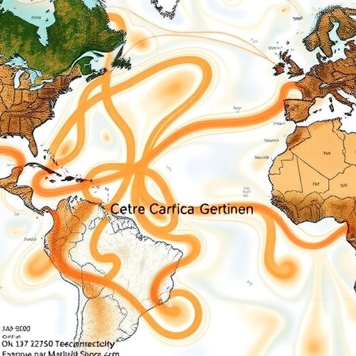
A new study has identified a major climate connection linking El Niño events in the central Pacific to wintertime circulation over the North Atlantic, suggesting that a region often treated as secondary in global forecasts may provide valuable clues about the behavior of the North Atlantic Oscillation. The North Atlantic Oscillation, or NAO, is one of the atmosphere’s most influential patterns. It describes shifts in the difference in air pressure between the subtropical Atlantic and the region near Iceland. When the NAO is strongly positive, powerful westerly winds often sweep across the North Atlantic, bringing milder, wetter conditions to northern Europe and colder, drier weather to parts of southern Europe. When it turns negative, that pattern can reverse, with consequences extending across Europe, Greenland, eastern North America and the Arctic.
The research, published in Communications Earth & Environment, focuses on a particular form of El Niño known as Central Pacific El Niño. El Niño is the warm phase of the El Niño–Southern Oscillation, a naturally recurring climate phenomenon rooted in changes to tropical Pacific Ocean temperatures and winds. In the most familiar version of the event, unusually warm water becomes concentrated in the eastern or east-central equatorial Pacific. Central Pacific El Niño, by contrast, places its strongest ocean warming farther west, closer to the international date line. That geographical distinction matters because the location of tropical heating determines how air rises, sinks and moves through the atmosphere, influencing weather patterns thousands of kilometres away.
The study’s central conclusion is that Central Pacific El Niño-driven Pacific–Atlantic teleconnections are an important source of predictability for the NAO. In climate science, a teleconnection is a physically connected response between distant parts of the atmosphere or ocean. The link does not mean that a disturbance in the Pacific travels across the planet as a single wave. Instead, changes in tropical convection—the formation of deep clouds and thunderstorms—alter the distribution of heat and momentum in the atmosphere. Those changes can launch large-scale Rossby waves, slow-moving undulations in the mid-latitude jet stream that help organize high- and low-pressure systems across entire ocean basins.
The Pacific influence can reach the Atlantic through a sequence of atmospheric adjustments. Warmer tropical waters increase evaporation and supply energy to thunderstorms. The release of latent heat as water vapour condenses then modifies upper-level winds, creating disturbances that propagate into the extratropics. As these disturbances interact with the jet stream and with existing weather systems, they can strengthen or weaken ridges and troughs in the atmosphere. Over the North Atlantic, the resulting circulation changes may shift the position and intensity of the westerly winds that define the NAO. The exact response depends on the location, timing and intensity of the Pacific warming, which is why distinguishing Central Pacific El Niño from other El Niño configurations is scientifically important.
Predicting the NAO has long been difficult. Unlike El Niño, whose most prominent signals develop in the tropical Pacific and can often be monitored months in advance, the NAO is strongly influenced by rapidly changing atmospheric processes. The pattern can arise from interactions among the jet stream, planetary waves, ocean temperatures, sea ice and stratospheric circulation. Some of its most consequential variations occur on timescales of weeks to seasons, when forecasts become valuable for energy demand, agriculture, water management and disaster preparedness. A better understanding of how tropical Pacific conditions precondition the North Atlantic atmosphere could therefore extend the useful range of seasonal forecasting, even if it cannot eliminate the atmosphere’s inherent unpredictability.
The emphasis on the Central Pacific is particularly relevant because El Niño events are not identical. Two events can produce similar averages of tropical Pacific warming while generating different atmospheric responses because their warmest waters occupy different locations. The atmosphere responds not simply to how much the ocean warms, but to where that warming occurs relative to the centres of tropical convection and the surrounding circulation. Central Pacific events can therefore excite a different pattern of upper-atmospheric waves from eastern Pacific events. By isolating this pathway, the researchers point to a mechanism that may help explain why some El Niño episodes are followed by pronounced NAO behavior while others produce a weaker or less consistent Atlantic response.
The finding also highlights the importance of treating the Pacific and Atlantic climate systems as parts of a connected network rather than independent regions. Ocean temperatures in the Atlantic, Arctic sea-ice conditions and stratospheric winds can all influence the NAO, but the new work places Pacific forcing among the potentially predictable sources of its variability. This perspective could improve climate models by encouraging them to reproduce not only the average state of the atmosphere, but also the pathways through which disturbances move between basins. If a model correctly represents tropical convection, Rossby-wave propagation and the North Atlantic jet stream, it may be better able to translate an observed Central Pacific El Niño into a probabilistic outlook for Atlantic and European weather.
Such forecasts would not amount to certainty. A teleconnection is a tendency, not a mechanical switch, and the same ocean pattern can produce different outcomes when the background atmosphere changes. Internal atmospheric variability can amplify, weaken or obscure the Pacific signal. Interactions with the stratosphere may also alter the timing and character of the NAO response. The value of the study is therefore not that it provides a simple rule linking every Central Pacific El Niño to a particular winter, but that it identifies a physically meaningful source of information that can be combined with other observations. The research points toward forecasts expressed in probabilities, in which Pacific conditions shift the odds of different North Atlantic circulation states rather than dictate them.
The result could become increasingly important as climate change alters the frequency, structure and background conditions of El Niño events, although the study itself establishes a predictability pathway rather than a forecast of future climate trends. For scientists, the next challenge is to determine how stable this Pacific–Atlantic connection remains across decades and under changing greenhouse-gas concentrations. For forecasters, the implication is immediate: the location of tropical Pacific warming deserves as much attention as its magnitude. By showing that Central Pacific El Niño can help anticipate the NAO, the research adds a new piece to the puzzle of long-range weather prediction—and offers a clearer explanation of how a change in tropical ocean temperatures can ultimately reshape winter conditions around the North Atlantic.
Cite this news
SCIENMAG. (August 27, 2026). Central Pacific El Niño Teleconnections Boost North Atlantic Oscillation Predictability. https://scienmag.com/central-pacific-el-nino-teleconnections-boost-north-atlantic-oscillation-predictability/
SCIENMAG. "Central Pacific El Niño Teleconnections Boost North Atlantic Oscillation Predictability." Scienmag, 27 August 2026, https://scienmag.com/central-pacific-el-nino-teleconnections-boost-north-atlantic-oscillation-predictability/. Accessed 27 August 2026.
SCIENMAG. "Central Pacific El Niño Teleconnections Boost North Atlantic Oscillation Predictability." Scienmag. August 27, 2026. https://scienmag.com/central-pacific-el-nino-teleconnections-boost-north-atlantic-oscillation-predictability/


