

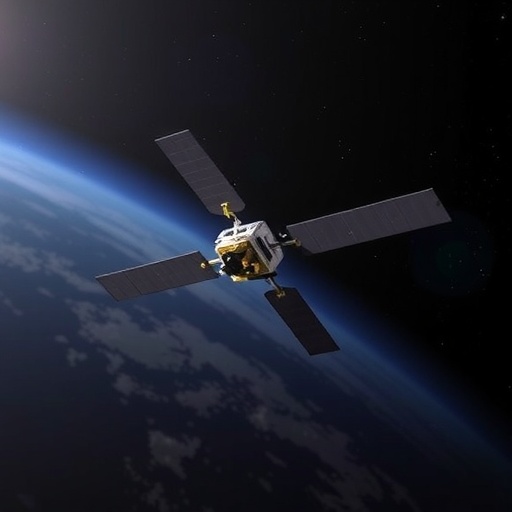
ESA’s PROBA-3 mission has gained a potentially important upgrade to the mathematical system that keeps its two spacecraft precisely aligned, according to a study published in Experimental Astronomy. Researchers from the Italian National Institute for Astrophysics and collaborating institutions have designed and tested an alternative algorithm for the mission’s Shadow Position Sensors, or SPS. In simulations, the new method reduced lateral positioning errors to less than 0.006 millimetres across the mission’s most demanding operating region—roughly an order of magnitude better than the already capable flight algorithm. The trade-off is speed: because the alternative method repeatedly solves a cubic equation for each sensor using Cardano’s formula, it requires about 50 times more computation. That makes it unsuitable for some time-critical onboard operations, but potentially valuable for ground-based data processing, where accuracy matters more than computational economy. The result is a sophisticated cross-check for a mission designed to demonstrate autonomous formation flying in space while producing unprecedented observations of the innermost solar corona.
PROBA-3 is Europe’s first mission dedicated to demonstrating highly precise autonomous formation flying with two independent spacecraft. Launched in December 2024, the mission operates in a highly elliptical orbit that reaches approximately 60,530 kilometres at apogee and descends to about 600 kilometres at perigee. The spacecraft spend around six hours near apogee conducting formation-flying operations, when their relative velocity and the influence of the Earth’s gravity gradient are comparatively low. During this period, they perform acquisition, rendezvous, station-keeping, retargeting and collision-avoidance manoeuvres without continuous instructions from Earth. The two vehicles are normally separated by about 144 metres, a distance that is too large to maintain during the high-speed perigee passage. They therefore break formation before entering the lower portion of the orbit and move into safe trajectories, later reassembling near apogee. This orbital choreography allows PROBA-3 to test the technologies needed for future observatories built from multiple spacecraft, including distributed telescopes, interferometers and large space structures that cannot be launched as a single rigid vehicle.
The mission’s scientific instrument, the Association of Spacecraft for Polarimetric and Imaging Investigation of the Corona of the Sun, or ASPIICS, exploits the unusual geometry. One spacecraft carries a telescope, while the other carries a precisely positioned disk known as the external occulter. When the two vehicles line up with the Sun, the occulter blocks the bright solar surface and creates an artificial eclipse for the telescope. The resulting coronagraph has an effective separation of 144 metres, greatly reducing the diffraction effects that limit conventional coronagraphs, in which the occulting disk and telescope are mounted on the same platform. ASPIICS is intended to image the faint inner corona, a region normally overwhelmed by sunlight scattered inside an instrument. The corona contains the plasma structures that drive solar eruptions and space weather, yet its innermost regions remain difficult to observe. To maintain the artificial eclipse, however, the spacecraft must remain aligned with extraordinary precision. The SPS subsystem is the final and most accurate link in a chain of metrology instruments that measures the relative three-dimensional position of the two vehicles.
The SPS hardware consists of eight silicon photomultipliers arranged around the 50-millimetre entrance pupil of the coronagraph on a circle with a radius of 55 millimetres. Silicon photomultipliers are highly sensitive photon detectors capable of converting faint optical signals into electrical measurements. Each sensor samples a different part of the penumbra—the gradual transition between the dark umbra and fully illuminated sunlight—projected by the external occulter onto the telescope’s pupil plane. If the two spacecraft are perfectly aligned, sensors placed opposite one another receive irradiance values that follow a predictable balance. A lateral displacement shifts the penumbra, changing those opposing signals in a characteristic way. Differences among the sensor readings therefore encode the position of the eclipse, while the overall illumination level provides information about the longitudinal separation between the spacecraft. In nominal operation, one group of four sensors, called Channel A, is used, while the other four in Channel B provide redundancy and opportunities for calibration. The sensor currents are converted into relative lateral coordinates and an along-the-line-of-sight coordinate, which are then supplied to the formation-flying guidance, navigation and control system.
The original onboard algorithm represents the penumbra with a pseudo-paraboloidal mathematical model. In practical terms, it approximates the irradiance as a third-order function of the horizontal and vertical distances from the centre of the umbra. The model includes linear, quadratic and cubic terms, with adjustable coefficients determined through numerical optimization and ground calibration. These coefficients can be updated during the mission to account for changes in the actual illumination profile, diffraction at the occulter edge, spacecraft tilt and other evolving conditions. The algorithm is fast because it uses the four sensor measurements together in a compact calculation. It can also be supplemented by a simple linear algorithm based on the differences between opposite sensors. The two approaches have complementary error patterns, so combining them can improve performance in selected regions. But the pseudo-paraboloid has a fundamental geometric limitation: its mathematical surface is not truly rotationally symmetric. The physical penumbra is expected to be nearly axis-symmetric when spacecraft tilt is negligible, whereas the model’s separate horizontal and vertical terms can reconstruct it unevenly, especially toward the corners of the positioning region.
That mismatch becomes important because PROBA-3’s SPS system was originally designed around extremely ambitious accuracy goals. The mission defines a requirement box extending 20 by 20 millimetres laterally and 200 millimetres longitudinally around the nominal alignment point. Under the currently relaxed formal requirements, the sensors must determine lateral position to within 0.5 millimetres and longitudinal position to within 50 millimetres in that region. A broader goal box covers a 100-by-100-millimetre lateral area and a 1,000-millimetre longitudinal range, with reduced performance expectations. Earlier in the project, the target was far more demanding: 50 micrometres laterally and 1 millimetre longitudinally inside the requirement box. An engineering review found that these specifications placed severe demands on both the electronics and the positioning algorithms, leading ESA to relax the formal limits to provide additional manufacturing margin. Nevertheless, the research team continued testing against the stricter values because ground-based processing could still benefit from extracting the highest possible precision from the mission data.
The alternative algorithm changes the geometry of the problem. Instead of describing the penumbra separately along two perpendicular axes, it calculates the radial distance of each sensor from the unknown centre of the umbra. The measured irradiance is fitted with a third-order radial polynomial containing adjustable coefficients corresponding to the fine and coarse calibration regimes used by the original algorithm. For every sensor reading, the algorithm must invert this cubic relationship to recover the sensor’s radial distance from the eclipse centre. It does so by transforming the equation into a “depressed” cubic, one without a squared term, and then applying Cardano’s method. Depending on the discriminant, a cubic can have one real solution or three real solutions. The algorithm selects the physically meaningful positive root that satisfies the boundaries of the operational region. Once the four radial distances are known, simple geometric relations recover the lateral coordinates of the umbra centre. For example, the difference between the squared distances measured by opposite sensors isolates one coordinate, while the corresponding pair isolates the other. This procedure naturally enforces circular symmetry, unlike the pseudo-paraboloidal model.
The researchers initially found that a straightforward third-order radial interpolation produced an unrealistic increase in the reconstructed irradiance near the central dark region, where the umbra should have little or no illumination. They corrected that behaviour and modified the alternative code to use both fine and coarse fitting parameters, matching the structure of the onboard algorithm and enabling a direct comparison. The fine parameters are applied within a lateral decentring of 13.8 millimetres, where the darkest portions of the penumbra demand the greatest accuracy. Coarse parameters cover the outer portions of the goal box. The longitudinal coordinate is calculated using the average irradiance inferred from the four sensors. A linear calibration can translate that average into the spacecraft separation, while a more elaborate expression includes additional fitting constants and a correction for the lateral displacement. These reconfigurable coefficients allow the algorithm to adapt to the real in-orbit penumbra rather than relying permanently on a profile established before launch.
To test the methods, the team generated a numerical grid containing one million simulated umbra positions within the requirement box. The synthetic sensor irradiances were calculated from the calibrated penumbra models and then fed back into the competing algorithms. The pseudo-paraboloidal method met the older 50-micrometre target only in a cross-shaped region near the centre, aligned with the sensor directions. Toward the corners, its error reached approximately 100 micrometres—still comfortably inside the current relaxed requirement of 0.5 millimetres, but twice the original target. The combined pseudo-paraboloidal-plus-linear method did not solve the problem across the full box; its accuracy improved near the centre but deteriorated rapidly elsewhere. By contrast, the Cardano-based alternative produced an almost uniform error pattern throughout the requirement region. Its maximum simulated lateral error remained below 0.006 millimetres, or 6 micrometres, meeting the stricter historical requirement by roughly a factor of eight. The improvement was especially visible at the edges and corners, precisely where the non-axisymmetric model was weakest.
The findings do not mean that PROBA-3 will replace its onboard software with the slower algorithm. The flight code must operate within strict limits on processor time, power consumption and response latency, making the compact pseudo-paraboloidal and linear methods attractive for real-time formation control. The alternative algorithm’s computational burden arises because it solves a separate cubic inversion for every sensor and may perform the calculation first with coarse parameters and then repeat it with fine parameters after checking the result against a threshold. In the researchers’ tests, this produced a calculation time about 50 times longer than the faster methods. That cost is acceptable in the Science Operation Center, where ground computers can process recorded measurements after transmission to Earth. There, the alternative can serve as an independent validation tool, identify systematic biases in the onboard position estimate and refine the final reconstruction of the spacecraft geometry. Such corrections could be particularly valuable when interpreting ASPIICS observations, because even tiny alignment errors can alter the apparent structure and brightness of the solar corona. By combining fast onboard control with more exact ground analysis, PROBA-3 may demonstrate not only that spacecraft can fly in formation autonomously, but also that their measurements can be sharpened after the most critical manoeuvres are complete.


