The ancient city of Napata, nestled in present-day Sudan, emerges as a remarkable example of how geological and hydrological dynamics shape civilizations. This once-thriving urban center of the Kush Empire, flourishing approximately between 800 BCE and 100 CE, owed its endurance largely to environmental stability dictated by the Nile River’s unique behavior in the region. Recent interdisciplinary research spearheaded by archaeologists and earth scientists from the University of Michigan reveals the critical role the river’s geological past played in fostering a favorable landscape that supported sustained human settlement and cultural development.
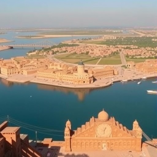
Napata, also known historically as Jebel Barkal, occupies a prominent sandstone outcrop along the Nile, now designated as a UNESCO World Heritage site. Despite its prominence in the ancient world and mentions in various historical texts including the Bible and the works of Herodotus, the environmental underpinnings that made Napata viable remained elusive. The Michigan team, through a combination of archaeological excavation and geomorphological analysis, delved beneath the surface to understand the physical factors that made this location not only habitable but strategically advantageous.
Central to their findings is the concept of the “gentling” of the Nile River. Unlike the well-studied stretches of the Nile in Egypt, where the river flows in a relatively stable and predictable manner, the Sudanese Nile is markedly distinct. The river in this region exhibits natural hydrological complexity due to geological formations that create rapids, waterfalls, and islands – features which historically challenged navigation and settlement continuity. However, near Napata, factors transformed this dynamic system into a more stable environment over millennia.
The research involved extracting 26 sediment cores along the Nile valley encompassing Napata, with core depths ranging from five to thirteen meters. These cores allowed for a detailed stratigraphic study of sediment deposition, revealing a timeline extending to approximately 12,500 years ago. Using optically stimulated luminescence (OSL) dating—a method that establishes the last exposure of sand grains to sunlight—the team reconstructed the river’s depositional history, a window into the ancient Nile’s fluctuating energy and sediment-carrying capacity.
Findings indicate that for the initial 8,000 years of the studied period, the Nile actively carved out its valley, maintaining a dynamic and often unstable channel characterized by erosional processes. However, a pivotal shift occurred approximately 4,000 years ago. At this juncture, the valley floor began to level, initiating the deposition of fine clays and silts and marking the beginning of a prolonged phase of relatively stable river conditions. This process facilitated the accumulation of a fertile floodplain approximately ten meters thick, providing an expansive arable landscape conducive to agriculture and settlement.
A significant geological factor implicated in this transformation is the Nile’s Fourth Cataract, positioned upstream of Jebel Barkal. Cataracts typically dissipate river energy through rapids and islands, which disrupt channel flow and sediment transport. The Fourth Cataract’s presence acted as a natural regulator, attenuating the river’s kinetic energy and encouraging sediment deposition just upstream where Napata would eventually develop. This sedimentation not only stabilized the river’s course but also created an environment that mitigated flood risk, balancing the need for reliable water access with manageable floodplain dynamics.
This combination of geological and hydrological factors underpinned the extensive agricultural productivity and urban complexity of the Kushite civilization centered at Napata. The sedimentary environment shaped by the Nile’s newfound gentleness supported the growth of royal pyramids, palaces, and temples along the sandstone outcrop, fortifying Napata’s role as a political and cultural powerhouse in the region. This spatial and ecological stability also facilitated religious and societal practices critical to Kushite identity and empire-building.
Despite the Nile’s centrality to regional lifeways, Sudan’s field of geomorphological and archaeological research has historically been underdeveloped compared to Egypt’s. This study by University of Michigan researchers thus fills critical gaps in understanding how natural forces influenced human history in Nubia and highlights the necessity of place-specific environmental investigations rather than extrapolations from adjacent regions. Particularly, the findings challenge assumptions about the Nile’s uniform behavior along its course and call attention to the distinctiveness of Nubian hydrology.
The study’s methodology—combining sediment core analyses, radiometric dating, and geomorphological surveying—provides a framework for integrating Earth science into archaeological inquiry. By elucidating how sediment dynamics over thousands of years shaped the habitability and economic foundations of Napata, the research exemplifies interdisciplinary collaboration’s power to unravel complex human-environment interactions. It also underscores the importance of sedimentological data in reconstructing past climates and landscapes that framed ancient civilizations’ trajectories.
Importantly, this work continues amidst Sudan’s ongoing conflict, highlighting the dedication of local Sudanese archaeologists and the broader scientific community’s commitment to preserving cultural heritage. Collaborative efforts with the National Corporation for Antiquities and Museums in Sudan ensure that research progresses despite geopolitical challenges, emphasizing community engagement and capacity-building alongside scientific discovery. This resilient scholarship underscores archaeology’s role not only in understanding the past but also in fostering cultural continuity and identity under duress.
The revelations about the Nile’s late Holocene dynamics deepen our comprehension of how environmental stability contributed to the rise and endurance of the Kush Empire, a political entity that left indelible marks on the ancient Near East and Africa. These insights provide a model for other regions where riverine landscapes have played pivotal roles in human settlement, offering analogs for understanding relationships between fluvial geomorphology and ancient socio-political complexity globally.
Looking forward, ongoing investigations aim to refine the temporal resolution of Nile sedimentation processes and examine how abrupt climatic events may have intersected with local geological features to impact societal development. Understanding these interplays can enhance predictive models of how modern river systems might respond to environmental change, building bridges between past and present in addressing humanity’s continuing dependence on riverine environments.
This study exemplifies how Earth sciences can illuminate the deep-time processes that shaped ancient civilizations, demonstrating that the fossil record not only resides in bones and artifacts but also in sediments and riverbeds. The story of Napata’s landscape and legacy invites reconsideration of the subtle forces that govern cultural resilience and transformation across time and space.
Subject of Research: Geological and hydrological processes shaping the ancient city of Napata and the Kush Empire in northern Sudan.
Article Title: Holocene Nile dynamics shaped the physical and cultural landscape of ancient Nubia
News Publication Date: 27-Apr-2026
Web References: http://dx.doi.org/10.1073/pnas.2529986123
Image Credits: Gregory Tucker
Keywords: Archaeology, Geomorphology, Hydrology, Nile River, Kush Empire, Nubia, Sedimentology, Optically Stimulated Luminescence Dating, Fourth Cataract, Holocene Climate, Ancient Urbanism, Geology
