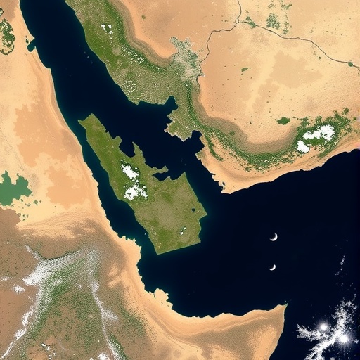
The Doñana National Park, one of Europe’s most treasured wetland ecosystems, faces a daunting future. Recent research conducted by the University of Seville has brought to light alarming predictions: if current trends continue, this iconic marshland could vanish in as little as 61 years. This profound projection arises from an extensive water-resource monitoring study anchored in cutting-edge technological advancements, particularly the innovative application of machine learning algorithms to satellite imagery. By harnessing data from the Sentinel-2 satellite, researchers have crafted a precise method for detecting surface water presence, allowing for a detailed assessment of the park’s hydrological health over time.
The study unfolds multiple potential scenarios, ranging from a pessimistic outcome wherein the wetlands disappear within 45 years to a highly optimistic projection that sees the marshland remaining viable for up to 175 years. These scenarios are intricately linked to future climate variables—most notably, shifts in regional temperature and rainfall patterns. Both of these elements are critical in determining the capacity of wetland ecosystems to sustain their unique biodiversity. The Doñana wetlands serve as an indispensable refuge for myriad bird species, acting as a seasonal stopover, breeding habitat, and wintering ground for thousands of European and African avian populations. Any degradation in this environment threatens not only local biodiversity but also migratory patterns on a continental scale.
Central to this investigation is a novel machine learning algorithm engineered to interpret multispectral satellite data with a high degree of specificity. The research team, led by Professor Emilio Ramírez Juidias at the Department of Graphic Engineering and involving promising students from the High Intellectual Abilities program, has successfully translated raw optical data—particularly near-infrared and red spectral bands—into actionable insights. Through meticulous calibration against field data, the algorithm efficiently differentiates between bodies of water and vegetative cover, a challenging distinction in wetland environments. This capacity enables the generation of dynamic, updated maps reflecting gradual changes in surface water extent, providing a robust predictive tool for long-term environmental planning.
The temporal dataset, spanning from 2005 to 2024, reveals a concerning trend: an approximate 15% decline in wetlands’ water surface area, volume, and depth over this period. Most notably, over 13% of this loss has occurred since 2010, coinciding with a marked increase in regional temperatures coupled with a sharp drop in precipitation. Additionally, illegal groundwater extraction exacerbates this decline, placing undue stress on the aquifer systems sustaining the marshlands. This confluence of anthropogenic pressures and climatic shifts highlights the urgent necessity for targeted intervention to mitigate further environmental degradation.
Addressing these challenges demands the implementation of robust, multifaceted strategies. First and foremost, stringent regulatory enforcement to curtail illegal water extraction is imperative. This includes permanent closure of unauthorized wells, heightened inspection protocols, and the deployment of real-time monitoring systems capable of tracking groundwater usage. Such technological integration would enhance compliance enforcement, ensuring sustainable water consumption practices are upheld. Equally important is a paradigm shift towards less water-intensive agricultural models, favoring crops that demand lower irrigation volumes, supported by highly efficient irrigation mechanisms such as drip systems.
Restoration ecology also plays a pivotal role in the park’s conservation framework. Rehabilitation of desiccated wetland zones through hydrological reconnection to underlying aquifers and reintroduction of native vegetation are critical steps to reestablish ecosystem functionality. These interventions not only enhance water retention capacity but also promote biodiversity resilience. Complementary to these measures is the advocacy for wastewater reuse in agricultural and forestry contexts, a practice that alleviates pressure on natural aquifers, ensuring that ecological water demands are met without compromising human needs.
Climate change adaptation is woven into the fabric of these conservation efforts. Integrated water management plans must incorporate predictive climate models encompassing declining rainfall trends and temperature increases, along with their cascading impacts on hydrological regimes. By proactively aligning management strategies with anticipated climatic shifts, resource planners can fortify the park’s resilience against future uncertainties. The innovative algorithm developed offers a scalable solution with broader applicability; its automated, high-precision nature affords it utility in diverse natural environments confronting analogous hydrological stressors.
The implications of this research extend beyond academic insights, championing the critical role of technological innovation in environmental stewardship. By advancing the frontier of remote sensing and artificial intelligence applications in ecosystem monitoring, the university affirms its leadership in merging scientific inquiry with real-world conservation imperatives. Moreover, fostering intellectual growth among gifted students through participation in high-impact projects demonstrates a forward-thinking approach to cultivating the next generation of environmental scientists and technologists.
Ultimately, the fate of the Doñana National Park’s wetlands hinges upon timely, informed action catalyzed by robust data-driven tools such as this machine learning algorithm. These efforts provide a beacon of hope amid alarming ecological forecasts, underscoring that with dedicated stewardship and integrated technological application, destruction can be averted, securing the vitality of this European natural treasure for generations to come.
Subject of Research: Water resource monitoring and conservation strategies in Doñana wetlands using satellite-derived spectral analysis and machine learning.
Article Title: Satellite-Derived Spectral Index Analysis for Drought and Groundwater Monitoring in Doñana Wetlands: A Tool for Informed Conservation Strategies
News Publication Date: 3-Dec-2025
Web References:
10.3390/geographies5040075
Image Credits: University of Seville
Keywords: Climate change, Earth sciences, Environmental impact assessments, Environmental issues, Environmental monitoring, Biodiversity conservation, Biodiversity threats
