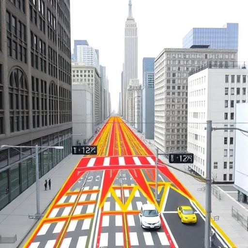
In the bustling urban environment of New York City, pedestrians share space with a myriad of vehicles, creating a complex tapestry of movement and interaction that has long escaped comprehensive study. While vehicular traffic patterns have been meticulously documented, an equivalent depth of knowledge about pedestrian flows has been conspicuously absent. This gap has been addressed by an innovative MIT research team that has developed the first complete, routable dataset mapping sidewalks, crosswalks, and footpaths across every borough of New York. This groundbreaking work not only illuminates the intricate dynamics of foot traffic in America’s largest metropolis but also sets a precedent for urban planning and pedestrian safety across cities nationwide.
Historically, urban planning and transportation engineering have prioritized vehicle movement, often marginalizing pedestrians in infrastructure and policy considerations. This tendency has been especially pronounced in U.S. cities, where car-centric design influences have shaped urban landscapes for decades. The MIT team’s model challenges this paradigm by modeling pedestrian movement at a scale and resolution previously unattainable. By synthesizing pedestrian count data gathered by New York City’s Department of Transportation in 2018 and 2019 and integrating that with a vast network of walkable pathways, researchers created a detailed simulation that estimates foot traffic volume and flows with precision across the entire city.
This detailed pedestrian map reveals that while Manhattan, particularly Midtown, exhibits the highest density of foot traffic—with almost 1,700 pedestrians per sidewalk segment per hour during peak evening times—significant pedestrian volumes also populate neighborhoods in other boroughs. Areas in Queens, Brooklyn, and the Bronx display foot traffic comparable to lesser-traveled parts of Manhattan, dispelling the misconception of a strict Manhattan-centric pedestrian pattern. This revelation is critical; it demonstrates that investments in pedestrian infrastructure should not be disproportionately focused on Manhattan, but rather distributed to reflect the geographic realities of pedestrian movement citywide.
Beyond quantifying volumes, the study incorporates a sophisticated analysis of pedestrian risk by normalizing pedestrian-vehicle crashes against foot traffic density. This per-pedestrian risk metric uncovers hazardous zones that differ from those identified by sheer crash counts alone. For instance, commercial hubs like Times Square experience numerous collisions but maintain relatively low per-pedestrian risk thanks to the staggering number of walkers. Conversely, locations adjacent to highway off-ramps and sprawling road infrastructures—some in Staten Island and peripheral neighborhoods—exhibit high risk per pedestrian, underscoring the intricacies of pedestrian safety landscapes.
Central to the model’s success is its dynamic understanding of temporal variations in pedestrian movement. The model captures diurnal rhythms, reflecting how morning commuters predominantly move towards jobs and schools, while midday and evening travelers engage in diverse activities — from social gatherings to errand-running. This nuanced temporal profiling allows urban planners to anticipate pedestrian densities and patterns throughout a typical day, facilitating targeted and timely infrastructure improvements aimed at enhancing pedestrian experience and safety.
Technically, the research blends urban science, geographic information systems (GIS), and complex network analysis to construct a comprehensive pedestrian flow model. By creating a routable network overlaying existing street and sidewalk configurations, the team employed data-driven calibration techniques tied to empirical pedestrian counts. This methodological rigor ensures high fidelity in predicting pedestrian traffic on unmonitored segments, enabling expansive predictive capability across the city’s multifaceted urban fabric.
This study’s broader implications extend beyond mere mapping and risk assessment. It challenges the current urban mobility paradigms by advocating for a shift towards pedestrian-centered planning. Given that nearly 41 percent of trips in New York City occur on foot—significantly higher than vehicular travel—urban strategies must more robustly accommodate and prioritize pedestrian mobility in efforts to reduce emissions, enhance public health, and build more equitable cities. This framework provides policymakers with actionable intelligence to support investments that synchronize with real-world pedestrian use patterns rather than outdated assumptions.
Moreover, the model has already caught the attention of other municipalities aiming to enhance pedestrian infrastructure and safety. Los Angeles, grappling with a surge in population and preparing for the 2028 Olympics, and the state of Maine, seeking to analyze pedestrian safety across its smaller cities and towns, are collaborating with the MIT team to adapt the model to their unique urban contexts. This adaptability underpins the model’s potential to catalyze a nationwide transformation in urban planning, emphasizing the primacy of non-motorized mobility.
The research team, led by Andres Sevtsuk of MIT’s Department of Urban Studies and Planning, underscores the significance of this work in inspiring a paradigm shift. For the first time, urban scientists and planners have a robust empirical foundation to evaluate how pedestrian activity intersects with development and infrastructure decisions. This empowers cities to make data-informed choices that balance vehicle and pedestrian needs, potentially reshaping urban land use, traffic engineering, and public space design to foster safer, more walkable environments.
In summary, this pioneering pedestrian flow model offers a blueprint for understanding the complexities of foot traffic in dense urban regions. It fills a critical knowledge void, providing unprecedented insights into pedestrian movement patterns and safety risks that were previously obscured. By illuminating the often-invisible dynamics of urban walking, this research elevates pedestrian considerations to a principal role in city planning, promoting healthier, more sustainable, and inclusive urban futures.
The research, detailed in the article titled “Spatial Distribution of Foot-traffic in New York City and Applications for Urban Planning,” will appear in the journal Nature Cities. It represents a major advancement in urban science, combining rigorous data-driven analysis with practical implications for planning departments, transportation officials, and policymakers seeking to manage the evolving needs of complex urban populations.
Subject of Research: Urban pedestrian movement patterns and safety in New York City; development of a routable dataset for pedestrian infrastructure and foot traffic modeling.
Article Title: “Spatial Distribution of Foot Traffic in New York City and Applications for Urban Planning”
Image Credits: Adam Glanzman
Keywords: Urban studies, Urban planning, Urbanization, Transportation engineering, Transportation, Traffic engineering, Transportation infrastructure, Roads, Streets, Cities, Human geography
