In recent years, the Barind Tract of Bangladesh has emerged as a critical zone for climate and environmental research, given its alarming vulnerability to heatwaves and drought. A groundbreaking study published in Environmental Earth Sciences in 2026 has delivered an unprecedented geospatial analysis mapping the frequency, intensity, and spatial distribution of these extreme climatic events. This research provides the crucial linkage between these heat-induced and drought-related stresses with vegetation health, soil moisture dynamics, and groundwater levels, painting a comprehensive picture of the environmental challenges besieging one of Bangladesh’s most thirsty regions. By leveraging sophisticated geospatial technologies, the authors have illuminated how climate variability directly alters both ecological and hydrological systems, thereby offering data-driven insights with potentially transformative implications for sustainable resource management.
Central to this investigation is the Barind Tract, a unique geomorphological landscape characterized by its elevated red loamy soil, which inherently faces limited water retention capabilities. The region’s agricultural productivity is tightly tethered to surface and sub-surface water availability, making it an ideal natural laboratory to study the complex interaction between atmospheric stressors and terrestrial responses. The researchers deployed satellite remote sensing data, various spectral indices, and ground-truth measurements to capture the nuanced responses of vegetation cover under varying degrees of thermal and hydric stress. Their approach transcends traditional single-parameter studies, integrating heatwave duration and intensity metrics with soil moisture quantification and groundwater monitoring to elucidate comprehensive feedback mechanisms.
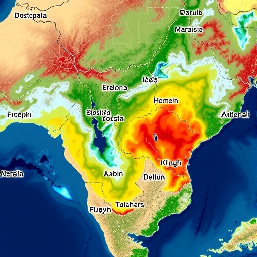
The methodology employed in the study harnessed the power of multi-temporal satellite imagery, enabling the investigation of temporal patterns of heatwaves over several years. These heatwaves, defined by prolonged periods of unusually high temperatures with severe impact on agricultural and ecological stability, were meticulously charted across the tract’s mosaic of land types. By aligning these data points with soil moisture indices derived from microwave remote sensing, the researchers were able to establish correlations illustrating how extended heatwaves exacerbate soil desiccation, thereby dramatically affecting plant water stress and productivity. This integrative approach also allowed for spatially explicit identification of drought hotspots—areas where the amalgamation of intense heat and depleted moisture levels coalesce to threaten local livelihoods.
Vegetation dynamics featured prominently in the study, with the Normalized Difference Vegetation Index (NDVI) and Enhanced Vegetation Index (EVI) serving as critical indicators of plant health and stress responses. Analysis uncovered stark spatial disparities in vegetation resilience, with areas exposed to recurrent heatwaves exhibiting significant declines in vegetation vigor. These declines were not uniform; rather, they closely paralleled observed variations in soil moisture and groundwater availability, underscoring the interconnectedness of these environmental variables. The observed vegetative dieback is a potent indicator of ecosystem distress, signaling broader implications for biodiversity, carbon sequestration capacities, and agricultural sustainability in the face of intensifying climate extremes.
Soil moisture serves as a pivotal middleman between surface climatic forcing and subsurface hydrological responses. Through the synthesis of remote sensing data and in-situ measurements, the study revealed pronounced declines in moisture content coinciding with periods of heatwave intensity. These periods of moisture stress reduce the water availability for plants, further stressing vegetation and compounding environmental vulnerability. The spatial heterogeneity in moisture depletion provides essential insights for targeted interventions, potentially guiding irrigation prioritization and drought mitigation strategies in the Barind Tract. Moreover, fluctuating moisture regimes affect soil microbial activity and nutrient cycling, factors critical for sustaining long-term land productivity.
Groundwater, a vital lifeline for both human consumption and agricultural irrigation in the semi-arid Barind region, emerged as a critical factor intricately tied to heatwave and drought patterns. The study’s geospatial maps revealed alarming trends of groundwater depletion in zones most affected by prolonged heat and moisture stress. This depletion not only undermines the region’s agricultural base but also presages potential socio-economic crises resulting from water scarcity. The temporal alignment of groundwater drops with increasing heatwave incidence suggests a feedback loop where surface climatic extremes cause subsurface water stress, which in turn exacerbates plant and soil vulnerabilities. These findings accentuate the pressing need for integrated groundwater management frameworks that account for climate variability.
What sets this research apart is its capacity to unify disparate environmental datasets into a cohesive narrative elucidating climate change impacts at a regional scale. The multidisciplinary integration of meteorological trends, remote sensing indices, and hydrogeological parameters provides a template for future studies in similarly vulnerable zones globally. Such holistic approaches are essential in advancing our predictive capabilities and tailoring localized responses in the context of accelerating global warming. The researchers also highlight the potential for these geospatial tools to be harnessed in real-time monitoring, enabling swift identification of emerging crises and facilitating more adaptive management practices.
From a policy perspective, the findings hold profound implications. They call for enhanced investment in drought-resistant agricultural practices, improved water conservation measures, and the promotion of climate resilient crop varieties adapted to withstand the twin challenges of heat and moisture stress. Moreover, local governance frameworks must integrate climate risk assessments with land use planning, ensuring that vulnerable communities receive support in water management and livelihood diversification. Importantly, this study advocates for the expansion of geospatial monitoring networks to cover more extensive temporal and spatial scales, thereby refining decision-support systems tailored to the Barind Tract’s unique climatic and ecological context.
Ecologically, the degradation of vegetation as mapped in the study serves as a bellwether for potential biodiversity losses. The region harbors unique fauna and flora adapted to its distinct environment; however, this resilience is being increasingly tested by climatic shocks. Vegetative stress reduces habitat suitability and may perturb ecological balances, leading to cascading effects that diminish ecosystem services. This interplay between climate stressors and ecological health not only threatens natural heritage but also impinges on ecosystem functions critical for human wellbeing such as pollination, soil stabilization, and water filtration. Therefore, conservation strategies must incorporate climate adaptation frameworks bolstered by continuous environmental monitoring.
From a scientific standpoint, the study exemplifies the growing importance of geospatial technologies in environmental research. Remote sensing platforms, coupled with advanced analytical algorithms, provide rich, high-resolution data that enable detection of subtle yet significant ecological changes. This capability is crucial for ground-level stakeholders ranging from farmers to policymakers, who require precise information for timely intervention. Furthermore, the layered integration of above-ground and below-ground environmental parameters fosters a systemic understanding of land-water-atmosphere interactions, fostering advancements in ecological modeling and climate resilience research.
The Barind Tract’s increasing susceptibility to heatwaves and drought as revealed through this innovative geospatial study acts as a microcosm for broader climate challenges threatening South Asia and the global drylands. The intensification of extreme weather events driven by anthropogenic climate change compounds historical environmental vulnerabilities, creating complex crises requiring coordinated responses. This research not only fills a critical knowledge gap but also offers urgently needed evidence for international dialogues focused on climate adaptation and resilience, underscoring the universality of the threats posed by global warming to hydrological and ecological systems.
Looking ahead, the research team envisions the expansion of their geospatial frameworks to incorporate climate projections, socio-economic variables, and land use changes. Such integration would enhance scenario planning, enabling stakeholders to assess future risks and co-develop resilience strategies. The coupling of predictive climate models with empirical geospatial data could revolutionize early warning systems, providing potentially life-saving lead times ahead of extreme events. Additionally, interdisciplinary collaborations with social scientists and local communities are planned to contextualize the geospatial findings within broader socio-ecological realities.
The data sets generated and methodologies advanced through this study serve as valuable resources for academics, environmental managers, and policy forums striving for sustainable development in climate-vulnerable regions. By highlighting the tangible linkages between heatwaves, drought, vegetation health, soil moisture, and groundwater dynamics, the research advocates for an integrative paradigm in climate impact assessments. The study sets a benchmark for geospatial sciences’ role in unraveling environmental complexities and crafting actionable knowledge aimed at fostering resilience in thirsty landscapes like the Barind Tract.
In conclusion, the researchers’ geospatial mapping effort has elucidated the intricate and amplified impacts of heatwaves and drought in the Barind Tract, bringing to light the fragile balance between climate forces and terrestrial systems. This enhanced understanding presents opportunities for more targeted interventions, better resource management, and informed policymaking that aligns with the realities of a warming world. As extreme climatic phenomena increase in frequency and severity globally, such pioneering regional studies are indispensable in charting pathways toward environmental sustainability and human security amid climate uncertainty.
Subject of Research: Geospatial analysis of heatwaves and drought impacts on vegetation, soil moisture, and groundwater in the Barind Tract, Bangladesh.
Article Title: Geospatial mapping of heatwaves and drought: Exploring their link to vegetation, soil moisture, and groundwater in the thirsty Barind Tract, Bangladesh.
Article References:
Sarker, T., Reza, S., Roy, R. et al. Geospatial mapping of heatwaves and drought: Exploring their link to vegetation, soil moisture, and groundwater in the thirsty Barind Tract, Bangladesh. Environ Earth Sci 85, 88 (2026). https://doi.org/10.1007/s12665-025-12787-z
Image Credits: AI Generated
