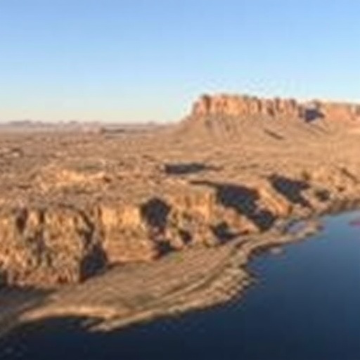
In the arid expanse of Arizona’s Willcox Basin, a geophysical crisis is unfolding with marked urgency. Over the past several decades, a combination of intensive groundwater extraction and insufficient natural recharge has triggered pronounced subsidence of the earth’s surface. This phenomenon, where the land literally sinks due to compaction of underground sediment layers, is not merely a local anomaly but a significant indicator of water resource depletion in regions reliant on groundwater for agriculture and human consumption. Recent research presented at the Geological Society of America’s Connects 2025 conference has brought to light the alarming rates and consequences of this subsidence, outlining the critical interplay between groundwater management and land stability.
Satellite-based remote sensing technologies have revolutionized our ability to monitor changes in the earth’s surface with unprecedented precision. In the Willcox Basin, Interferometric Synthetic Aperture Radar (InSAR) instruments have captured data revealing ground subsidence rates of up to six inches per year over a five-year timeframe between 2017 and 2021. Summed across this period, certain zones have experienced nearly three feet of land sinking, contributing to visible fissures, drying wells, and intermittent flooding in unusual locations. Historical datasets dating back to the 1950s indicate cumulative land surface declines reaching as much as 12 feet, signaling a long-term degradation of subsurface geological integrity across the basin.
At the heart of the subsidence issue lies a fundamental hydrogeological process wherein groundwater pumping surpasses natural recharge rates. Sedimentary layers beneath the surface are typically saturated with water, which maintains pore pressure and structurally supports the overburden sediments. However, as irrigation wells aggressively extract groundwater, the hydraulic support diminishes, causing the sediment grains to compact and resulting in a tangible sinking of the ground level. This compaction is largely irreversible; once the sediment matrix collapses, the loss of pore space permanently reduces aquifer storage capacity, hampering future water availability in an already water-stressed desert environment.
Geospatial research scientist Dr. Danielle Smilovsky, affiliated with the Conrad Blucher Institute, has meticulously catalogued these subsidence dynamics through her multi-year investigation. Her studies emphasize that prior to recent water management efforts, the Willcox Basin lacked enforceable groundwater regulations, permitting unrestrained pumping. The consequences have manifested not only as physical deformation of the terrain but also as significant ecological and infrastructural vulnerabilities. The expansion of fissures in the earth’s crust disrupts soil stability, damages infrastructure, and poses risks to agricultural productivity and local communities.
The impact of land subsidence extends beyond surface damage. Brian Conway, a geophysicist with the Arizona Department of Water Resources, highlights that the compaction of sediment layers permanently reduces subterranean porosity, translating to a lasting diminution in aquifer recharge potential. In desert climates like southern Arizona’s, every unit of available groundwater storage is critical for sustainability. The irreversible alteration of sediment structure therefore compounds the challenges of managing water resources amid increasing demand and climatic variability.
The Willcox Basin’s plight is not isolated. Across Arizona, subsidence has become a widespread concern, reflective of the state’s broader struggle balancing groundwater usage with recharge rates. Historically abundant groundwater reserves have been stressed by agricultural irrigation and urban growth, driving policies toward active water management. However, these efforts must contend with longstanding extraction patterns and the ecological limits imposed by arid environments.
Unseasonably heavy precipitation during the winter of 2022 to 2023 initially offered a glimmer of hope for natural replenishment of groundwater reserves. A significant mountain snowpack accumulation suggested potential mitigation of subsidence by replenishing aquifers. Nevertheless, the subsequent hot and dry summer curtailed these gains. Dr. Smilovsky’s data showed a temporary slowing of subsidence rates, but not a full recovery or stoppage of land sinking. The resilience of subsidence to recharge events underscores the complexity of reversing subsurface compaction once it has occurred.
Water resource managers are increasingly turning to legal frameworks to curb unsustainable groundwater pumping. One vital regulatory tool in Arizona is the designation of Active Management Areas (AMAs). These AMAs impose restrictions and monitoring requirements aimed at achieving sustainable groundwater use. After unsuccessful attempts via ballot initiatives, the Willcox Basin was recently designated as an AMA, marking a hopeful step toward better groundwater governance. Experience from other regions, such as Phoenix and Tucson, demonstrates that AMAs can effectively reduce subsidence rates and contribute to groundwater level recoveries.
In metropolitan areas like Tucson, strict groundwater management within AMAs has led to encouraging results. Brian Conway notes that subsidence has been drastically reduced and in some locations, has even ceased altogether thanks to proactive water regulations. Such achievements provide a model for the Willcox Basin, though the underlying environmental and climatic challenges remain formidable.
Despite such regulatory progress, the land structural changes already endured in the Willcox Basin are irreversible. Dr. Smilovsky cautions that natural recovery of groundwater levels will likely require transformative efforts, including alterations to land use and water consumption practices that significantly reduce reliance on groundwater. Given the basin’s desert conditions and persistent demand, subsidence may continue at some level, albeit potentially at a diminished pace.
The emerging picture from the Willcox Basin is a sobering case study in the consequences of prolonged groundwater overexploitation in arid landscapes. It highlights the intricate connections between hydrogeology, surface deformation, and sustainable resource management. Technological advancements in geospatial monitoring now allow scientists and policymakers to quantify these changes with high accuracy, informing a new generation of water governance that must balance human needs with geological realities.
This body of research serves as a vital reminder that groundwater is a finite and fragile resource, especially in desert regions where recharge rates are inherently limited. Without careful regulatory intervention and community engagement, continued subsidence will exacerbate vulnerabilities in water security, agricultural viability, and ecosystem health. The consequences reverberate beyond localized effects, providing a cautionary narrative for arid and semi-arid zones globally facing similar pressures on groundwater systems.
In summary, subsidence in Arizona’s Willcox Basin has escalated due to unchecked groundwater extraction, with satellite observations confirming rapid sinking of the land surface. Efforts to institute regulatory frameworks offer hope for stabilization, but existing compactions are permanent, underscoring the need for sustainable, science-informed water management strategies. This ongoing challenge exemplifies the critical intersection of Earth sciences, hydrology, and public policy in confronting the realities of human-induced environmental change.
Subject of Research: Persistent Land Subsidence Due to Groundwater Extraction in Arizona’s Willcox Basin
Article Title: Recharged but Not Recovered: Persistent Land Subsidence in Arizona’s Willcox Basin
News Publication Date: September 2024
Web References:
References: Not provided in the source content.
Image Credits: Brian Conway
Keywords: Geology, Groundwater, Water resources, Water tables, Hydrology
